Nations Online
All Countries in the World
Nations Online All Countries in the World | |
Home  |
___ Satellite View and Map of the City of Potsdam, Germany |
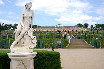
Searchable Map of Potsdam using Google Earth DataSatellite view is showing Potsdam, the capital city of the German Federal State of Brandenburg. The cityis located in easternPotsdam was the residence of the Prussian kings until 1918. Potsdam has a city population of about 150 000 inhabitants, , the city is part of the Metropolitan area of Berlin/Brandenburg. Just zoom in (+) to see Sanssouci castle, former summer palace of Friedrich dem Grossen (Frederick the Great) and the largest World Heritage Site in Germany The Map shows a city map of Potsdam with expressways, main roads and streets. |
|||
| Local Time Potsdam:
Thursday-May-2 01:10
Standard Time Zone (CET): UTC/GMT +1 hourCEST (Daylight Saving Time) in use from end of March until end of October: time zone offset: UTC/GMT +2 hours |
|||
|
φ Latitude, λ Longitude (of Map center; move the map to see coordinates): , |
||
| Google Earth: Searchable map and satellite view of Potsdam, Germany. |
||
| City Coordinates: 52°24′0″N 13°4′0″E |
||
| More about Germany: Landmarks: Satellite view and map showing Brandenburg Gate and surroundings with description. Searchable map/satellite view of some major cities in Germany: Berlin, Bremen, Dresden, Düsseldorf, Erfurt, Frankfurt, Hamburg, Hannover, Kiel, Köln (Cologne), Magdeburg, Mainz, München (Munich), Saarbrücken, Schwerin, Stuttgart, Wiesbaden Bundesland (State): Country: Continent: External Links Stadt Potsdam (Official web site) Wikipedia: Potsdam |
Potsdam/Berlin Weather Conditions: |
Related Consumer Information:
|
| Countries and Territories of Europe Countries of the World: A - C | D - G | H - L | M - P | Q - T | U - Z Continents: Africa | The Americas | Asia | Australia/Oceania |
Map Help [ show ] |
One World - Nations Online .:. let's care for this planet Promote that every nation assumes responsibility for our world. Nations Online Project is made to improve cross-cultural understanding and global awareness. More signal - less NOISE |
| Site Map
| Information Sources | Disclaimer | Copyright © 1998-2023 :: nationsonline.org |