Nations Online
All Countries in the World
|
One Planet Nations Online All Countries in the World | |
Home  |
___ Satellite View and Map of Luxembourg (City), Luxembourg (45-degree view available) |
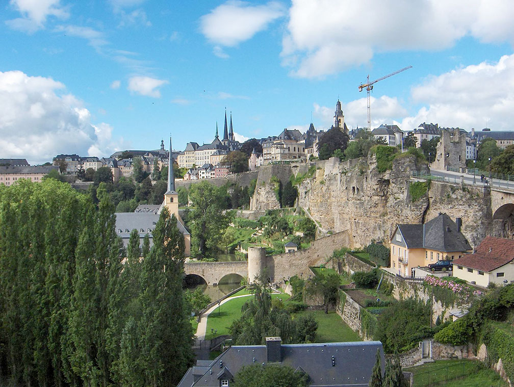
-view-from-Metz-square.jpg) Luxembourg (city) view from Metz square. Image: Marcin Szala |
About Luxembourg (City) Satellite view showing Luxembourg (City), the national capital of the Satellite view showing Luxembourg (City), the national capital of the  Luxembourg City straddles several valleys and outcrops. Image: Streppel Today Luxembourg city has a population of about 100.000 inhabitants. Some points of interest: Main attractions are the Grand Ducal Palace, Notre-Dame Cathedral, the only cathedral in the country, the National Museum of History and Art, the Mudam, the foremost museum dedicated to contemporary art in Luxembourg, and the Neumünster Abbey, formerly a Benedictine Abbey is today a public meeting place and cultural center. Just zoom in (+) to see Grand Ducal Palace, the official residence of the Grand Duke of Luxembourg. Nearby to the south there are the city's Old Quarters and Fortifications, a UNESCO World Heritage Site The map shows a city map of Luxembourg City with expressways, main roads and streets, zoom out to find the location of Luxembourg – Findel Airport (IATA code: LUX), about 6 km (4 mi) northeast of the city. To find a location use the form below. To view just the map, click on the "Map" button. |
|
| To find a location type: street or place, city, optional: state, country. |
Local Time Luxembourg:
Friday-April-26 12:08
Standard Time Zone (CET): UTC/GMT +1 hourCEST (Daylight Saving Time) in use from end of March until end of October: time zone offset: UTC/GMT +2 hours |
|
φ Latitude, λ Longitude (of Map center; move the map to see coordinates): , |
||||||
| Google Maps: Searchable map/satellite view of Luxembourg (City), Luxembourg. City Coordinates: 49°36′36″N 6°08′00″E |
Bookmark/share this page
|
|||||
| More about Luxembourg: Country: Continent: |
Weather Conditions Luxembourg External Links: Luxembourg City (official web site; in French) Wikipedia: Luxembourg (City) Wikipedia entry Luxembourg (City). |
Related Consumer Information:
|
||||
Europe Alpha City Tour: Rome - Zürich - Madrid - Paris - Amsterdam London - Stockholm - Berlin - Prague - Vienna - Istanbul Other Major Cities in Western Europe Bern, Bordeaux, Brussels, Cannes, Cologne, Den Hague, Dresden, Düsseldorf, Frankfurt, Geneva, Hamburg, Luxembourg (City), Lyon, München, Monaco, Nice, Rotterdam, Strasbourg, Stuttgart, Toulouse, Vaduz Searchable Maps of other Countries in Western Europe: Austria | Belgium | France | Germany | Liechtenstein | Monaco | Netherlands | Switzerland Political Maps of other Countries in Western Europe: Austria Map | Belgium Map | France Map | Germany Map | Netherlands Map | Switzerland Map |
||||||
Map Help [ show ]  |
||||||
One World - Nations Online .:. let's care for this planet Promote that every nation assumes responsibility for our world. Nations Online Project is made to improve cross-cultural understanding and global awareness. More signal - less NOISE |
| Site Map
| Information Sources | Disclaimer | Copyright © 1998-2023 :: nationsonline.org |