
One World
Nations Online
Countries in the World
 |
|
 One World Nations Online Countries in the World | |
Home  |
___ Satellite View of the City of Den Haag (The Hague) |
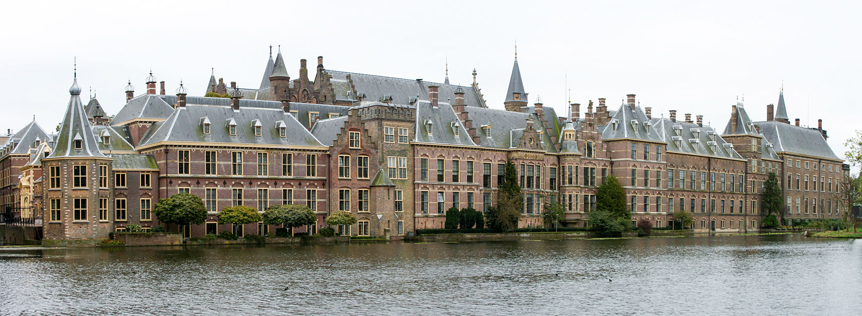
 Panorama of the Binnenhof at the Hofvijver lake in The Hague, the government complex houses the Senate (Eerste Kamer) and the House of Representatives (Tweede Kamer), and the office of the Prime Minister of the Netherlands. Image: Jesterhat84 |
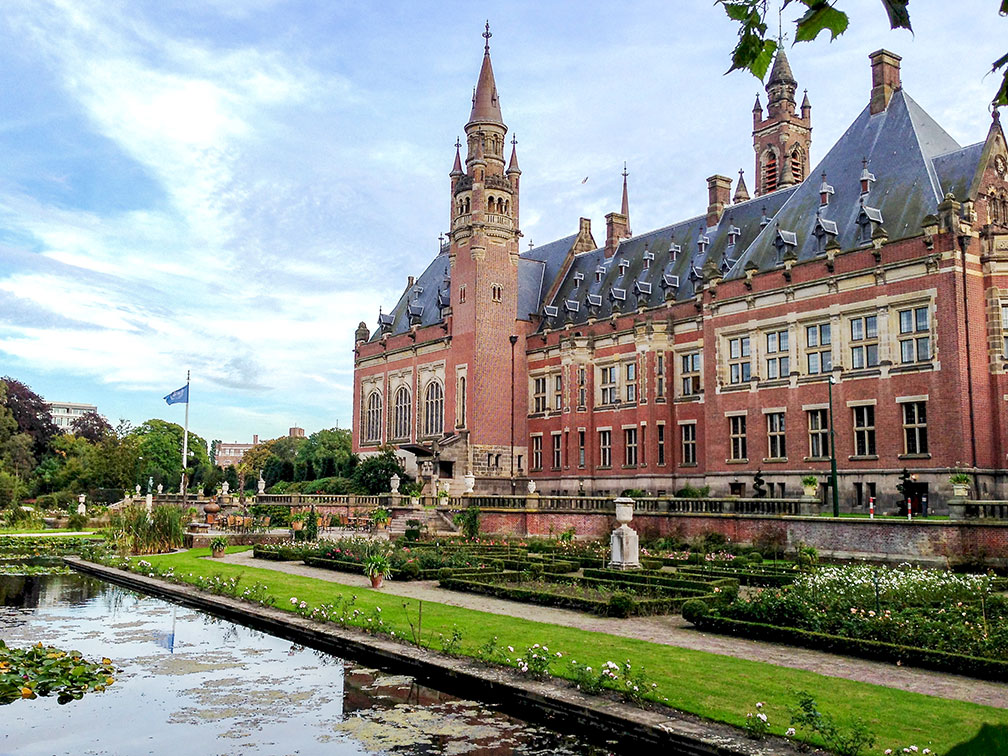
About Den Haag Satellite view is showing The Hague, third-largest city, capital of the province of South Holland, and the seat of the government of the Satellite view is showing The Hague, third-largest city, capital of the province of South Holland, and the seat of the government of the  The Peace Palace, the seat of the International Court of Justice in the City of The Hague. Image: Roman Boed Den Haag is also seat of the United Nation's International Court of Justice. Den Haag has a population of about 516,000 inhabitants in its urban area (in 2015). 2,2 million people live in the Rotterdam The Hague Metropolitan Area. Official language is Dutch. The city is home to a campus of the Leiden University, the oldest university in the Netherlands (universiteitleiden.nl). Due to its role as a government city, The Hague has a service-oriented economy, a large number of civil servants, magistrates and diplomats are working in the city. Several large international companies have their headquarters or regional headquarters in The Hague. Some points of interest in The Hague: Binnenhof, government complex in the city center at Hofvijver lake. Peace Palace, the seat of the International Court of Justice (vredespaleis.nl). Noordeinde Palace, one of the three official palaces of the Dutch royal family, the "working palace" for King Willem-Alexander. Huis ten Bosch palace, one of the three official palaces of the Dutch royal family located in the Haagse Bos forest. Grote of Sint-Jacobskerk, Protestant church, a landmark in the city and one of the oldest buildings in The Hague. Kloosterkerk, church and monastery on the Lange Voorhout. Mauritshuis, museum with a collection of Dutch Golden Age paintings (mauritshuis.nl). Gemeentemuseum Den Haag, art museum famous for its large Mondrian collection (gemeentemuseum.nl). Escher Museum, featuring works of the famous Dutch graphical artist M. C. Escher (escherinhetpaleis.nl). Panorama Mesdag, the museum features the 19th-century artist Hendrik Mesdag, famous for his panoramic beach paintings of Scheveningen, one of The Hagues beach resorts (panorama-mesdag.nl). Louwman Museum, museum for classic and historic cars, coaches, and motorcycles (louwmanmuseum.nl). Museon, popular museum for science and culture (www.museon.nl). Beelden aan Zee, sculpture museum in Scheveningen (beeldenaanzee.nl). Drievliet, amusement park (drievliet.nl). Madurodam, park with miniature models depicting Dutch buildings and landmarks (madurodam.nl). The Map shows a city map of The Hague with expressways, main roads and streets. To find a location use the form below. To view just the map, click on the "Map" button. second largest city and main seaport is Rotterdam. |
|
| To find a location type: street or place, city, optional: state, country. |
Local Time The Hague:
Wednsday-April-24 22:32
Standard Time Zone (CET): UTC/GMT +1 hourCEST (Daylight Saving Time) in use from end of March until end of October. Time zone offset: UTC/GMT +2 hours |
|
φ Latitude, λ Longitude (of Map center; move the map to see coordinates): , |
||||||
| Sorry! Google's pricing policy has made it impossible for us to continue showing Google Maps. We apologize for any inconvenience. Google Map: Searchable Map of the City of Den Haag (The Hague), Netherlands. City Coordinates: 52°5′N 4°19′E |
Bookmark/share this page
|
|||||
| More about the Netherlands: Cities: Country: Continent: External Links Den Haag (official website) Wikipedia: Den Haag |
Weather Conditions The Hague |
Related Consumer Information:
|
||||
Europe's Alpha Cities Tour: Rome - Zürich - Madrid - Paris - Amsterdam London - Stockholm - Berlin - Prague - Vienna - Istanbul Other Major Cities in Western Europe Bern, Bordeaux, Brussels, Cannes, Cologne, Dresden, Düsseldorf, Frankfurt, Geneva, Hamburg, Luxembourg (City), Lyon, München (Munic), Monaco, Nice, Rotterdam, Strasbourg, Stuttgart, Toulouse, Vaduz |
||||||
Map Help [ show ]  |
||||||
One World - Nations Online .:. let's care for this planet Promote that every nation assumes responsibility for our world. Nations Online Project is made to improve cross-cultural understanding and global awareness. More signal - less NOISE |
| Site Map
| Information Sources | Disclaimer | Copyright © 1998-2023 :: nationsonline.org |