Nations Online
All Countries in the World
Nations Online All Countries in the World | |
Home  |
 Playa de Pocitos, Montevideo's beach front. Image: José Porras |
___ Satellite View and Map of the City of Montevideo, Uruguay |
About Montevideo Satellite view is showing Montevideo, by far the largest city, chief port and the national capital of Satellite view is showing Montevideo, by far the largest city, chief port and the national capital of 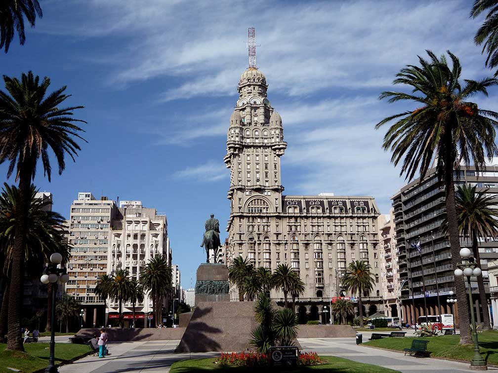 Plaza Independencia with Palacio Salvo in Montevideo. Image: Chrissy Today Montevideo has a population of about 1.3 million inhabitants (census 2011), that's one-third of the Uruguay's total population. Official language is Spanish. The city is the cultural, economical, educational, and political center of the nation, and a leading institution in South America, similar to Brussels in Europe. Montevideo is the seat of the administrative headquarters of Mercosur, the Southern Common Market, and ALADI, Latin America’s primary trade blocs. Montevideo is ranked by Mercer’s Quality of Living Survey as one of the top Latin American cities. Just zoom in (+) to see Plaza Independencia with Palacio Salvo, the center of Ciudad Vieja (old city) of Montevideo. The map shows a city map of Montevideo with expressways, main roads and streets, zoom out to find the location of Carrasco International Airport (IATA code: MVD) 18 km (11.2 mi) by road (via Avenida Italia/Av Italia) northeast of the city center. A High-speed ferry line to Buenos Aires (2 h) leaves from Ciudad Vieja district. To find a location use the form below. |
| To find a location type: street or place, city, optional: state, country. |
|
φ Latitude, λ Longitude (of Map center; move the map to see coordinates): , |
||||||
| Google Earth: Searchable Map and Satellite view of Montevideo, Uruguay. City Coordinates: 34°53′1″S 56°10′55″W |
Bookmark/share this page |
|||||
| More about Uruguay: Country: Continent: External Links Montevideo (official web site) Wikipedia: Montevideo | Weather Conditions Montevideo: Weather station is at Carrasco International Airport
|
Related Consumer Information:
|
||||
Other Cities in South America: Asunción (Paraguay) - Bogotá D.C. (Colombia) - Brasilia, Rio de Janeiro, São Paulo, Salvador, (all Brazil) - Buenos Aires (Argentina) - Caracas (Venezuela) - Cayenne, Kourou (both French Guiana) - Georgetown (Guyana) - La Paz, Sucre (both Bolivia) - Lima (Peru) - Paramaribo (Suriname) - Port of Spain (Trinidad and Tobago) - Quito (Ecuador) - Santiago (Chile) |
||
Map Help [ show ] |
||
One World - Nations Online .:. let's care for this planet Promote that every nation assumes responsibility for our world. Nations Online Project is made to improve cross-cultural understanding and global awareness. More signal - less NOISE |
| Site Map
| Information Sources | Disclaimer | Copyright © 1998-2023 :: nationsonline.org |

