Nations Online
All Countries in the World
Nations Online All Countries in the World | |
Home  |
___ Satellite View and Map of the City of Rio de Janeiro |
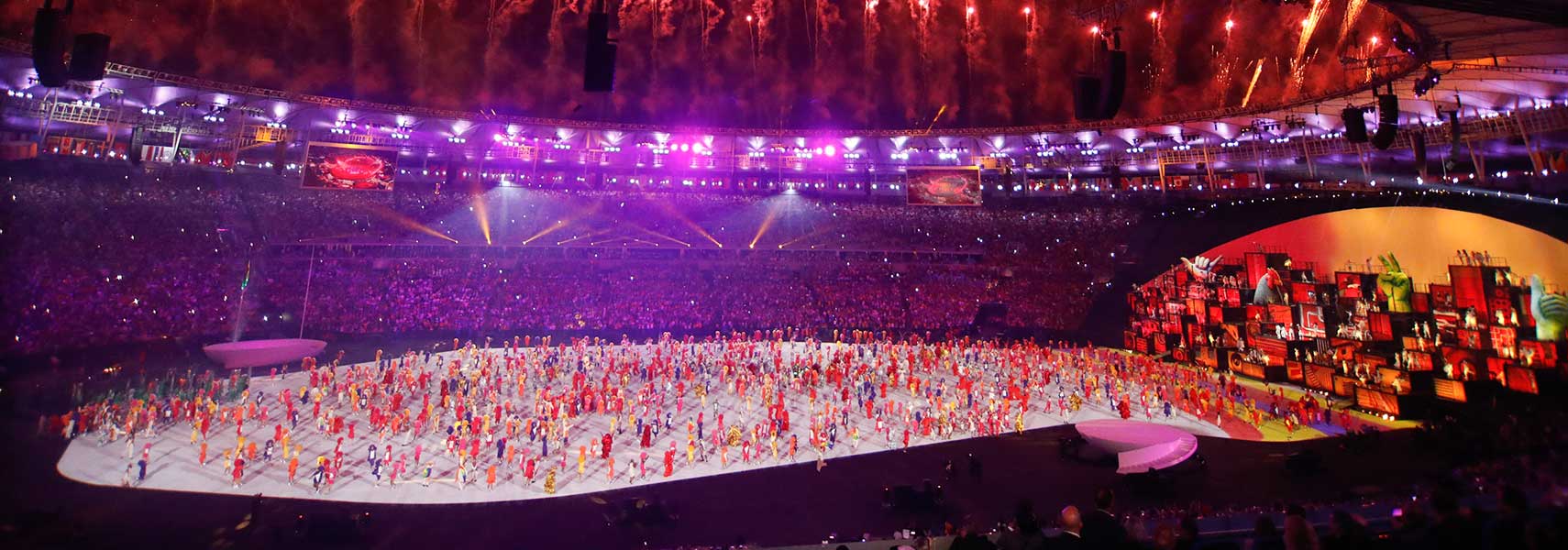 2016 Summer Olympics opening ceremony Rio de Janeiro, Brazil. Image: Agência Brasil |
About Rio de Janeiro Satellite view showing São Sebastião do Rio de Janeiro or shortened Rio de Janeiro, also just called Rio, is the second latgest city in Satellite view showing São Sebastião do Rio de Janeiro or shortened Rio de Janeiro, also just called Rio, is the second latgest city in 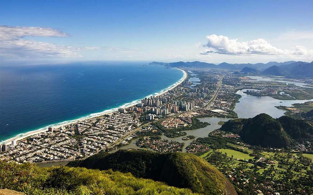 Panorama of Barra da Tijuca, the famous borough in the West Zone of Rio de Janeiro. Image: Barrazine da Barra Today Rio is the capital of the Brazilian state of the same name (Rio de Janeiro) and is the chief port of Brazil. The megacity has a population of about 6.4 million people (in 2014), 11-12 million live in the larger metropolitan area. Ipanema with its famous beach is located in the southern region of Rio de Janeiro, adjacent east of Ipanema lies Copacabana with its beaches. Rio's Carioca Landscapes between the Mountain and the Sea Rio de Janeiro points of interest: Beaches: Copacabana (balneario beach with samba, beach football and beach volleyball), Ipanema (bohemic beach adjacent to Copacabana), Botafogo (upper middle class beachfront neighborhood), Leblon (affluent beachfront neighborhood), Recreio dos Bandeirantes (beachfront neighborhood with no skyscrapers). 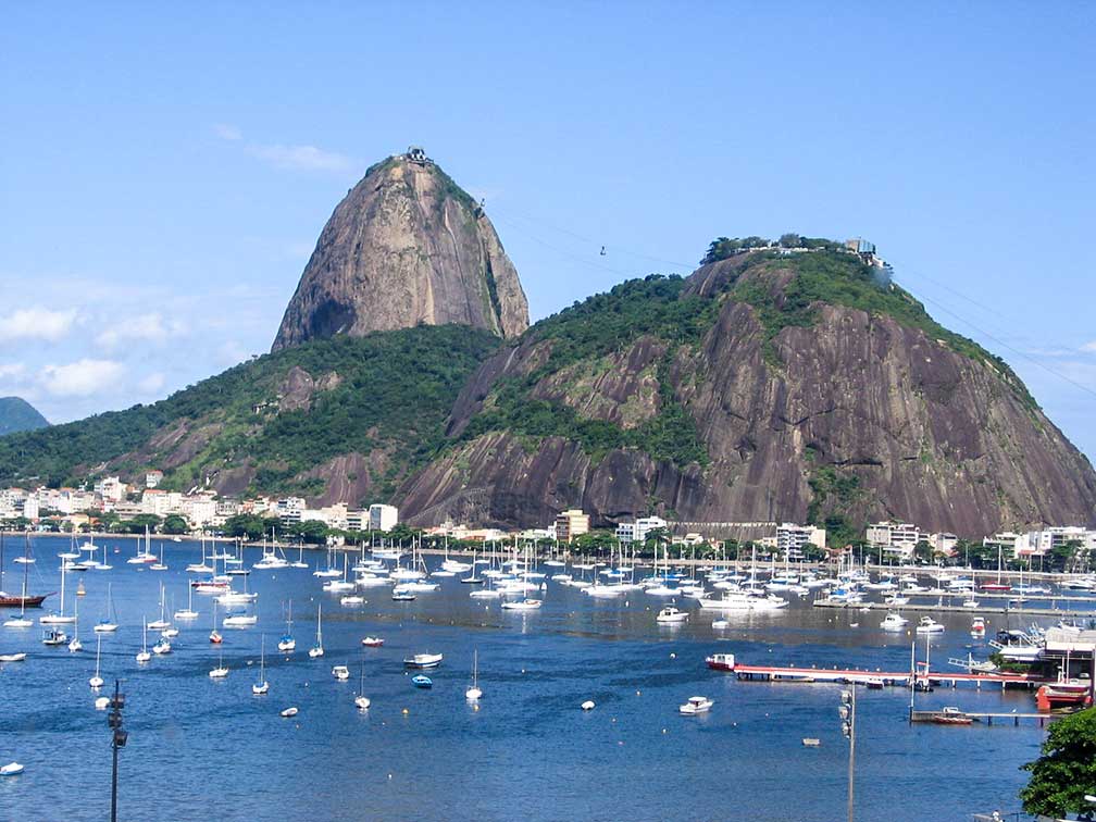 Sugarloaf Mountain or Pão de Açúcar in Portuguese, Rio's famous landmark. Image: Gfonsecabr Museums: Museu Nacional de Belas Artes (important national art museum), Museum of Modern Art (MAM Rio shows collections of modern art, largely from the collection Gilberto Chateaubriand), National Historical Museum (history of Brazil on display), Catete Palace (Neoclassical multi-purpose urban mansion, today it houses the Museum of the Republic), Museu Imperial de Petrópolis (museum housed in the former summer palace of Emperor Pedro II ) Theater: Theatro Municipal (twentieth century theater located in Cinelândia) Churches: Metropolitan Cathedral of Rio de Janeiro (Pyramid-shaped modernist church from the 60s, seat of the Roman Catholic Archdiocese of São Sebastião), Candelária Church (historical Roman Catholic church), Old Cathedral of Rio de Janeiro (historical building and the former Royal and Imperial Chapel) Parks: Tijuca Forest (perhaps the world's largest urban forest), Quinta da Boa Vista (formerly the park of the residence of the Emperors of Brazil), Passeio Público (oldest public park of Brazil in the historic center of Rio), Jardim Botânico (Brazilian and foreign flora) Sports: 2016 Olympic and Paralympic Games In 2009, in Copenhagen (Denmark), the then IOC President Jacques Rogge announced that Rio de Janeiro had won the right to host the 2016 Olympic and Paralympic Games. The 2016 Summer Games, the world's largest sporting event, will take place in South America for the first time. 2014 FIFA World Cup The city was one of the twelve host cities of the 2014 FIFA World Cup. Seven matches including the Final were held at the Maracanã stadium (officially named: Estádio Jornalista Mário Filho). The Map shows a city map of Rio de Janeiro with expressways, main roads and streets, and the location of Santos Dumont Airport (IATA Code: SDU), Rio’s city airport. Zoom out to find of Rio de Janeiro-Galeão International Airport (IATA Code: GIG), situated north of the city. To find a location use the form below. |
|
| To find a location type: street or place, city, optional: state, country. |
Local Time Rio de Janeiro:
Friday-April-26 23:44
Brazil Standard Time: UTC/GMT -3 hoursDaylight Saving Time starts on the 3rd Sunday of October and ends on the 3rd Sunday of February shifts time offset to UTC/GMT -2 hours. |
|
φ Latitude, λ Longitude (of Map center; move the map to see coordinates): , |
||||||
| Google Earth: Searchable map/satellite view of the City of Rio de Janeiro, Rio de Janeiro State, Brazil. City Coordinates: 22°54′30″S 43°11′47″W |
Bookmark/share this page |
|||||
| More about Brazil: Cities - background notes and a searchable map/satellite view of other Brazilian cities: Largest cities in Brazil: Other Cities: Aracaju, Belém, Boa Vista, Campo Grande, Cuiabá, Florianópolis, Goiânia, João Pessoa, Macapá, Maceió, Natal, Palmas, Porto Alegre, Porto Velho, Recife, Rio Branco, São Luís, Teresina, Vitória Country: Continent: |
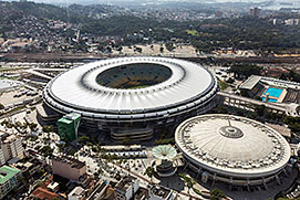 The Maracana Stadium, Rio de Janeiro Image: Brazilian Government Weather Conditions Rio de Janeiro
External Links: Rio de Janeiro (official website) Turisrio Official tourism website of the State of Rio de Janeiro. Rio Guide Official tourism website of the City of Rio de Janeiro. Maracanã stadium The official stadium website. Wikipedia: Rio de Janeiro Wikipedia entry: Rio de Janeiro |
Explore more:
Related Consumer Information:
|
||||
Other Cities in South America: Asunción (Paraguay) - Bogotá D.C. (Colombia) - Buenos Aires (Argentina) - Caracas (Venezuela) - Cayenne, Kourou (both French Guiana) - Georgetown (Guyana) - La Paz, Sucre (both Bolivia) - Lima (Peru) - Montevideo (Uruguay) - Paramaribo (Suriname) - Quito (Ecuador) - Santiago (Chile) |
||
Map Help [ show ] |
||
One World - Nations Online .:. let's care for this planet Promote that every nation assumes responsibility for our world. Nations Online Project is made to improve cross-cultural understanding and global awareness. More signal - less NOISE |
| Site Map
| Information Sources | Disclaimer | Copyright © 1998-2023 :: nationsonline.org |

