Nations Online
All Countries in the World
Nations Online All Countries in the World | |
Home  |
___ Satellite View and Map of the City of Lima, Peru |
About Lima
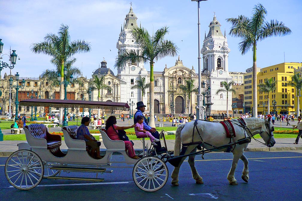 Plaza de Armas, the famous square in Lima with the Cathedral of Lima. The Historic Centre of Lima Image: Dozenist The city was founded by Spanish conquistador Francisco Pizarro in 1535, as Ciudad de los Reyes (City of Kings). In 1542 it became the capital of the Viceroyalty of Peru, a Spanish colonial administrative district. Today Lima is the 5th largest city in Latin America, behind Mexico City, São Paulo, Buenos Aires and Rio de Janeiro. Almost 9 million people live in the city. Together with its port at Callao, it forms a large urban area known as the Lima Metropolitan Area with an overall population of 10 million, around one-third of the Peruvian population. Spoken language is Peruvian Coastal Spanish. The city is home to the National University of San Marcos, one of the oldest higher learning institutions in the New World, founded on May in1551. Lima hosted the 2014 United Nations Climate Change Conference, and was chosen to be the host city of the 2019 Pan American Games. Lima was in Frommer's list of Top Top Food & Drink Destinations 2012. The city is described as: "Though Lima started out as the richest and most beautiful colonial settlement in the Americas, by the 1980s and '90s it had become one of its most sprawling and disorderly cities. Travelers in a hurry to get to Cusco and Machu Picchu often landed and blitzed right past the capital. But recently this coastal city has been riding a wave of growing fame for its gustatory pleasures. Lima is now drawing a new flock of visitors who travel all the way to Peru just to eat". Just zoom in (+) to see Plaza Mayor, also known as or Plaza de Armas, the core of the city, located in the Historic Centre of Lima, a UNESCO World Heritage Site. The page shows a city map of Lima with expressways, main roads and streets, districts, parks and institutions, and the location of Jorge Chávez International Airport To find a location use the form below. |
|
| To find a location type: street or place, city, optional: state, country. |
Local Time Lima:
Sunday-April-28 11:02
UTC/GMT -5 hours |
|
φ Latitude, λ Longitude (of Map center; move the map to see coordinates): , |
||||||
| Google Earth: Searchable map/satellite view of Lima, Peru. City Coordinates: 12°2′36″S 77°1′42″W |
Bookmark/share this page |
|||||
| More about Peru: Key statistic figures Peru. External Links: Lima (Municipalidad de Lima; in Spanish) Wikipedia: Lima |
Weather Conditions Lima
|
Related Consumer Information:
|
||||
Other Cities in South America: Asunción (Paraguay) - Bogotá D.C. (Colombia) - Brasilia, Rio de Janeiro, São Paulo, Salvador, (all Brazil) - Buenos Aires (Argentina) - Caracas (Venezuela) - Cayenne, Kourou (both French Guiana) - Georgetown (Guyana) - La Paz, Sucre (both Bolivia) - Montevideo (Uruguay) - Paramaribo (Suriname) - Port of Spain (Trinidad and Tobago) - Quito (Ecuador) - Santiago (Chile) |
||
Map Help [ show ] |
||
One World - Nations Online .:. let's care for this planet Promote that every nation assumes responsibility for our world. Nations Online Project is made to improve cross-cultural understanding and global awareness. More signal - less NOISE |
| Site Map
| Information Sources | Disclaimer | Copyright © 1998-2023 :: nationsonline.org |


