More about Argentina 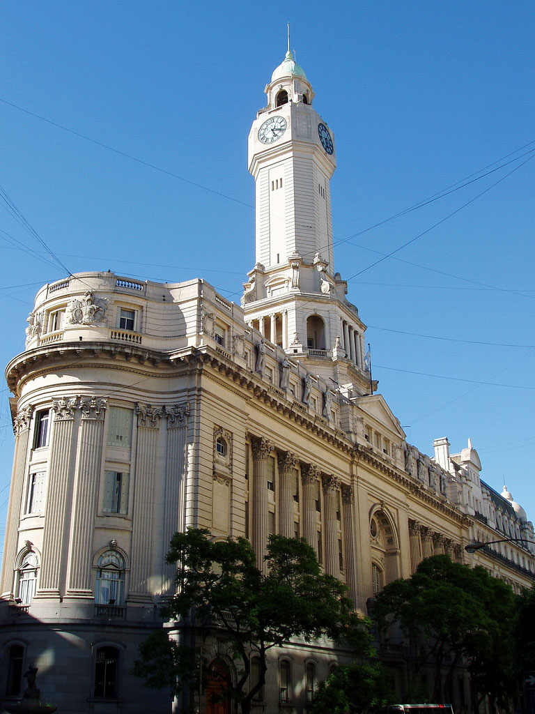 The Neoclassical style Palacio Legislativo is the legislature of the City of Buenos Aires; it houses the Government of the City of Buenos Aires. Photo: orourkepatricio
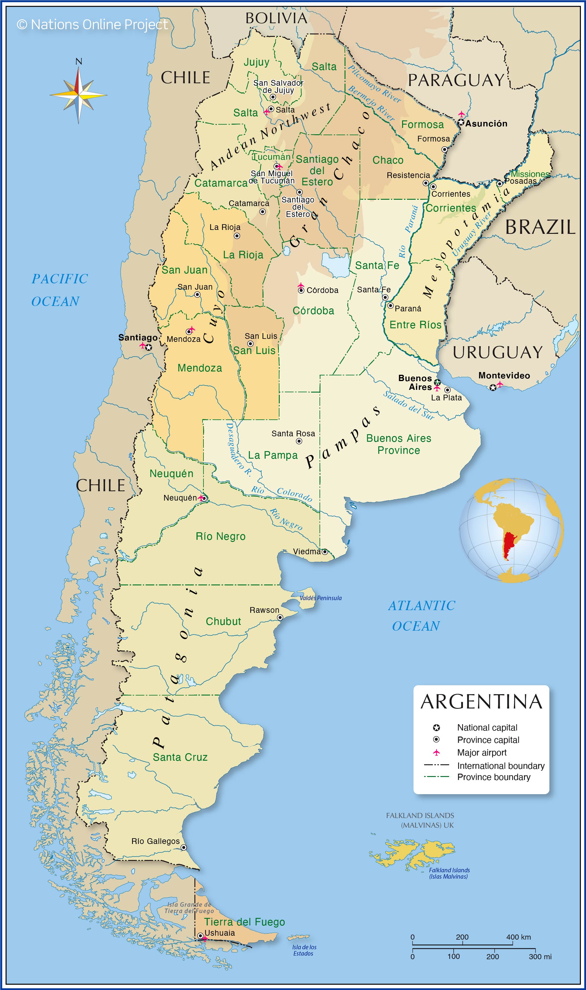
 Argentina is a federation of twenty-three provinces (Spanish: provincias, singular provincia) and one autonomous city (ciudad autónoma), Buenos Aires. The provinces and the capital exist in a federal system but have their own constitutions.
Provinces of Argentina The
Autonomous City of Buenos Aires (Ciudad Autónoma de Buenos Aires; "CABA"). The atonomous city of Buenos Aires is not part of Buenos Aires Province.
The
Buenos Aires Province (Provincia de Buenos Aires) is Argentina's largest and most populous province; its capital city is La Plata.
The mountainous semiarid
Catamarca province is situated in the northwest of the country; its capital is San Fernando del Valle de Catamarca. The route of the
Los Seismiles offers scenic views of the highest volcanoes on the planet, such as
Monte Pissis at 6,792 m, an extinct volcano on the border between the provinces of La Rioja and Catamarca, and
Ojos del Salado at 6893 m, the highest volcano on earth, located on the border between Argentina (Catamarca) and Chile.
The
Chaco (provincia del Chaco) is a province in central north-east of the country and lies within the southern part of the Gran Chaco region. The capital and largest city is Resistencia.
Chubut (Provincia del Chubut) is a province in southern Argentina within the Patagonia region. Chubut is almost as large as Great Britain and extends from the Andes chain in the west to the Atlantic Ocean in the east. Its capital is Rawson; the largest city is Comodoro Rivadavia. The Valdes Peninsula, a nature reserve and a UNESCO World Heritage Site, is part of Chubut.
The
Córdoba province is located in the center of the country. The main geographical features are the Sierras de Cordoba mountain range and the Mar Chiquita, a large saltwater lake.
Together with the provinces of Santa Fe and Entre Ríos, the province of Córdoba forms the political and economic association of the Center Region. Córdoba's capital is Córdoba, Argentina's second city.
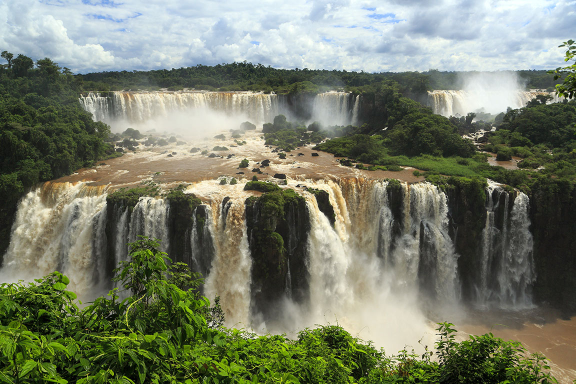 The Iguazú Falls on the border between the Brazilian state of Paraná and the Argentinean province of Misiones is one of the region's main attractions. Photo: Falk2
 The Province of
Corrientes is located in the Mesopotamia region between two major rivers in the northeast of Argentina. The Paraná River forms the border with Paraguay to the north and west, and the Uruguay River shapes the frontier to Brazil and Uruguay in the southeast. Corrientes is home to the Iberá National Park and the Esteros del Iberá, an international protected wetland. The capital city is Corrientes, a river port on the Paraná River, opposite Resistencia, the capital of Chaco province.
The
Entre Ríos province (Provincia de Entre Ríos) is part of the Mesopotamia region in northeastern Argentina. It is bordered by Uruguay in the east. Entre Ríos is the southeastern part of the historical and cultural region of Argentine Littoral (Región del Litoral), which comprises the banks and areas near the Paraná River, Paraguay River, Uruguay River, the islands of the Parana Delta, and the northern end of the Buenos Aires Province. Entre Ríos' capital and most populous city is Paraná.
The subtropical province of
Formosa with its mostly flat landscape is located in the northeast of Argentina and belongs geographically to the Gran Chaco region. It borders Paraguay in the north and the east. Its capital and most populated city is the homonymous Formosa. A major tourist attraction is the Río Pilcomayo National Park, which protects a portion of the
Humid Chaco ecoregion with its tropical and subtropical grasslands in the north of the province.
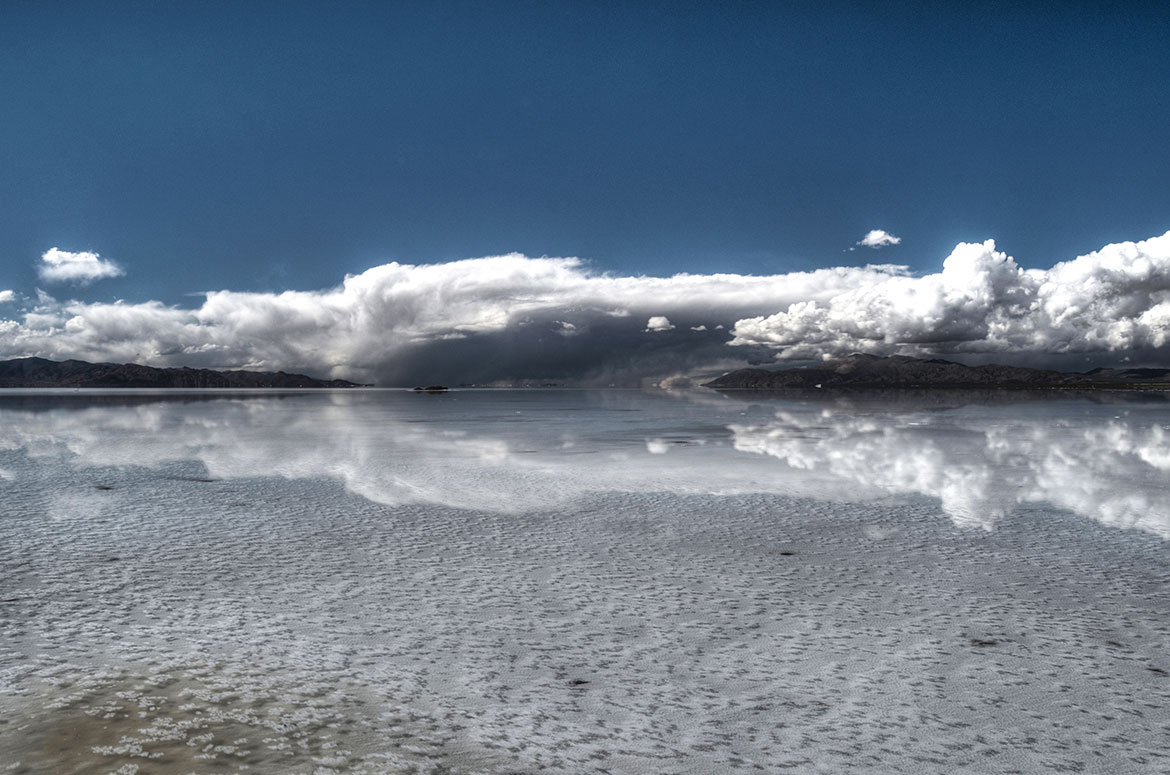 Mirror effect in the salt flats of Salinas Grandes in the provinces of Jujuy and Salta Photo: schnoogg
 The mineral-rich
Jujuy province is part of the Argentine Northwest region and lies within the Andes in the extreme northwest of Argentina. It borders Chile in the west, and Bolivia in the north. Jujuy's landscape is dominated by several mountain ranges and the eastern part of a barren tableland, the Atacama Plateau.
The capital city is San Salvador de Jujuy. The
Quebrada de Humahuaca, a narrow mountain valley, is a UNESCO World Heritage Site.
The
La Pampa province in central Argentina lies mainly in the semiarid Pampas, the fertile lowlands of South America, known for its prairies, gauchos, and farms. Most of the province has a cool temperate climate, but the north-eastern part enjoys a humid subtropical climate. On the shore of the Don Tomás Lagoon lies Santa Rosa, the capital city.
The Argentine
La Rioja province is located in the northwest of the country, bordering Chile in the west. The
Talampaya National Park, a UNESCO World Heritage Site, is located about 160 km southwest of the province capital La Rioja.
The scenic
Mendoza province in west-central Argentina is part of the Cuyo region known for its wine-growing culture, especially in the Luján de Cuyo wine region. Besides wine, other important crops are fruits and olives.
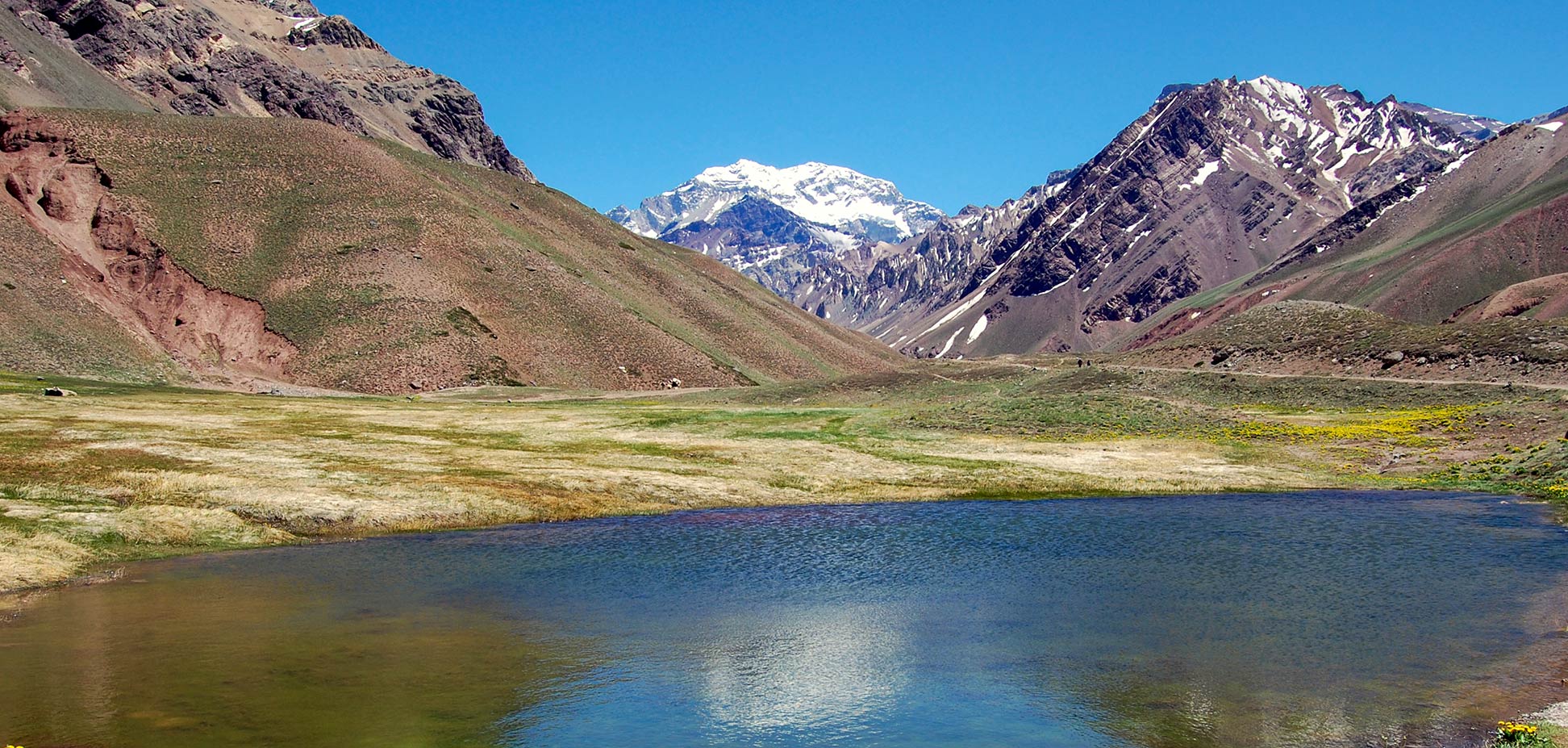
Aconcagua, at 6,961 m, the highest mountain in the Western Hemisphere, is located about 100 km west of the city of Mendoza, the capital of the province.
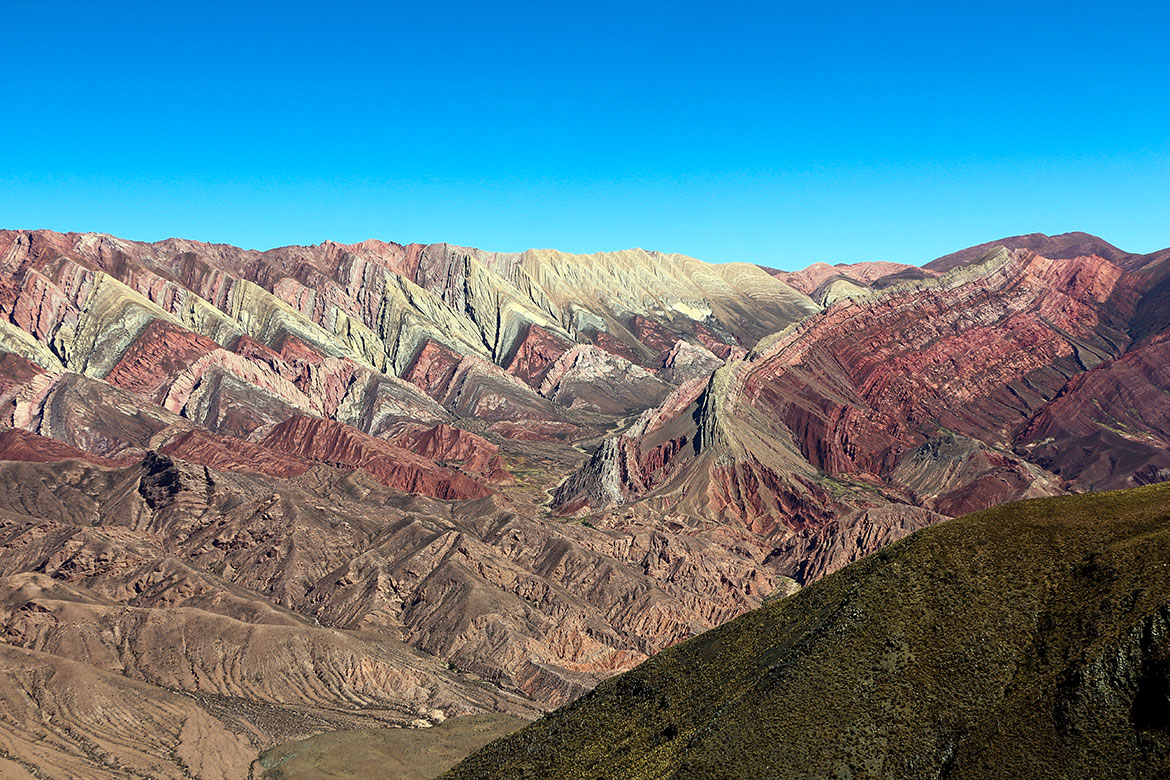 The mountain wasteland of Serranía de Hornocal in the province of Jujuy in Argentina. The colorful mountains are part of the UNESCO World Heritage Site of Quebrada de Humahuaca. Photo: Bernard Gagnon
 province is located in the northeastern corner of the country, between the Paraná and the Paraguay rivers. Iguazú National Park to the north of the province protects subtropical rainforest and is home to Iguazu Falls, one of the world's largest and most impressive waterfalls. The
Iguazu National Park is a UNESCO World Heritage Site. The capital of Misiones is Posadas on the Paraná River, which forms the border with Paraguay.
The province of
Neuquén in northwest Patagonia, borders the Andes mountains and Chile in the west, the Rio Colorado in the north, and the Limay River in the south. Neuquén is home to the Los Arrayanes National Park, a Patagonian Forest ecoregion that is part of the larger Nahuel Huapi National Park. Argentina's first national park was established in 1903 and is situated in the southwest of Neuquén. The province's capital is the city of Neuquén. The largest city Patagonia's, with a population of 340,000, is located at the confluence of the Limay and Neuquén rivers.
Río Negro province in the northeast of Patagonia consists of arid tablelands in the southern part. The Río Negro defines its northwestern boundary with Neuquén province, and Rio Colorado its northeastern border with La Pampa. In the west are the Andes with forested valleys and a chain of lakes. It is the site of Nahuel Huapí National Park, which it shares with the Neuquén province. The city of San Carlos de Bariloche in the foothills of the Andes is a popular starting point for hiking and skiing in the mountains and exploring the nearby lake district. Río Negro is bounded by the Atlantic in the east. The provincial capital is Viedma, which is located about 30 km from the Atlantic coast on the Negro River. Viedma is, together with the city of Carmen de Patagones on the opposite bank of the river, the oldest European settlement in Patagonia.
The
Salta province in the northwest of the country is located in a tropical zone; it is part of Argentina's Andean Northwest, surrounding Jujuy province. Salta encompasses territories of the Andes Mountains in the west, where it borders Chile. To the east are Yungas forests and the semiarid Gran Chaco lowlands. The provincial capital and most populous city is also called Salta, nicknamed "La Linda," the beautiful. The city is the departure point for the
Tren a las Nubes, a high-altitude (tourist) railway.
San Juan province in west-central Argentina is part of the Cuyo region known for its many vineyards. In the extreme west, near the Chilean border, the towering peak of
Cerro Mercedario dominates the Andes; at 6,720 m, it is the highest peak of the Cordillera de la Ramada. San Juan is home to the El Leoncito National Park; the park protects the fauna and flora of the Argentine Puna, a high-altitude desert. Within the isolated National Park, at an altitude of 2550 m, there are two astronomical facilities, the Leoncito Astronomical Complex and the Félix Aguilar Observatory. The capital of the province is the city of the same name San Juan. The city, nicknamed "Oasis City," lies in an oasis in a dry steppe-like region.
San Luis province in the Dry Pampas grasslands of the Cuyo region is situated near the geographical center of Argentina. The entire northern half of the province is dominated by rugged hills of low mountain ranges. The Sierra de las Quijadas National Park is known for its spectacular ochre-colored sandstone rock formations and for its fossils and dinosaur tracks. The capital is San Luis, the city lies at the foot of the Sierras de San Luis at an altitude of 762 m on the Río Chorrillos.
Santa Cruz is an Argentine province about the size of the Korean Peninsula or the US state of Michigan. It is located in the southern part of the Southern Cone of South America between the Andes mountains to the west and the Atlantic Ocean to the east. The capital is Río Gallegos, a port in the southern part of Santa Cruz, other port cities in the province are Caleta Olivia and Puerto Deseado. Santa Cruz is home to the
Los Glaciares National Park and the
Cueva de las Manos, both UNESCO World Heritage Sites.
The Argentine province of
Santa Fe in the Pampas region northeast of Buenos Aires and west of the river Paraná is characterized by agriculture. Major cities are the capital Santa Fe de la Vera Cruz and Rosário, a river port on the Paraná River, Rafaela in the Castellanos department, and Reconquista with a river port on the bank of the Paraná river nearby. The National Park Islas de Santa Fe in the San Jerónimo department to the north of Rosário protects a delta-like, fluvial-insular territory of the Paraná River and its branches Carcarañá and Coronda.
Santiago del Estero province in the north of the country lies almost entirely in the subtropical, semiarid Gran Chaco plains and belongs culturally to the Argentine Northwest region. Its capital and most populous city is the homonymous Santiago del Estero, the oldest continuously inhabited city in the country was founded in 1553 or 1550. The salt flat of Lago Salinas de Ambargasta and the northern end of the Mar Chiquita Lagoon characterizes the landscape in the southwest.
Tierra del Fuego is the southernmost and least populous province of Argentina which occupies the eastern half of Isla Grande de Tierra del Fuego and the much smaller Isla de los Estados on the southern tip of South America. Its capital is Ushuaia; its most populous city is Río Grande.
According to the Argentinean perspective, the two British Overseas Territories of the Falkland Islands and South Georgia and the South Sandwich Islands, the Antarctic Peninsula (also claimed by Chile and the United Kingdom), and a segment of Antarctica also belong to the province.
Tucumán is a small province in northwest Argentina; its landscape is characterized by the Andes Mountains (Aconquija range) in the west, the Gran Chaco lowlands in the east and south, and a hilly area to the north of the capital San Miguel de Tucumán. The highest peak in Tucumán province is Cerro del Bolsón at 5,552 m.
Regions and Provinces of Argentina Argentina extends over several climatic zones and offers a number of very different geographical and historical regions. Its landscape features high mountains and fertile river valleys, glaciers, fjords, salt flats, endless grassland plains, deserts, savannah and forests, rivers and lakes, and a 5,000 km coastline on the South Atlantic Ocean.
There are several different definitions of Argentinean regions and landscapes. Below you will find the most current.
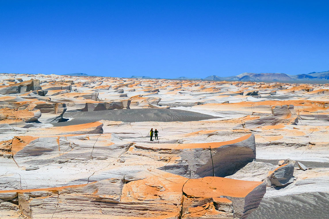 The protected area of Campo de Piedra Pómez, a pumice stone field landscape in Catamarca province. Photo: Mario Peretti
 (or Andean Northwest)
The mountainous, subtropical Argentine Northwest is a geographic and historical region in the northwestern edge of the country; it borders Bolivia in the north and Chile in the west. The two highest volcanoes in the world,
Ojos del Salado (6,880 m) and
Monte Pissis (6,795 m) are located at the edge of the Atacama Desert of Chile. The region includes four provinces, Jujuy, Salta, Tucumán, and Catamarca. Major cities are San Miguel de Tucuman, Salta, and Jujuy.
Gran Chaco The Gran Chaco region is located in the central north of Argentina and extends into western Paraguay and southeastern Bolivia in the north. Its landscape is characterized by dry subtropical broadleaf forests and thornbush savannas. The region extends over several provinces, mainly Santiago del Estero, Chaco, and Formosa, as well as into parts of La Rioja, Córdoba, in the south, and Juju, Salta, and Catamarca in the northwest.
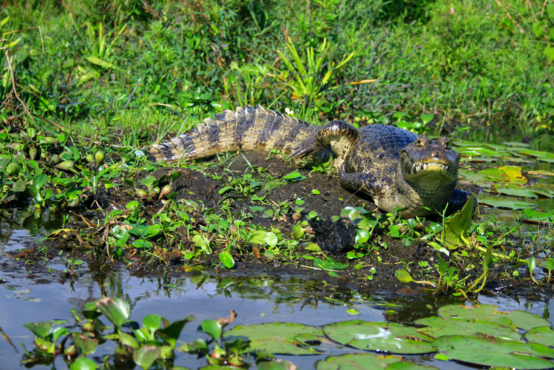 An obviously bad-tempered Yacare caiman in the Iberá wetlands (Esteros del Iberá), an international protected wetland in the Corrientes province. Photo: Mario Peretti
 The "land between rivers" is the tropical humid region in the northeast of Argentina, which borders Paraguay and Brazil; the rivers are the Paraná and the Uruguay river. The area includes the provinces of Misiones, Entre Ríos, and Corrientes. Mesopotamia is home to the Iguazú Falls, the Iguazú National Park, and the
Jesuit Missions of the Guaranis, a UNESCO World Heritage Site.
Cuyo Cuyo is a historic mountainous region in the Andes that borders the Atacama province of Chile to the west. The area is known as the wine country of Argentina and includes the provinces of San Juan, San Luis, Mendoza, and La Rioja. The largest city in Cuyo is Mendoza. The
Aconcagua is with its 6,961 m, the highest mountain in the Western Hemisphere. The Andes peak is located in the province of Mendoza.
Pampas The fertile humid and dry grasslands of the Pampas, a South American plain, covers an area of more than 1,200,000 km². The natural region includes all of Uruguay and the Argentine provinces of Córdoba, Santa Fe, La Pampa, and Buenos Aires Province.
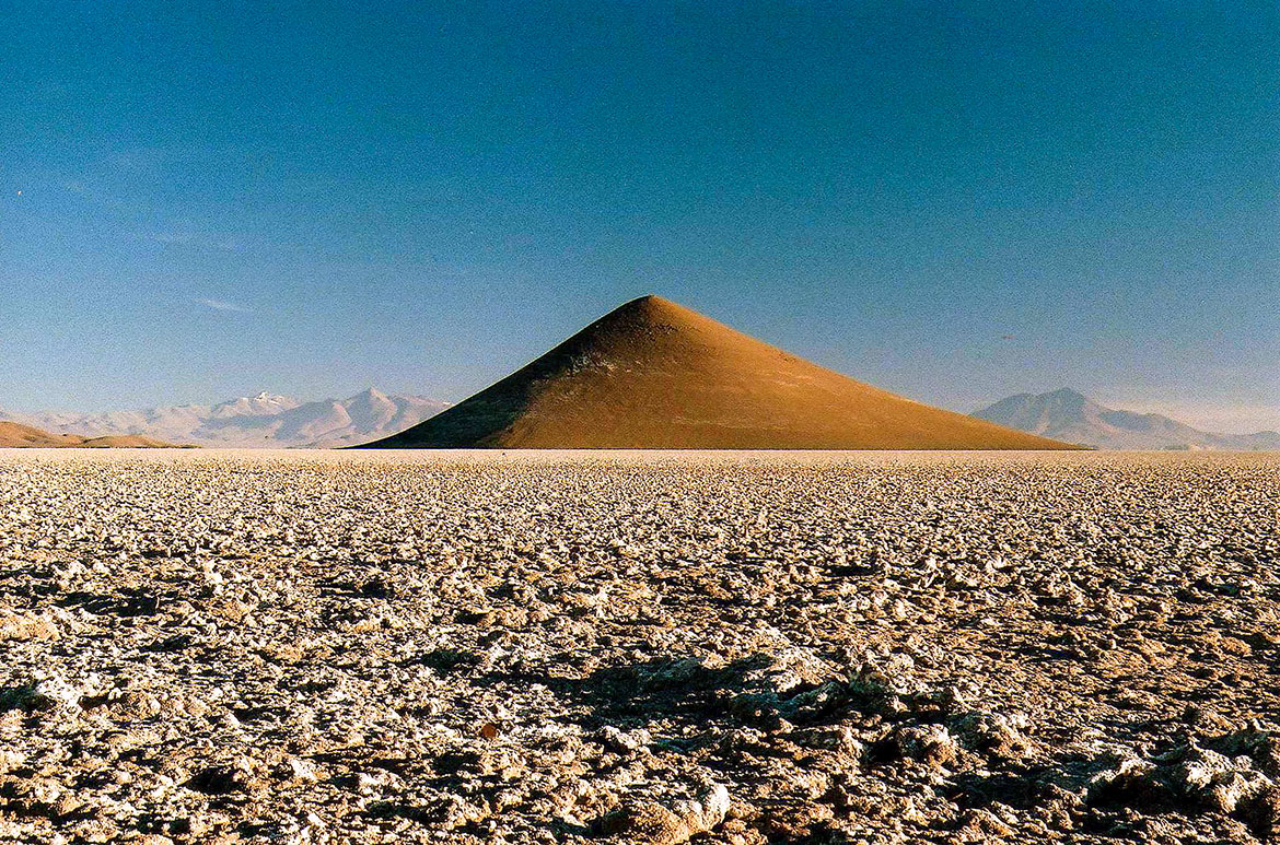 Cono de Arita in Salta province. Photo: rodoluca88
 The southern portion of South America is known as Patagonia; it is shared by Chile and Argentina. It is the largest region in Argentina and extends from the Colorado River in central Argentina to the Strait of Magellan and from the Andes to the Atlantic coast. The provinces of Río Negro (Viedma), Neuquén (Neuquén), Chubut (Rawson), and Santa Cruz (Río Gallegos) are located within this region.
Tierra del Fuego Isla Grande de Tierra del Fuego is the main island of the Tierra del Fuego archipelago at South America's southern tip. The largest island in South America occupies more than half of the area and is separated from the mainland by the Strait of Magellan. The island is divided between Argentina and Chile. The largest city is Ushuaia, a port and the capital of the Argentine Tierra del Fuego, Antártida e Islas del Atlántico Sur Province.
Argentine Antarctica Argentine Antarctica is an area of Antarctica claimed by Argentina, which formally took possession of the territory in 1942. The Argentinean claim, like the claims of other states, is not recognized by the international community.
Antarctica and South Atlantic Islands Province. Argentina operates several scientific research stations in Antarctica; the largest is the Marambio-Station on Seymour Island.

