About Pakistan
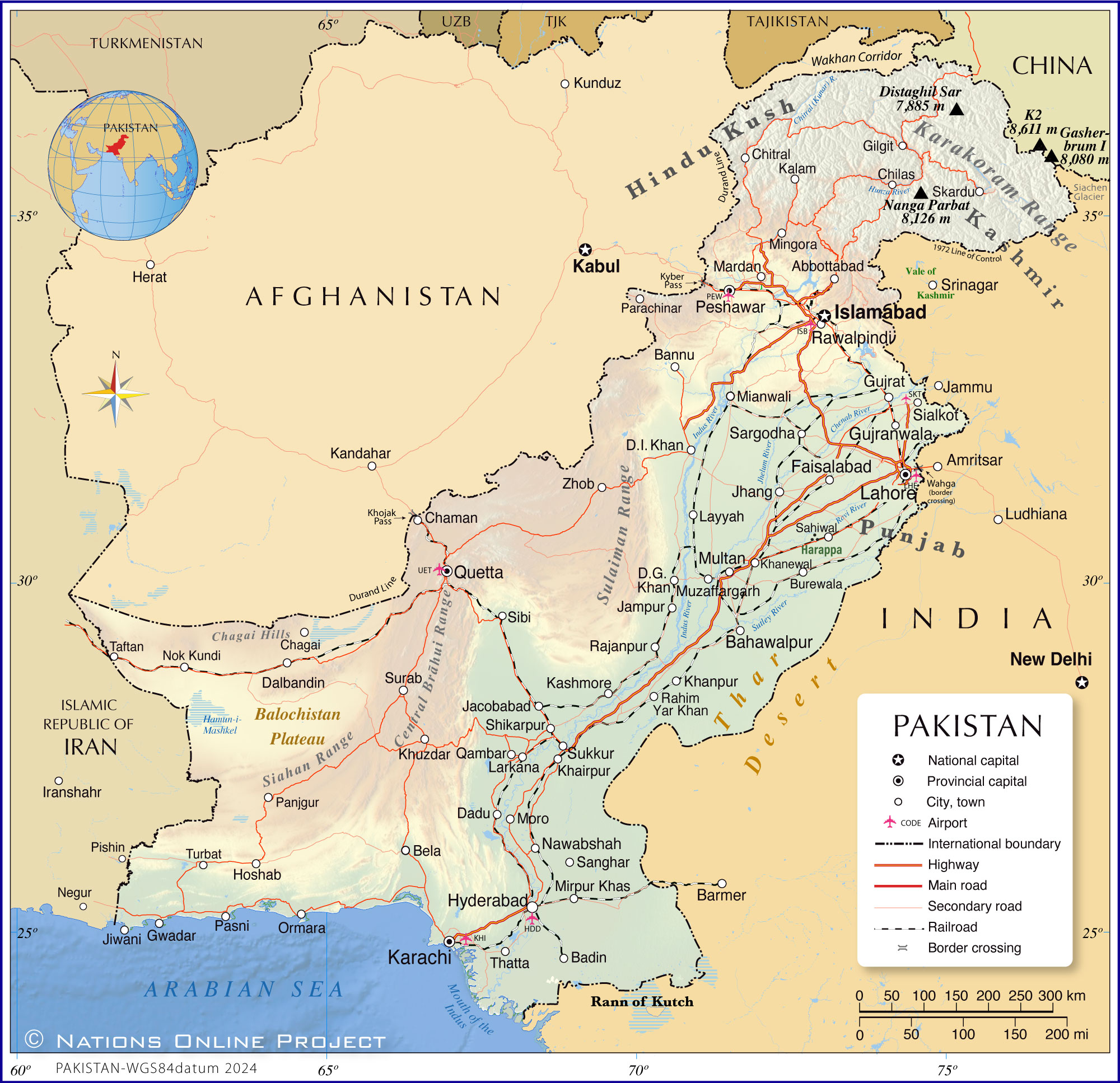
The map shows Pakistan, a South Asian country in the northwestern part of the Indian subcontinent. Pakistan borders
India to the east,
Afghanistan and
Iran to the west, and
China to the northeast. The country has over 1,000 km of coastline along the Arabian Sea in the south.
The northern part of Pakistan is known as Gilgit-Baltistan; it is the northern portion of the larger
Kashmir region, which has been the subject of a dispute between India and Pakistan since the partition of
British India in 1947. The Pakistan-administered
Kashmir region is home to several peaks of the
Himalayas and the
Karakoram mountain ranges, such as the
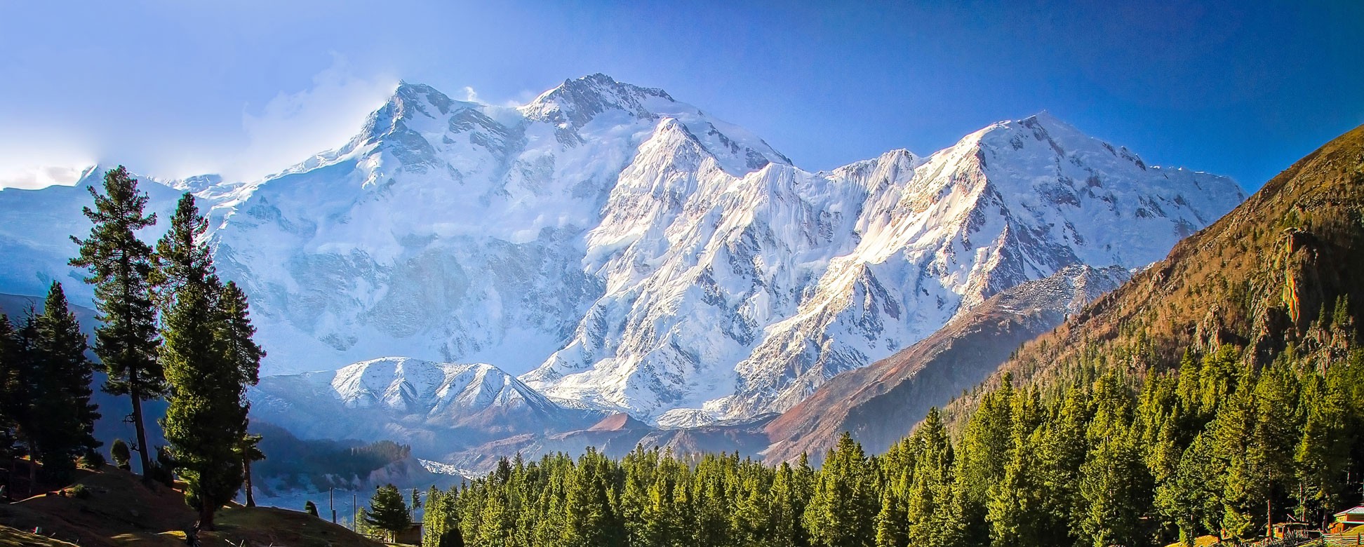
Nanga Parbat and the
K2, the world's second-highest mountain.
Pakistan occupies an
area of 796,095 km²; compared, it is somewhat larger than
Turkey (783,562 km²) or nearly twice the size of the U.S. state of
California.
Pakistan is the world’s fifth-most populous country, with a
population of 241.5 million (data from
PBoS, in 2023 (PDF)). The federal capital is
Islamabad. The largest city, chief port and economic hub is
Karachi; the second largest city is
Lahore. Other major Pakistani cities are Faisalabad, Rawalpindi, Multan, Gujranwala, Hyderabad, Peshawar, and Quetta.
The official
languages are Urdu and English; other languages in use are Punjabi, Sindhi, and Pashto.
The official religion of Pakistan is Islam; around 97 percent of Pakistanis are Muslims, most of whom belong to the Sunni sect. The nation's official name is the
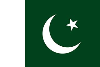
Islamic Republic of Pakistan.
More about Pakistan
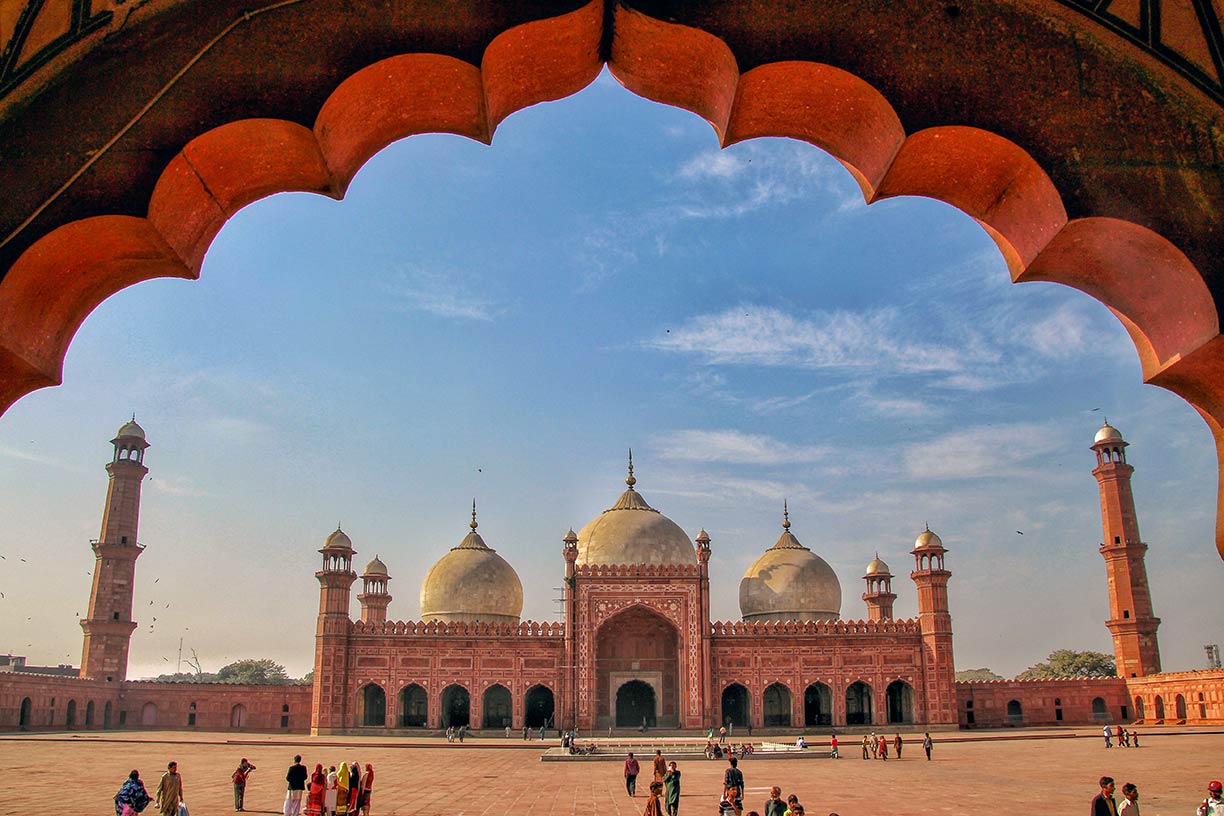 Mughal era Badshahi Mosque in Lahore, the capital of Punjab, Pakistan. The Badshahi Mosque, Lahore, is on UNESCO's tentative list of World Heritage Sites.
Photo: Fassifarooq
Pakistan was created on 14 August 1947 as a result of the partition of
British India, primarily on the basis of religious identity, to provide a separate nation for Muslims.
The movement for a separate Muslim state was led by the
All-India Muslim League under the leadership of
Muhammad Ali Jinnah. The partition led to massive communal violence and the largest mass migration in human history, with millions of Muslims moving to Pakistan and millions of Hindus and Sikhs moving to India.
In Urdu language, the term Pakistan can be translated to "Land of the Pure."; the origin of the name came from a 1933 pamphlet with the title "
Now or Never" in which was explained that Pakistan is an acronym of
Punjab,
Afghania (North-West Frontier Province),
Kashmir, and
Indus-Sind, together with the -stan suffix from Baluchistan (Balochistan).
The creation of Pakistan marked the end of British rule in the region and the establishment of an independent Muslim-majority country, initially comprising two geographically and culturally distinct regions,
East and West Pakistan, until the eastern portion seceded and became the
Republic of Bangladesh.
Geography of Pakistan
Pakistan's territory offers diverse landscapes and climates; there are arid deserts and lush green valleys, high mountain peaks, and fertile plains.
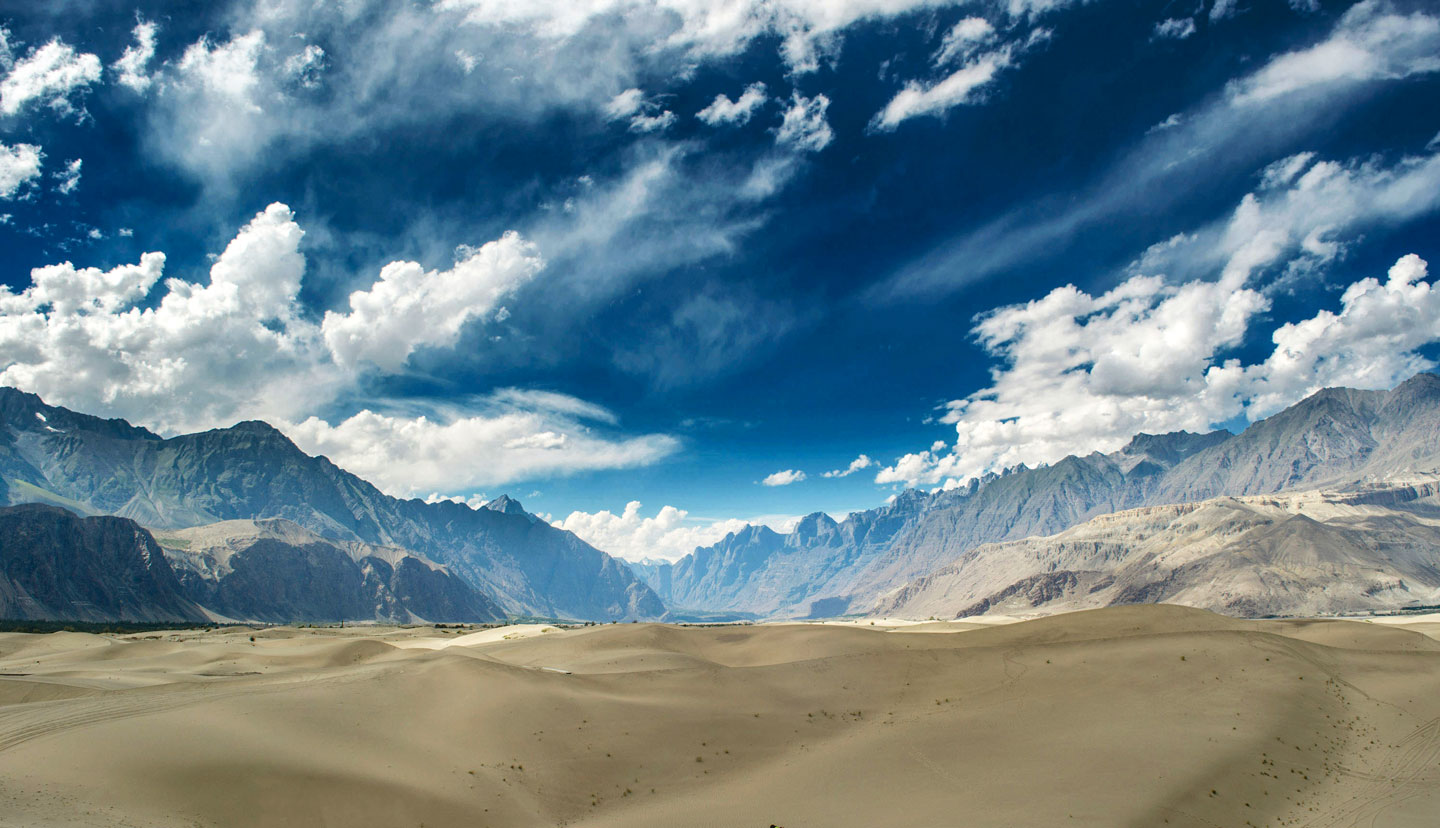 The Katpana Desert or Cold Desert near Skardu in Gilgit-Baltistan. The high-altitude desert is one of the highest in the world.
Photo: Fassifarooq
Pakistan's geography includes several deserts, such as the
Thar Desert on the eastern border with India and the
Balochistan Plateau in the southwest, characterized by arid conditions and rugged terrain.
The
Katpana Desert near Skardu in District Shigar, Gilgit-Baltistan, is a high-altitude cold desert located near Skardu in District Shigar, of Gilgit-Baltistan in northern Pakistan.
Rivers and Plains
Pakistan's eastern terrain is characterized by the flat
Indus Plain (part of the larger Indo-Gangetic Plain), crossed by the
Indus River and its tributaries. The Indus is the country's primary river and an essential water resource, but it also can cause floods and mudflows. The
Indus River basin is crucial for Pakistan's agricultural economy, supporting the livelihoods of millions of people. The Indus River valley is known as the cradle of the ancient
Indus Valley Civilization, one of the world's earliest urban cultures, which flourished around 2500 BCE.
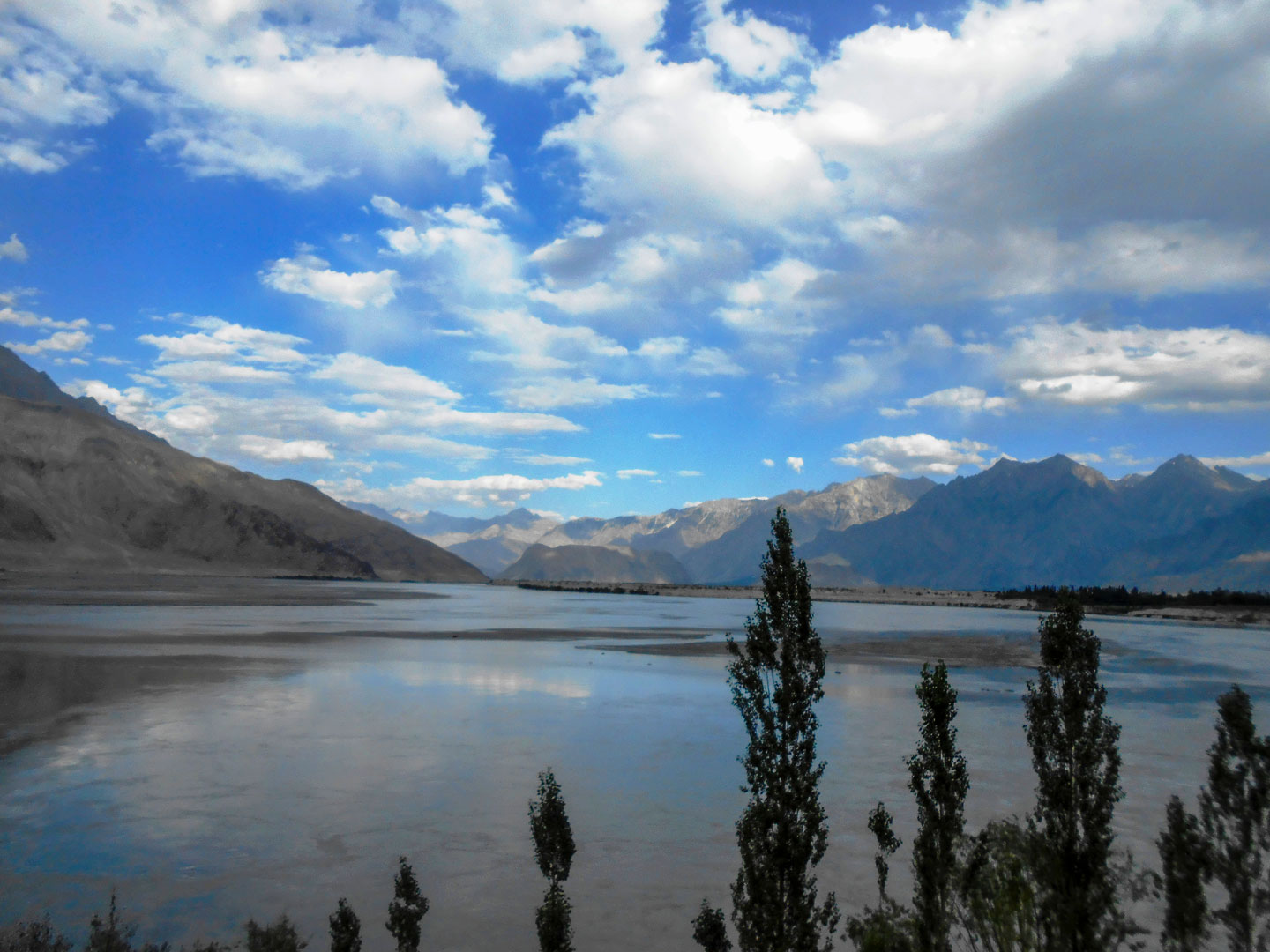 The Indus River near Skardu in Gilgit-Baltistan, Pakistan. The city is an important gateway to the eight-thousand-meter peaks of the nearby Karakoram Mountains. The Indus River and its tributaries are the backbone of agriculture and food production in Pakistan.
Photo: Akhtar Bashir Nigyaal
Pakistan has a coastline along the Arabian Sea in the south, with the port city of
Karachi serving as a major hub for trade and commerce. The coastal areas are vital for Pakistan's fishing industry and host important marine biodiversity.
Indus River Delta
The region where the Indus River flows into the Arabian Sea is one of the world's largest deltas, featuring extensive mangrove forests that provide habitat for a variety of wildlife, including several species of birds and aquatic life.
The mangrove forests support a rich biodiversity and are an important buffer against coastal erosion, storm surges, and rising sea levels. The delta hosts the
Indus River Delta-Arabian Sea Wetland, internationally recognized under the Ramsar Convention. The
Indus Delta is threatened due to the excessive use of pesticides and fertilizers, overfishing, water diversion, deforestation of mangroves, pollution and climate change.
Mountain Ranges
The Pakistani region north of the capital Islamabad is mountainous. The landscape there is dominated by the towering peaks of the
Himalayas, the
Karakoram, and the
Hindu Kush mountain ranges. The highest peak in the country is
K2, at 8,611 m; it is the second-highest mountain on Earth (after Mount Everest/Chomolungma). K2 is located in the Karakoram range on the border between Pakistan and China. The mountain is also known as Mt. Godwin-Austen, Chhogori/Qogir, and Ketu/Kechu.
There are f
ive eight-thousanders in Pakistan; the others are
Nanga Parbat (8,126 m),
Gasherbrum I (8,080 m),
Broad Peak (8,051 m) and
Gasherbrum II (8,035 m). Other mountain ranges in Pakistan are the
Sulaiman Mountains, a foothill of the southern
Hindu Kush Mountains, and the
Siahan Mountains in the central part of Balochistan Province, with mountains up to 2,000 meters high.
Climate
Pakistan's climate varies dramatically from north to south, ranging from arctic cold in the northern mountains to tropical on the southern coast. The country experiences four seasons: a cool, dry winter from December through February; a hot, dry spring from March through May; the summer rainy season, or monsoon period, from June through September; and the retreating monsoon period of October and November.
Transport
Railways
Pakistan Railways (PR), based in Lahore, is the national state railroad company with a route network of almost 7800 km.
PR provides rail transportation across the country, connecting major cities, towns, and regions.
Ports in Pakistan
The largest ports in the country are
Port of Karachi and
Port Qasim, two deep-water seaports in
Karachi, Pakistan's largest city. The third largest port in the country is
Gwadar Port, Pakistan's link to China's Belt and Road Initiative.
Airports in Pakistan
Largest airports in Pakistan are
Jinnah International Airport (KHI) in Karachi, I
slamabad International Airport (ISB), Islamabad-Rawalpindi,
Allama Iqbal International Airport (LHE) in Lahore,
Bacha Khan International Airport (PEW) in Peshawar,
Multan International Airport (MUX) in Multan,
Sialkot International Airport (SKT) in Sialkot, and Quetta International Airport (UET) in Quetta.
Cities and Towns in Pakistan
Depicted on the map are the locations of the following Pakistani cities and towns.
Abbottabad, Badin, Bahawalpur, Bannu, Bela, Burewala, Chagai, Chaman, Chilas, Chitral, Dera Ghazi Khan (D.G. Khan), Dera Ismail Khan (D.I. Khan), Dadu, Dalbandin, Faisalabad, Gilgit, Gujranwala, Gujrat, Gwadar, Hoshab, Hyderabad, Islamabad, Jacobabad, Jampur, Jhang, Jiwani, Kalam, Karachi, Kashmore, Khairpur, Khanewal, Khanpur, Khuzdar, Lahore, Larkana, Layyah, Mardan, Mianwali, Mingora, Mirpur Khas, Moro, Multan, Muzaffargarh, Nawabshah, Nok Kundi, Ormara, Panjgur, Parachinar, Pasni, Peshawar, Qambar, Quetta, Rahim, Rajanpur, Rawalpindi, Sahiwal, Sanghar, Sargodha, Shikarpur, Sialkot, Sibi, Skardu, Sukkur, Surab, Taftan, Thatta, Turbat, Yar Khan and Zhob.
Advertisements:


