Nations Online
All Countries in the World
|
One Planet Nations Online All Countries in the World | |
Home  |
___ Satellite View and Map of the City of Mandalay |
 Buddhist nuns in Mandalay at Image: kk nationsonline.org |
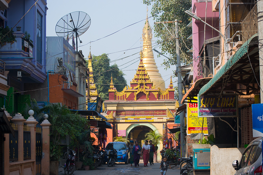
About Mandalay Satellite view is showing Mandalay, the 'northern capital' and the second largest city in Satellite view is showing Mandalay, the 'northern capital' and the second largest city in Mandalay was founded in 1857 and is located on the east bank of the Irrawaddy River, in central Burma.  Ein Daw Yar Pagoda Mandalay. Image: kk - Nations Online Project Mandalay is a major trading center, much of Burmese external trade to China goes through Mandalay. Official Language is Burmese, English is spoken by some Burmese, particulary in the tourism service sector. Just zoom in (+) to see Mandalay Palace, the last royal palace of the last Burmese monarchy of King Thibaw and Queen Supayalat. The palace was first looted by the British, and later destroyed during World War II by the Allied forces, it was reconstructed in the 1990s by the military junta. The map shows a city map of Mandalay with expressways, main roads and streets, zoom out to find the location of Mandalay International Airport (IATA code: MDL) located in a distance of about 38.4 km (24 mi) by road (via Saging-Mandalay Expy) south of Mandalay in Tada-U. To find a location use the form below. To view just the map, click on the "Map" button. |
|
| To find a location type: street or place, city, optional: state, country. |
Local Time Mandalay:
Thursday-April-25 15:13
UTC/GMT +6:30 hours |
|
φ Latitude, λ Longitude (of Map center; move the map to see coordinates): , |
||||||
| Google Maps: Searchable map/satellite view of Mandalay, Myanmar. City Coordinates: 21°58′30″N 96°5′0″E |
Bookmark/share this page
|
|||||
| More about Myanmar: Images: Landmark: Cities: Map and satellite view of the new national capital. Myanmar's buiness capital. Country: Myanmar key statistical data. Continent: External Link: Wikipedia: Mandalay |
Mandalay Weather Conditions: If the station is not responding, there might be a power outage of the public power network. These blackouts use to happen daily on a regular basis in the city. |
Related Consumer Information:
|
||||
Searchable Maps of other Countries in South East Asia: Brunei, Cambodia, Indonesia, Laos, Malaysia, Myanmar (Burma), Philippines, Singapore, Thailand, Vietnam Major Cities in Southeast Asia Bandar Seri Begawan, Bandung, Bangkok, Chiang Mai, Hanoi, Ho Chi Minh City (Saigon), Jakarta, Johor Bahru, Kuala Lumpur, Mandalay, Manila, Medan, Naypyidaw, Phnom Penh, Singapore, Surabaya, Vientiane, Yangon |
||
Map Help [ show ]  |
||
One World - Nations Online .:. let's care for this planet Promote that every nation assumes responsibility for our world. Nations Online Project is made to improve cross-cultural understanding and global awareness. More signal - less NOISE |
| Site Map
| Information Sources | Disclaimer | Copyright © 1998-2023 :: nationsonline.org |