Nations Online
All Countries in the World
|
One Planet Nations Online All Countries in the World | |
Home  |
___ Satellite View and Map of the City of Bandung |
 Panoramic view of central and southern Bandung. Image: Sabung.hamster |
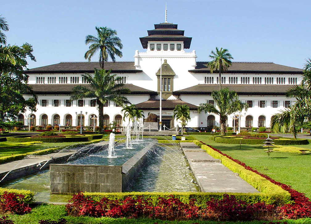
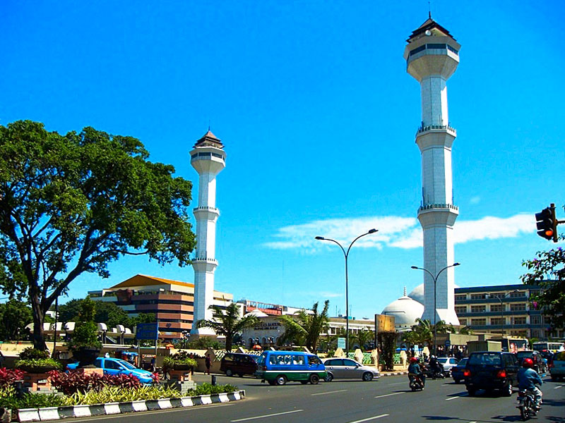
About Bandung The Dutch-built Gedung Sate, the Indo-European architecture style building in the city of Bandung was seat of the Dutch East Indies department of Transport, today the building serves as the governor's office of West Java. Image: Mey Lee  Satellite view is showing sprawling Bandung, provincial capital of Jawa Barat (West Java), and third largest city of Satellite view is showing sprawling Bandung, provincial capital of Jawa Barat (West Java), and third largest city of The city is situated about about 150 km (93 mi) by road, southeast of Jakarta, on a plateau in the Parahayangan mountains, south of Mount Tangkuban Perahu, a dormant volcano. The Cikapundung River divides Bandung from north to south. The city was founded by the Dutch in 1810, supposed to be new the capital of the Dutch possessions in Southeast Asia, the Dutch East Indies. Today the city has grown into a mega metropolis, but still offers numerous examples of Dutch colonial architecture with its tropical Art Deco architectural style. Bandung has a population of about 2.5 million inhabitants (2014 estimate), 8 million people live in its sprawling greater metropolitan area.  Grand Mosque of Bandung was built in 1812 and expanded several times. Image: Prayudi Setiadharma The map shows a city map of Bandung with expressways, main roads and streets, and the location of Husein Sastranegara International Airport (IATA code: BDO). Bandung Majalengka International Airport is an airport under construction near the city of Majalengka, about 100 km by road east of Bandung. To find a location use the form below. To view just the map, click on the "Map" button. |
|
| To find a location type: street or place, city, optional: state, country. |
Local Time Indonesia:
Wednsday-April-24 22:23
UTC/GMT +7 hours |
|
φ Latitude, λ Longitude (of Map center; move the map to see coordinates): , |
||||||
| Google Maps:Searchable map/satellite view of Bandung, Indonesia. City Coordinates: 6°54′53.08″S 107°36′35.32″E |
Bookmark/share this page
|
|||||
| More about Indonesia: Searchable Maps/Satellite View of other major Indonesian Cities: Country: Indonesia key statistical data. Continent: |
Weather Conditions Bandung: External Links: Bandung (official website) Bandung Tourism Official Tourism website. Wikipedia: Bandung |
Related Consumer Information:
|
||||
Other Major Cities in South East Asia: Bandar Seri Begawan, Bangkok, Hanoi, Ho Chi Minh City (Saigon), Johor Bahru, Kuala Lumpur, Manila, Phnom Penh, Singapore, Vientiane, Yangon Searchable Maps of other Countries in South East Asia: Brunei, Cambodia, Laos, Malaysia, Myanmar (Burma), Philippines, Singapore, Thailand, Vietnam Country Profiles of South East Asian Nations Brunei, Cambodia, Laos, Malaysia, Myanmar (Burma), Philippines, Singapore, Thailand, Vietnam |
||
Map Help [ show ]  |
||
One World - Nations Online .:. let's care for this planet Promote that every nation assumes responsibility for our world. Nations Online Project is made to improve cross-cultural understanding and global awareness. More signal - less NOISE |
| Site Map
| Information Sources | Disclaimer | Copyright © 1998-2023 :: nationsonline.org |