Nations Online
All Countries in the World
|
One Planet Nations Online All Countries in the World | |
Home  |
___ Satellite View and Map of the City of Adelaide, South Australia (SA) |
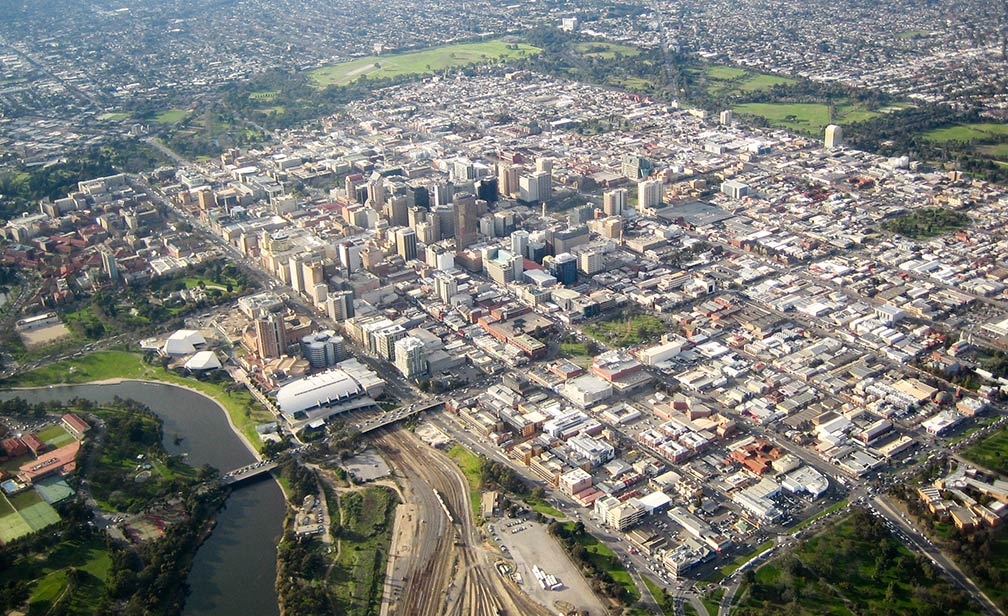
About Adelaide Satellite view is showing Adelaide, most populous city and capital of the Satellite view is showing Adelaide, most populous city and capital of the  Aerial view of Adelaide city center surrounded by Adelaide Parklands and Torrens River in the foreground. Aerial view of Adelaide city center surrounded by Adelaide Parklands and Torrens River in the foreground.Image by: Doug Barber Today the city extends with its suburbs 20 km (12 mi) from the coast to the foothills, and from Sellicks Beach in the south to its northern extent at the country town of Gawler which is located 44 km (25 miles) north of Adelaide's city center. The city is listed frequently in the Top 10 of the World's Most Liveable Cities (rank 6 in 2016), published annually in The Economist's "Liveability rankings" index. Adelaide is Australia's festival and event capital, and it is well noted for its food, wine and culture, the city is home to the South Australian Museum, and the Tandanya National Aboriginal Cultural Institute, Australia's oldest Indigenous owned and managed multi-arts center. The Map shows a city map of Adelaide with expressways, main roads and streets; and the location of Adelaide Airport (IATA Code: ADL) about 6 km (3.7 mi) west of the city center. |
|
| To find a location type: street or place, city, optional: state, country. |
Local Time Adelaide:
Thu-Apr-25 03:39
Central Standard Time ACST: UTC +9:30Daylight saving time (ACDT) from first Sunday in October to first Sunday in April UTC+10:30 |
|
φ Latitude, λ Longitude (of Map center; move the map to see coordinates): , |
||||||
| Google Earth: Map and Satellite View of the city of Adelaide, South Australia, Australia. City Coordinates: 27°28′04″S 153°01′40″E |
Bookmark/share this page
|
|||||
| More about Australia: Landmarks: City info with a searchable map and satellite view of : Country: Continent: |
Weather Conditions Adelaide External Links: Adelaide Official guide to Adelaide. South Australia The official site of The South Australian Tourism Commission. The Advertiser Local news. Wikipedia: Adelaide |
Related Consumer Information:
| ||||
|
Countries and territories of Australia/Oceania |
||
Map Help [ show ]  |
||
One World - Nations Online .:. let's care for this planet Promote that every nation assumes responsibility for our world. Nations Online Project is made to improve cross-cultural understanding and global awareness. More signal - less NOISE |
| Site Map
| Information Sources | Disclaimer | Copyright © 1998-2023 :: nationsonline.org |