Nations Online
All Countries in the World
Nations Online All Countries in the World | |
Home  |
___ Satellite View and Map of Kingdom of Swaziland |
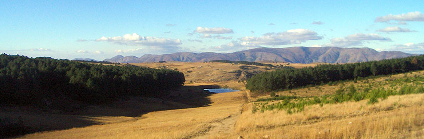 Swaziland landscape Image: Sara Atkins |
About Swaziland Map is showing Swaziland, the small landlocked kingdom in southern Africa. The country is bordered by South Africa and Mozambique. Swaziland occupies an area of 17,364 km², it is one of Africa's smallest countries, somewhat larger than half the size of Belgium, or slightly smaller than the U.S. state of New Jersey. Map is showing Swaziland, the small landlocked kingdom in southern Africa. The country is bordered by South Africa and Mozambique. Swaziland occupies an area of 17,364 km², it is one of Africa's smallest countries, somewhat larger than half the size of Belgium, or slightly smaller than the U.S. state of New Jersey. Swaziland's landscape is mountainous in west and along its eastern border, in between the lowveld, sloping plains of grasslands and thorn trees. Highest point is Mount Emlembe with 1,862 m, located in the east Drakensberg mountain range on the border with South Africa. Swaziland has a population of 1.2 million people (est. 2010), capital city is Mbabane (Lobamba is the royal and legislative capital). Official languages are siSwati and English. Countries with international borders to Swaziland are Mozambique, South Africa. The map shows Swaziland with national parks, game reserves, cities, towns, expressways, main roads and streets. To find a location use the form below. To view just the map, click on the "Map" button. |
||
| To find a location type: street or place, city, optional: state, country. | Local Time Swaziland:
Wednsday-April-24 20:26
(UTC/GMT +2 hours) |
|
|
φ Latitude, λ Longitude (of Map center; move the map to see coordinates): , |
||||||
| Google Maps: Searchable Map of Kingdom of Swaziland. | Bookmark/share this page |
|||||
| More about Swaziland: Cities: Country: Continent: | Weather Conditions Swaziland
|
Related Consumer Information:
|
||||
| Other Countries of Southern Africa: Botswana | Lesotho | Namibia | South Africa Maps of other Countries of Southern Africa: Botswana Map | Namibia Map | South Africa Map Searchable Maps of other Countries of Southern Africa: Botswana Interactive Map | Namibia Interactive Map | Lesotho Interactive Map | South Africa Interactive Map Major Cities in Southern Africa: Bloemfontein | Cape Town | Durban | Gaborone | Johannesburg | Maseru | Nelspruit | Polokwane Port Elizabeth | Pretoria | Rustenburg | Windhoek |
||||||
Map Help [ show ] |
||||||
One World - Nations Online .:. let's care for this planet Promote that every nation assumes responsibility for our world. Nations Online Project is made to improve cross-cultural understanding and global awareness. More signal - less NOISE |
| Site Map
| Information Sources | Disclaimer | Copyright © 1998-2023 :: nationsonline.org |

