Nations Online
All Countries in the World
Nations Online All Countries in the World | |
Home  |
___ Satellite View and Map of the City of Windhoek, Namibia |
 Tintenpalast (ink palace) in Windhoek is the seat of both chambers of the Parliament of Namibia. Image: Simon W |
About Windhoek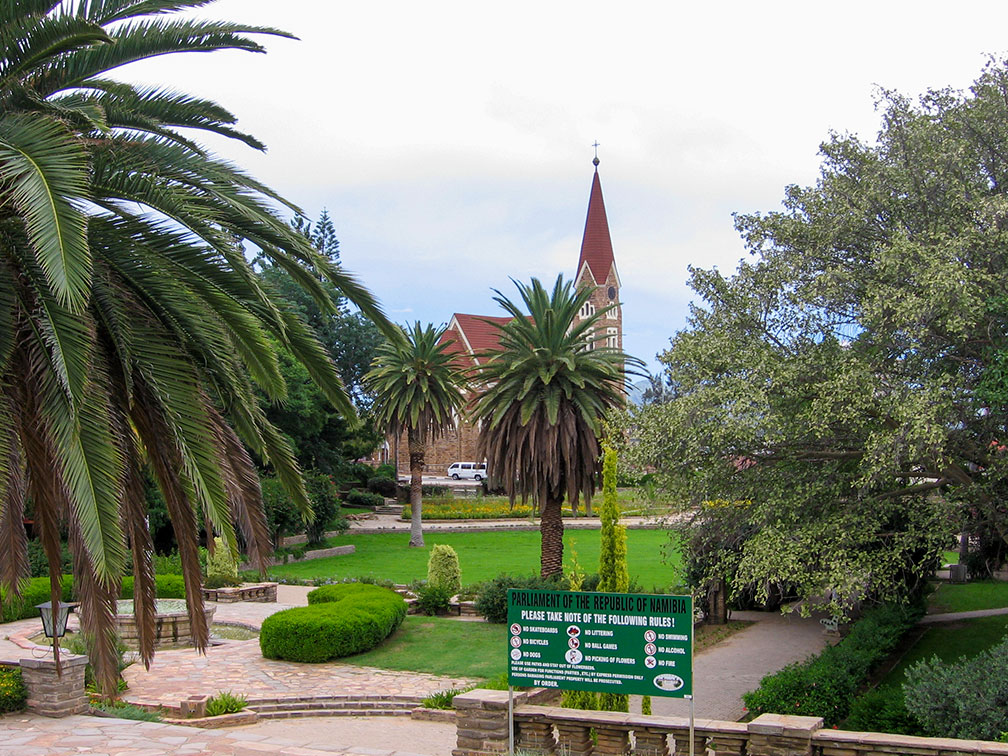 Parliament Gardens with Christ Church (Christuskirche), the small park in downtown Windhoek is opposite the “Tintenpalast”, the seat of the national parliament. Image: Alexander Johmann  Satellite view is showing Windhoek, largest city and the national capital of Satellite view is showing Windhoek, largest city and the national capital of The city is located in the center of Namibia on a highland plateau about 1,700 m (5,600 ft) above sea level in the Khomas Region of the country. One can call the city "the heart of Namibia", a primate city, the cultural, educational, and economical center of the country. It is home to the University of Namibia, the National Art Gallery, the “Tintenpalast” (German for "ink palace") the seat of the National Assembly and the National Council, and the National Botanical Research Institute with its gardens. 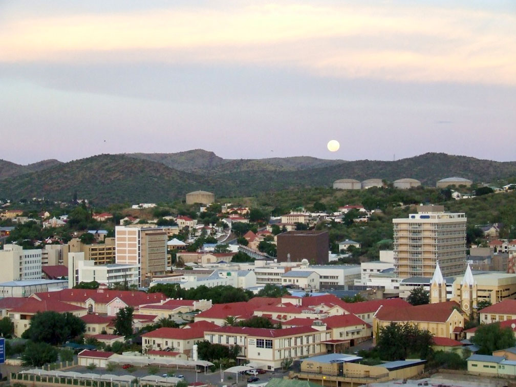 Moonrise over Windhoek, Namibia's capital in the Khomas Highland plateau area in the center of the country. Image: Michael Paskevicius The city has also two traditional names, Otjomuise, a word from Herero language means: "place of steam" and “/Ai-//Gams” (a Nama word for Fire Water), both names referring to Windhoek's hot springs. The map shows a city map of Windhoek with expressways, main roads and streets, zoom out to find the location of Windhoek Hosea Kutako International Airport (IATA code: WDH) 43 km (26.5 mi) by road (via B6) east of the city. To find a location use the form below. |
|
| To find a location type: street or place, city, optional: state, country. | Local Time Namibia:
Thursday-June-18 03:40
Time Zone: West African Time (WAT) GMT/UTC +1From September to April Namibia observes West African Summer Time (WAST) GMT/UTC +2 |
One World - Nations Online .:. let's care for this planet Promote that every nation assumes responsibility for our world. Nations Online Project is made to improve cross-cultural understanding and global awareness. More signal - less NOISE |
| Site Map
| Information Sources | Disclaimer | Copyright © 1998-2024:: nationsonline.org |

