Nations Online
All Countries in the World
Nations Online All Countries in the World | |
Home  |
___ Satellite View and Map of the City of Bloemfontein (Mangaung), South Africa
|
 Bloemfontein City Hall Image: Carlviloria |
About Bloemfontein Satellite view is showing Bloemfontein, capital of the province of Free State and the judicial capital of Satellite view is showing Bloemfontein, capital of the province of Free State and the judicial capital of 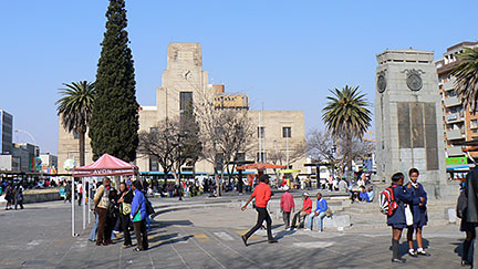 Hoffman Square, Bloemfontein Hoffman Square, BloemfonteinImage: Martin Kozák Today Bloemfontein is the seat of Mangaung Metropolitan Municipality and has a population of about 256,000 inhabitants, about 750,000 people live in the Mangaung metropolitan area. Spoken language are Afrikaans, Sesotho and Setswana. The map shows a city map of Bloemfontein with expressways, main roads and streets, zoom out to find the location of Bloemfontein Airport (IATA code: BFN), located northeast of the city center. To find a location use the form below. |
|
| To find a location type: street or place, city, optional: state, country. |
Local Time Bloemfontein:
Thursday-April-25 15:32
(UTC/GMT +2 hours)
|
|
φ Latitude, λ Longitude (of Map center; move the map to see coordinates): , |
||||||
| Google Earth: Satellite View and Map of Bloemfontein, South Africa. City Coordinates: 29°06′S 26°13′E |
Bookmark/share this page |
|||||
| More about South Africa: Other major Cities in South Africa: Country: South Africa key statistical data. Continent: External Links Bloemfontein (official web site) Wikipedia: Bloemfontein |
Weather Conditions Bloemfontein
|
Explore more:
Related Consumer Information:
|
||||
Other Countries of Southern Africa: Botswana | Lesotho | Namibia | Swaziland Maps of other Countries of Southern Africa: Botswana Map | Namibia Map | Swaziland Map Searchable Maps of other Countries of Southern Africa: Botswana Interactive Map | Namibia Interactive Map | Lesotho Interactive Map | Swaziland Interactive Map Other Major Cities in Southern Africa: Gaborone | Lobamba | Maseru | Mbabane | Windhoek |
||||||
Map Help [ show ] |
||||||
One World - Nations Online .:. let's care for this planet Promote that every nation assumes responsibility for our world. Nations Online Project is made to improve cross-cultural understanding and global awareness. More signal - less NOISE |
| Site Map
| Information Sources | Disclaimer | Copyright © 1998-2023 :: nationsonline.org |

