Nations Online
All Countries in the World
Nations Online All Countries in the World | |
Home  |
___ Satellite View and Map of the City of Durban (Zulu: eThekwini), South Africa |
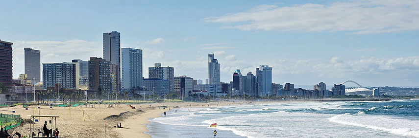 At uShaka Beach with the skyline of Durban, also known as the 'Golden Mile'. Image: Bgabel |
About DurbanDurban has a population of about 3.2 million inhabitants. Spoken languages are Zulu (80%), English (13%), Xhosa, and Afrikaans. 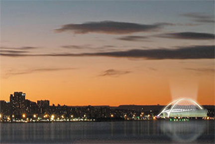 View of Durban City (eThekwini), Moses Mabhida Stadium to the right. Image: Courtesy of City of Durban With its mild subtropical climate (winter months are June, July and August) the city is a popular tourist destination particularly among domestic tourists. Durban is a gateway to the national parks and historic sites of Zululand and the uKhahlamba-Drakensberg region ("the Dragons Mountain"). Some of the points of interest in or near Durban are uShaka Marine World (family-friendly marine theme park); Suncoast Casino and Entertainment World (casino complex with a semi-private beach at the northern end of Durban's Golden Mile); Durban Botanic Gardens (Africa's oldest surviving botanical gardens). The map shows a city map of Durban with expressways, main roads and streets, zoom out (-) to find Durban International Airport, and the location of the new King Shaka International Airport, (IATA Code: DUR) about 33.5 km (21 mi) by road (via Ruth First Highway/M4 and N2) north of the city. To find a location use the form below. |
|
| To find a location type: street or place, city, optional: state, country. |
Local Time Durban:
Monday-June-29 11:26
(UTC/GMT +2 hours)
|
|
φ Latitude, λ Longitude (of Map center; move the map to see coordinates): , |
||||||
| Sorry! Google's pricing policy has made it impossible for us to continue showing Google Maps. We apologize for any inconvenience. Google Map: Searchable Map and Satellite View of the City of Durban, South Africa. City Coordinates: 29°53′S 31°03′E |
Bookmark/share this page |
|||||
| More about South Africa: Other major Cities in South Africa: Country: South Africa key statistical data. Continent: |
Current Weather Conditions Durban
External Links: City of Durban eThekwini Municipality (Durban) official web site. IOL - The Merkury Local news Wikipedia: Durban Wikipedia article about Durban. |
Explore more:
Related Consumer Information:
|
||||
Other Countries of Southern Africa: Botswana | Lesotho | Namibia | Swaziland Maps of other Countries of Southern Africa: Botswana Map | Namibia Map | Swaziland Map Searchable Maps of other Countries of Southern Africa: Botswana Interactive Map | Namibia Interactive Map | Lesotho Interactive Map | Swaziland Interactive Map Other Major Cities in Southern Africa: Gaborone | Lobamba | Maseru | Mbabane | Windhoek |
||||||
Map Help [ show ] |
||||||
One World - Nations Online .:. let's care for this planet Promote that every nation assumes responsibility for our world. Nations Online Project is made to improve cross-cultural understanding and global awareness. More signal - less NOISE |
| Site Map
| Information Sources | Disclaimer | Copyright © 1998-2024:: nationsonline.org |

