Nations Online
All Countries in the World
Nations Online All Countries in the World | |
Home  |
___ Satellite View and Map of the City of Pretoria (Tshwane), Gauteng Province, South Africa )(45-degree view available) |
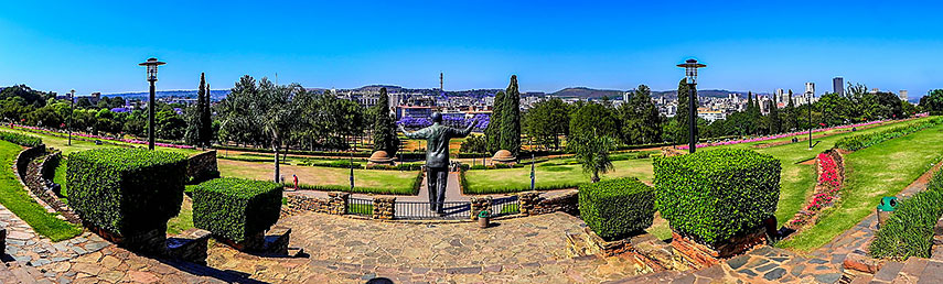 Nelson Mandela Statue, Pretoria. Image: Paul Saad |
About Pretoria Satellite view is showing Pretoria, the administrative and de facto capital of Satellite view is showing Pretoria, the administrative and de facto capital of Pretoria is the central part of the City of Tshwane Metropolitan Municipality, located in the northern part of Gauteng Province, in the north-east of South Africa. 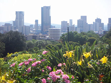 Central Business District Pretoria, South Africa. Image: zakysant Today the city has a population of about 741,000 inhabitants, almost 3 million people live in the Tshwane Metropolitan Municipality (census 2011, the official name of the greater Pretoria metropolitan area). Main languages spoken in Pretoria are Tswana, Ndebele, Afrikaans, and English. Some points of interest in and near Pretoria: Union Buildings (the official seat of the national government, the complex houses also the offices of the president); Voortrekker Monument (Pioneer history of Southern Africa); Kruger House (historical residence of the Boer leader and President of the South African Republic, Paul Kruger); Church Square ((Kerkplein), the historic center of Pretoria); Ditsong National Museum of Natural History (fossils and dinosaur bones);Ditsong National Museum of Cultural History (explore South Africa’s cultural diversity); Van Wouw Museum (exhibits the sculptural work of Dutch-born sculptor Anton van Wouw (1862 - 1945)); Burgers Park (a botanical garden and a South African National Monument); Wonderboom Nature Reserve (Wonderboom (Ficus salicifolia) park with a Stone-Age site); Pretoria National Botanical Garden (National garden with the National Herbarium); National Zoological Gardens of South Africa (National zoo with an aquarium and an aviary). The Map shows a city map of Pretoria with expressways, main roads and streets. Zoom out (-) to find the location of Pretoria’s Wonderboom Airport (IATA code: PRY) an airstrip north of the city. Pretoria is served by Johannesburg OR Tambo International Airport To find a location use the form below. |
|
| To find a location type: street or place, city, optional: state, country. |
Local Time Pretoria:
Sunday-April-28 13:20
Time zone: South Africa Standard Time (SAST) :: UTC/GMT +2 hours
|
|
φ Latitude, λ Longitude (of Map center; move the map to see coordinates): , |
||||||
| Google Earth: Searchable Map/Satellite View of Pretoria (Tshwane), Republic of South Africa. City Coordinates (City Hall): 25°45′12″S 28°11′13″E |
Bookmark/share this page |
|||||
| More about South Africa: Information and searchable maps of other major cities in South Africa: Country: South Africa key statistical data. Continent: |
Weather Conditions Pretoria
External Links: City of Tshwane SABC Pretoria News The Citizen South Africa News. Mail & Guardian South Africa News. Wikipedia: Pretoria |
Explore more:
Related Consumer Information:
|
||||
Other Countries of Southern Africa: Botswana | Lesotho | Namibia | Swaziland Maps of other Countries of Southern Africa: Botswana Map | Namibia Map | Swaziland Map Searchable Maps of other Countries of Southern Africa: Botswana Interactive Map | Namibia Interactive Map | Lesotho Interactive Map | Swaziland Interactive Map Other Major Cities in Southern Africa: Gaborone | Lobamba | Maseru | Mbabane | Windhoek |
||||||
Map Help [ show ] |
||||||
One World - Nations Online .:. let's care for this planet Promote that every nation assumes responsibility for our world. Nations Online Project is made to improve cross-cultural understanding and global awareness. More signal - less NOISE |
| Site Map
| Information Sources | Disclaimer | Copyright © 1998-2023 :: nationsonline.org |

