Nations Online
All Countries in the World
Nations Online All Countries in the World | |
Home  |
___ Satellite View and Map of Lesotho |
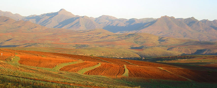 Landscape of Lesotho Image: Tjeerd Wiersma |
About Lesotho Satellite view is showing Lesotho a landlocked mountainous Kingdom in Southern Africa. The country forms an enclave in central east of South Africa, about 300 km south west of Swaziland. Lesotho was known as Basutoland until independence from the UK in 1966. Satellite view is showing Lesotho a landlocked mountainous Kingdom in Southern Africa. The country forms an enclave in central east of South Africa, about 300 km south west of Swaziland. Lesotho was known as Basutoland until independence from the UK in 1966.The country occupies an area of 30,355 km², this is about the size of Belgium, or slightly smaller than the U.S. state of Maryland. It is the only country in the world that lies entirely above 1,000 m (3,280 ft) and more than 80 percent of Lesotho is 1,800 m (5,905 ft) above sea level. Its highest point is Thabana Ntlenyana 3,482 m, situated in the Maloti Mountains, part of the Drakensberg range in central east of the country close to the border. The Maloti-Drakensberg Park is a UNESCO World Heritage Site, the transboundary site is composed of the uKhahlamba Drakensberg National Park in South Africa and the Sehlathebe National Park in Lesotho. The country enjoys a temperate climate, with cool to cold dry winters (from June to August) and hot, wet summers (mid-October to mid-February). The Kingdom of Lesotho has a population of just under 2 million people. Capital city of is Maseru. Spoken languages are Sesotho and English. The map shows Lesotho with cities, towns, expressways, main roads and streets. To find a location use the form below. |
||
| To find a location type: street or place, city, optional: state, country. | Local Time Lesotho:
Sunday-July-19 18:12
Time zone: South Africa Standard Time (SAST) :: UTC/GMT +2 hours
|
|
|
φ Latitude, λ Longitude (of Map center; move the map to see coordinates): , |
||||||
| Google Maps: Searchable Map of the Kingdom of Lesotho. |
Bookmark/share this page |
|||||
| More about Lesotho: Cities: Country: Continent: | Weather Conditions Maseru:
|
Related Consumer Information:
| ||||
| Other Countries of Southern Africa: Botswana | Namibia | South Africa | Swaziland Maps of other Countries of Southern Africa: Botswana Map | Namibia Map | South Africa Map | Swaziland Map Searchable Maps of other Countries of Southern Africa: Botswana Interactive Map | Namibia Interactive Map | South Africa Interactive Map | Swaziland Interactive Map Major Cities in Southern Africa: Bloemfontein | Cape Town | Durban | Gaborone | Johannesburg | Lobamba | Maseru | Mbabane | Nelspruit | Polokwane Port Elizabeth | Pretoria | Rustenburg | Windhoek |
||||||
Map Help [ show ] |
||||||
One World - Nations Online .:. let's care for this planet Promote that every nation assumes responsibility for our world. Nations Online Project is made to improve cross-cultural understanding and global awareness. More signal - less NOISE |
| Site Map
| Information Sources | Disclaimer | Copyright © 1998-2024:: nationsonline.org |

