Nations Online
All Countries in the World
Nations Online All Countries in the World | |
Home  |
___ Satellite View and Map of Estonia (Eesti) |
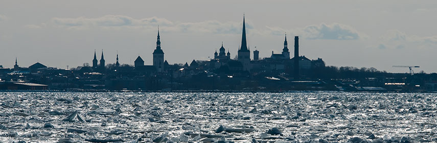 Frozen Sea and the silhouette of Tallinn. Image: Abrget47j |
About Estonia Map is showing Estonia, one of the three Baltic States. The North Eastern European country borders the Gulf of Finland in north, the Baltic Sea in west, Latvia in south, and it shares Lake Peipus (Peipsi järv) with Russia, the Narva river (Narva jõgi) forms a section of the border of Estonia and Russia. Map is showing Estonia, one of the three Baltic States. The North Eastern European country borders the Gulf of Finland in north, the Baltic Sea in west, Latvia in south, and it shares Lake Peipus (Peipsi järv) with Russia, the Narva river (Narva jõgi) forms a section of the border of Estonia and Russia. Estonia is the smallest of the Baltic states, with an area of 45,227 km², it is about the size of Denmark, or slightly smaller than the U.S. states of New Hampshire and Vermont combined. 60% of Estonia's territory is covered by forests. The country has a population of 1.3 million people, the national capital is Border countries are: Latvia, Russia, and Estonia shares a maritime border with Finland. The map shows Estonia with international borders, cities, highways and main roads. To view just the map, click on the "Map" button. |
||
| To find a location type: street or place, city, optional: state, country. |
Local Time Estonia:
Friday-April-19 10:32
Time zone: Eastern European Time (EET) :: UTC/GMT +2 hours.Daylight saving time from end of March till end of October UTC/GMT +3 hours. |
|
|
φ Latitude, λ Longitude (of Map center; move the map to see coordinates): , |
||||||
| Sorry! Google's pricing policy has made it impossible for us to continue showing Google Maps. We apologize for any inconvenience. Google Map: Searchable Map and Satellite View of the Republic of Estonia. |
Bookmark/share this page |
|||||
| More about Estonia: Cities: Country: Key statistical data of Estonia. Continent: |
Current Weather Conditions Tallinn:
|
Related Consumer Information:
|
||||
The Baltic States Estonia, Latvia, Lithuania Maps of other Countries in Northern Europe Denmark Map, Faroe Islands Map, Greenland Map, Iceland Map, Ireland Map, Latvia Map, Lithuania Map, United Kingdom Map Interactive Maps of other countries and regions in Northern Europe: Denmark Interactive Map, Faroe Islands Interactive Map, Greenland Interactive Map, Iceland Interactive Map, Ireland Interactive Map, Latvia Interactive Map, Lithuania Interactive Map, Norway Interactive Map, Scotland Interactive Map, Sweden Interactive Map, United Kingdom Interactive Map, Wales Interactive Map Major Cities in Northern Europe Belfast | Cardiff | Copenhagen | Dublin | Edinburgh | Glasgow | Helsinki | London | Nuuk | Oslo | Reykjavik | Riga Countries and Territories of Europe |
||||||
Map Help [ show ] |
||||||
One World - Nations Online .:. let's care for this planet Promote that every nation assumes responsibility for our world. Nations Online Project is made to improve cross-cultural understanding and global awareness. More signal - less NOISE |
| Site Map
| Information Sources | Disclaimer | Copyright © 1998-2023 :: nationsonline.org |

