Advertising

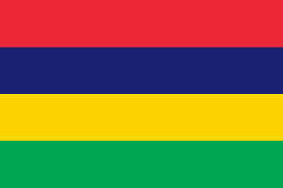
Mauritius Flag detail
Home Earth Continents Africa Mauritius Country Profile Map of Mauritius

Maps Index


Map of Mauritius, Africa

Sunset seen from the Trou au Cerf crater on Mauritius
Sunset on Mauritius, seen from the Trou au Cerf, a dormant volcano in the city of in Curepipe.
Image: Hansueli Krapf

About Mauritius


Mauritius Flag
The map shows Mauritius, an island state south of the equator in the southwestern part of the Indian Ocean, about 910 km (565 mi) east of Madagascar. In addition to the main island of Mauritius, the national territory includes the island of Rodrigues and the more distant Cargados-Carajos Islands (St. Brandon) and the Agaléga Islands.

Mauritius, Rodrigues, and Réunion belong to the Mascarene Islands, with Mauritius being the largest. The island is around 61 km long and 45 km wide, with an area of 1,864 km²; in comparison, it is slightly smaller than Tenerife or about as big as Maui, Hawaii.

The Republic of Mauritius has a population of 1.37 million people (in 2020). The island state is the African country with the highest population density. Almost the entire population lives on the main island. The capital and largest city is Port Louis. The predominantly spoken language is Morisien, a French-based Creole; English and French are in use in tourism, administration, and education.


Map of Mauritius

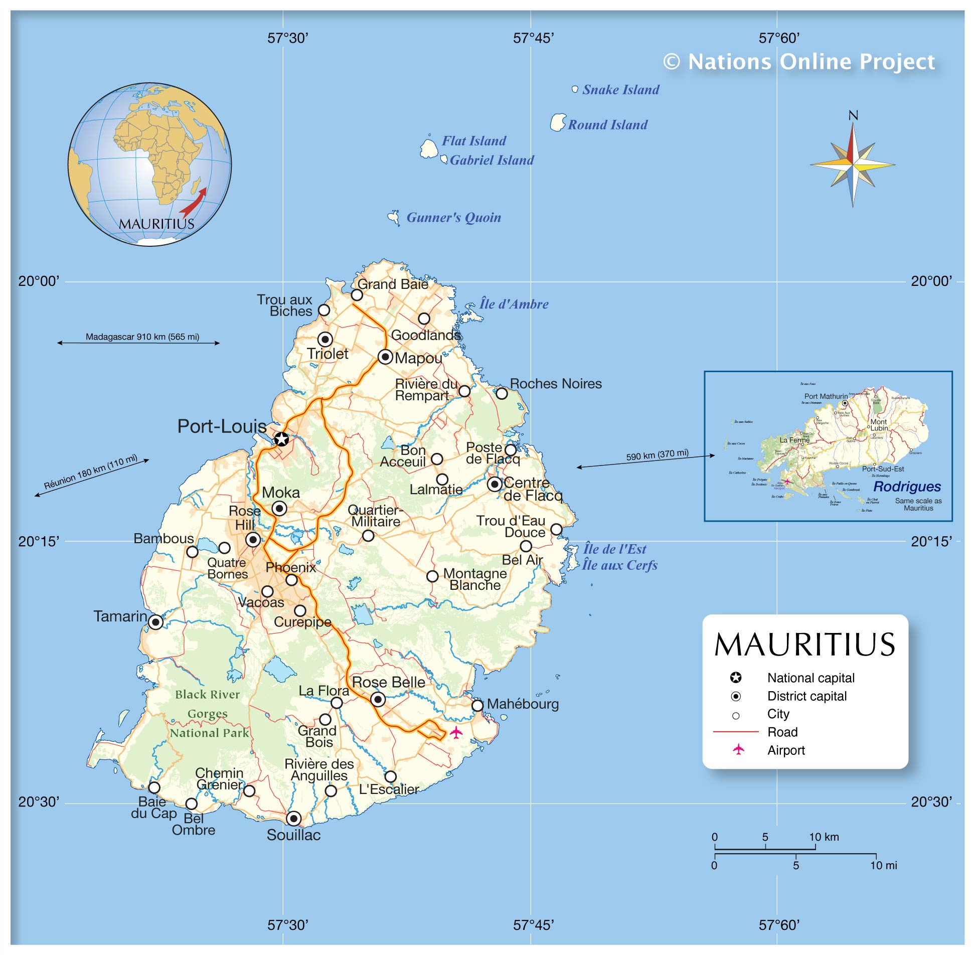
Political Map of Mauritius

The map shows Mauritius and the island of Rodrigues, the location of Mauritius' national capital Port Louis, district capitals, major cities and towns, main roads, and the location of Mauritius airport.

You are free to use the above map for educational purposes (fair use); please refer to the Nations Online Project.


More about Mauritius


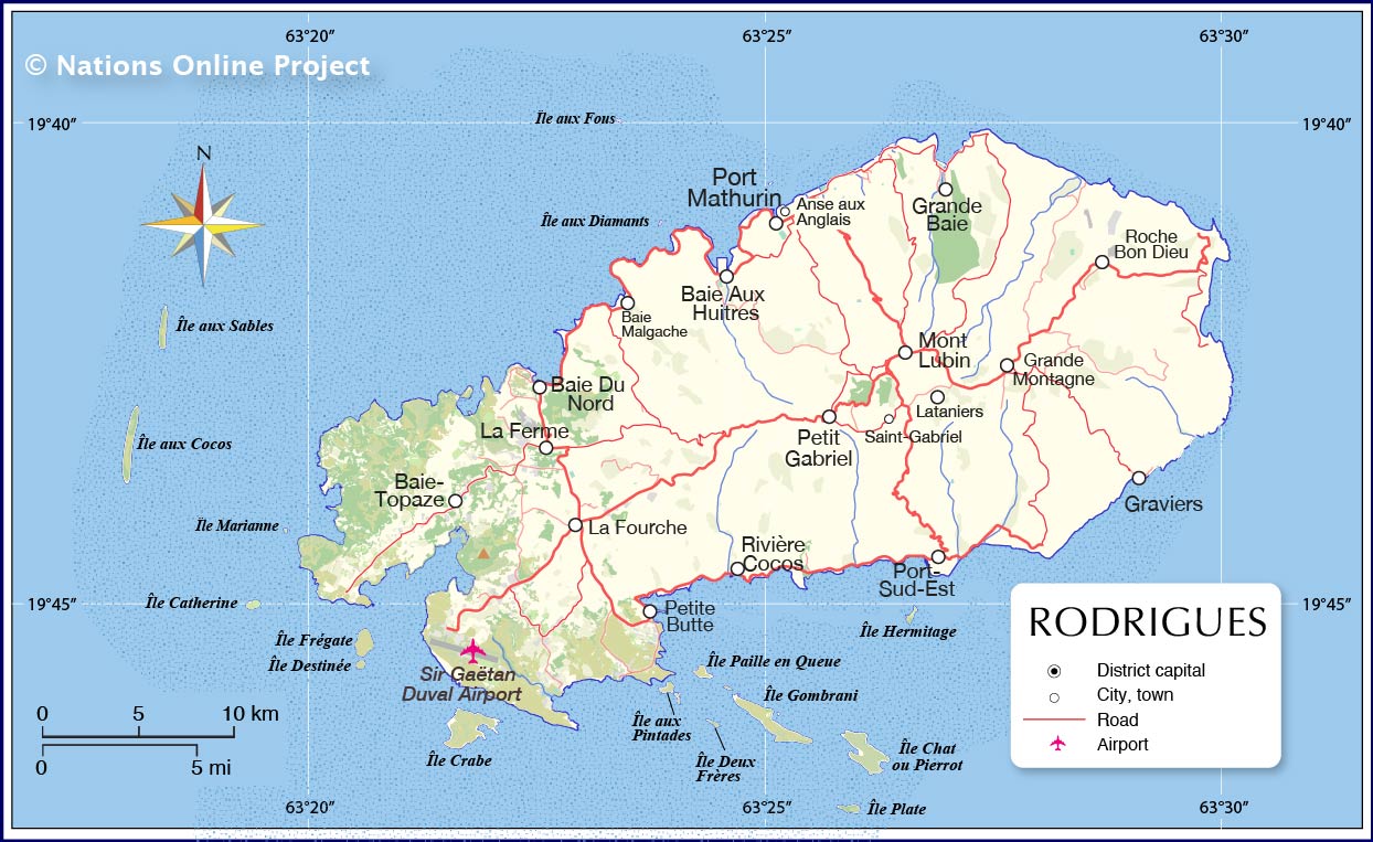
Map of Rodrigues Islands, Mauritius
Map of Rodrigues Islands

Climate
Mauritius is located in the southern hemisphere, and therefore the seasons are opposite to those in the northern hemisphere.
Mauritius is a tropical island, with average temperatures ranging from 23°C on the coast to almost 20°C at high altitudes.
Cyclones, tropical storm systems, can hit the island. The cyclone season lasts from mid-November to mid-May.


Geography
Mauritius is of volcanic origin and rests on the massive tectonic plate of Africa.
Together with French Réunion, the islands Mauritius and Rodrigues belong to the Mascarenhas Archipelago (French: Mascareignes), a group of islands in the Indian Ocean. The archipelago is shared between two countries, France and Mauritius.

The highest mountains on Mauritius are the Piton de la Petite Rivière Noire with 828 m, Pieter Both (820 m) and Le Pouce (811 m). The probably most famous mountain on the island is the 556 m high Le Morne Brabant, a UNESCO world heritage site.

There are three national parks on the main island Mauritius. The Black River Gorges National Park is the largest.

The strategically important Chagos Archipelago belonged to the territory of Mauritius, but was excluded by Great Britain shortly before the foreseeable independence of Mauritius in 1965. The Chagos Atolls are the southernmost archipelago of the Chagos-Laccadive Ridge, an underwater mountain range, which is also home to the Indian union territory of Lakshadweep, and the Maldives.

The largest of the Chagos atolls is Diego Garcia, today part of the British Indian Ocean Territory. The United Kingdom evicted the inhabitants between 1967 and 1973 to allow the United States to build a military base on the island.


The Mauritius map shows the location of the following cities, towns:

Baie du Cap, Bambous, Bel Air, Bel Ombre, Bon Acceuil, Centre de Flacq, Chemin, Curepipe, Goodlands, Grand Baie, Grand Bois, Grenier, L'Escalier, La Flora, Lalmatie, Mahébourg, Mapou, Moka, Montagne Blanche, Phoenix, Port-Louis, Poste de Flacq, Quartier-Militaire, Quatre Bornes, Rivière des Anguilles, Rivière du Rempart, Roches Noires, Rose Belle, Rose Hill, Tamarin, Triolet, Trou aux Biches, Trou d'Eau Douce, and Vacoas.

The Rodrigues Island map shows the location of the following cities, towns:

Anse aux Anglais, Baie Aux Huitres, Baie Du Nord, Baie Malgache, Baie-Topaze, Grande Baie, Graviers, La Ferme, La Fourche, Lataniers, Mont Lubin, Petit Gabriel, Petite Butte, Port Mathurin, Port-Sud-Est, Rivière Cocos, Roche Bon Dieu, and Saint-Gabriel.


Weather Conditions Port Louis:

PORT LOUIS WEATHER


Advertisements:


Maps of other Countries in East Africa
Burundi Map | Comoros Map | Djibouti Map | Eritrea Map | Ethiopia Map | Kenya Map | Madagascar Map | Malawi Map | Mozambique Map | Réunion Map | Rwanda Map | Seychelles Map | Somalia Map | Tanzania Map | Uganda Map | Zambia Map | Zimbabwe Map