Nations Online
All Countries in the World
Nations Online All Countries in the World | |
Home  |
___ Satellite View and Map of Belgium (België, Belgique, Belgien) |
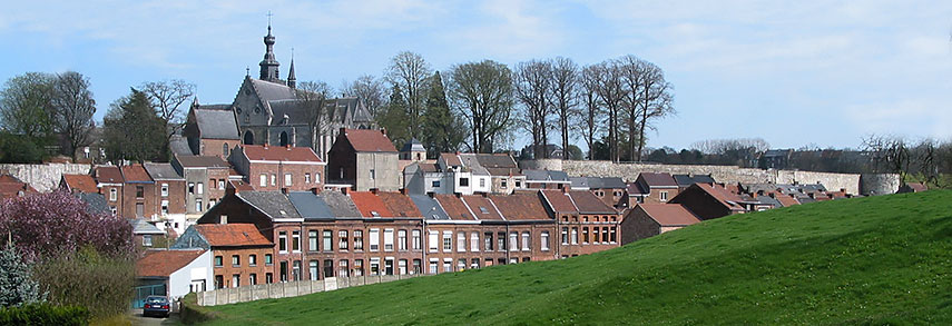 Binche, an old town in Wallonia, Belgium. Image: Jean-Pol GRANDMONT |
About Belgium Belgium, officially the Kingdom of Belgium is a low-lying country in Western Europe bordering the North Sea between France and the Netherlands. The country is also bordered by Luxembourg and Germany in east and it shares maritime borders with the United Kingdom. Belgium, officially the Kingdom of Belgium is a low-lying country in Western Europe bordering the North Sea between France and the Netherlands. The country is also bordered by Luxembourg and Germany in east and it shares maritime borders with the United Kingdom.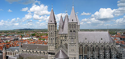 Notre-Dame, the Cathedral of Our Lady in Tournai (Doornik), Wallonia. The Roman Catholic church from the 12th century is a World Heritage Site Image: Jean-Pol Grandmont Belgium is divided into three regions: Dutch-speaking Flanders in the north, francophone Wallonia in the south and Brussels, the bilingual capital, where French and Dutch share official status. There is also a small German-speaking minority in the eastern part of the country. Belgium is famous for its chocolate, waffles, fries, beer and the appropriate beer glassware, Tintin (comic books), billiard balls and Brussels sprout. The city of Spa, the famed site of healing cold springs has become eponymous with any place having a natural water source that is believed to possess special health-giving properties. The first Beauty pageant in the world was held at Spa on 19 September 1888. |
|
| To find a location type: street or place, city, optional: state, country. |
Local Time Belgium:
Sunday-April-28 17:04
Standard Time Zone (CET): UTC/GMT +1 hourCEST (Daylight Saving Time) in use from end of March until end of October. Time zone offset: UTC/GMT +2 hours |
|
φ Latitude, λ Longitude (of Map center; move the map to see coordinates): , |
||||||
| Google Maps:Searchable map/satellite view of the Kingdom of Belgium. |
Bookmark/share this page |
|||||
| More about Belgium: Cities: Country: Continent: |
Weather Conditions Brussels
|
Related Consumer Information:
|
||||
Major Cities in Western Europe Amsterdam, Berlin, Bern, Cologne, Brussels, Frankfurt, Hamburg, Luxembourg (City), Monaco, Munich (München), Nice, Paris, Rotterdam, The Hague, Vaduz, Vienna (Wien), Zurich Searchable Maps of other Countries in Western Europe: Austria | France | Germany | Liechtenstein | Luxembourg | Monaco | Netherlands | Switzerland Political Maps of other Countries in Western Europe: Austria Map | France Map | Germany Map | Netherlands Map | Switzerland Map |
||||||
Map Help [ show ] |
||||||
One World - Nations Online .:. let's care for this planet Promote that every nation assumes responsibility for our world. Nations Online Project is made to improve cross-cultural understanding and global awareness. More signal - less NOISE |
| Site Map
| Information Sources | Disclaimer | Copyright © 1998-2023 :: nationsonline.org |

