Nations Online
All Countries in the World
Nations Online All Countries in the World | |
Home  |
___ Administrative Map of Senegal |
| Map is showing Senegal, a West African country bordered in west by the North Atlantic Ocean, capital city is Dakar. The map shows the country with international borders, regional boundaries, the national capital Dakar, regional capitals, cities and towns, and major airports. Click on the map to see a detailed map of Senegal. 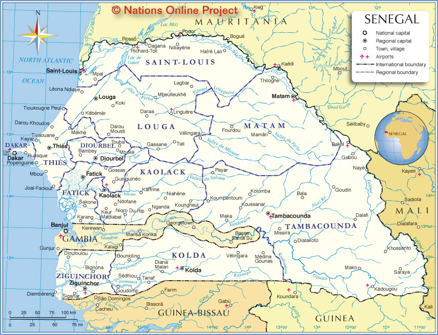 Administrative Map of Senegal |
||||||
| Senegal is divided into 14 regions, the regions are named after their capital: Dakar, Diourbel, Fatick, Kaffrine, Kaolack, Kédougou, Kolda, Louga, Matam, Saint-Louis, Sédhiou, Tambacounda, Thiès, and Ziguinchor. |
Bookmark/share this page |
|||||
| More about Senegal: Cities: Country: Continent: |
Current Weather Conditions Dakar
|
Related Consumer Information:
|
||||
Political Maps of Countries in West Africa: Benin Map | Burkina Faso Map | Cape Verde Map | Côte d'Ivoire Map | Ghana Map | Guinea Map | Guinea-Bissau Map Liberia Map | Mali Map | Mauritania Map | Niger Map | Nigeria Map | Sierra Leone Map | Togo Map |
||||||
One World - Nations Online .:. let's care for this planet Promote that every nation assumes responsibility for our world. Nations Online Project is made to improve cross-cultural understanding and global awareness. More signal - less NOISE |
| Site Map
| Information Sources | Disclaimer | Copyright © 1998-2024:: nationsonline.org |
