|
Home |
|
|
|
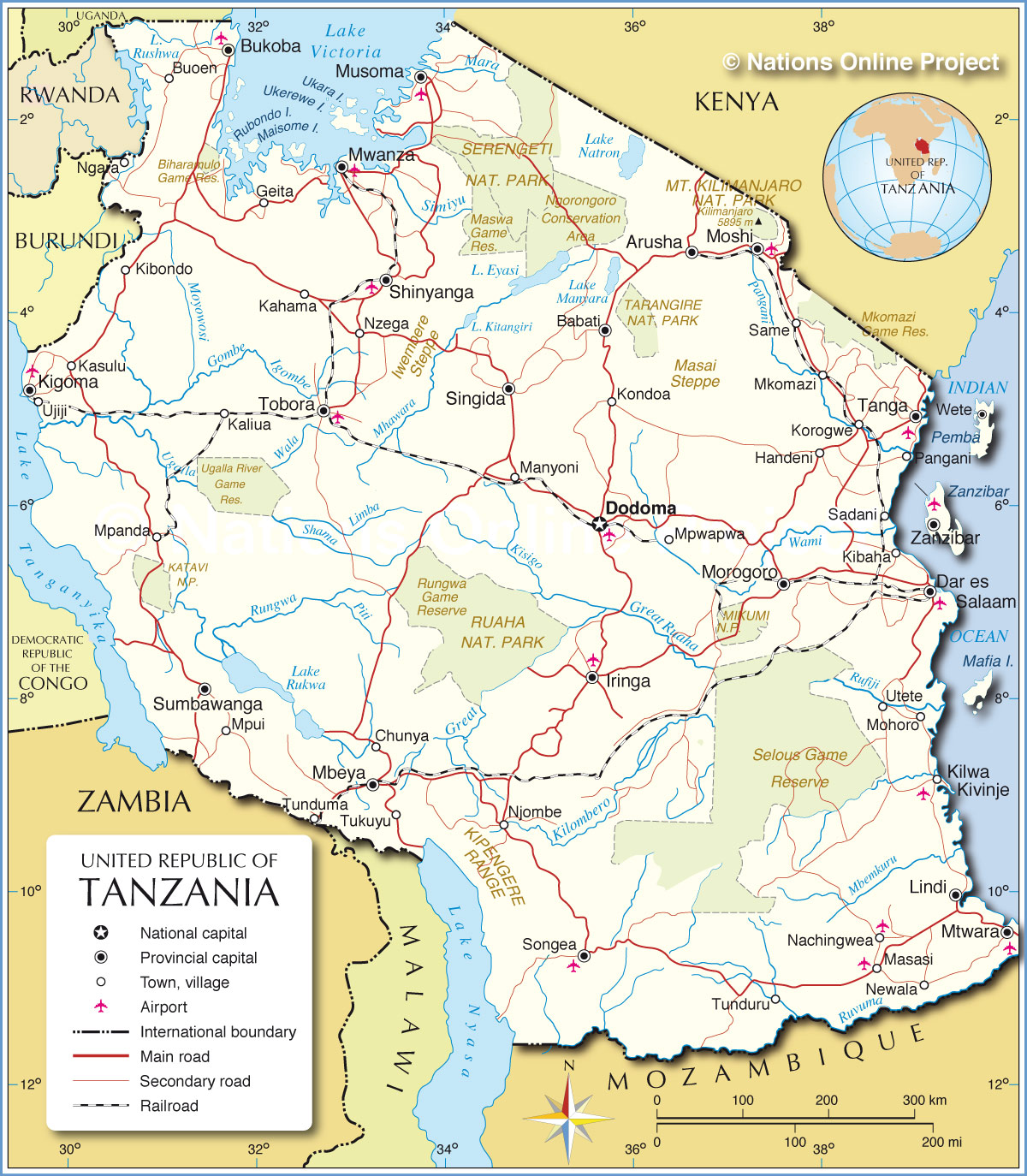
___ Political Map of Tanzania |
|
Map is showing Tanzania, a country in East Africa with a coastline at the Indian Ocean. It is bordered by Burundi, Democratic Republic of the Congo (via Lake Tanganyika), Kenya, Malawi, Mozambique, Rwanda, Uganda, and Zambia, it shares maritime borders with Comoros and the Seychelles and it has a shoreline at Lake Victoria in north. Area: Tanzania mainland 945,000 km² (378,000 sq. mi.) plus Zanzibar 1 658 km² (640 sq. mi.) this is about three times the size of Italy or slightly larger than twice the size of California. Highest point is Kilimanjaro with 5,895 m the mountain is also the highest point in Africa. Tanzania has a population of 47.42 million people, capital is Dodoma, largest city, chief port, major economic and transportation hub and de facto capital is Dar es-Salaam. Spoken languages are Swahili and English (both official), Arabic (widely spoken in Zanzibar). The map shows Tanzania with surrounding countries, its international borders, the official national capital Dodoma, province capitals, cities, villages, roads, railroads and major airports. |
 Bookmark/share this page |
 One World - Nations Online all countries of the world |
|
|
||
One World - Nations Online .:. let's care for this planet Every nation is responsible for the current state of our world. |
| Site Map
| Information Sources | Disclaimer: Privacy Policy, etc. Contact: [email protected] | Copyright © 1998-2021 :: nationsonline.org |