One World
Nations Online
One World Nations Online |
|
| Home |
___ Comoros |
 Fisher boats Comoros islands. Image: Chamara Irugalratne |
 Location map of the Comoros The Comoros consists of the four main islands: Ngazidja (French: Grande Comore), Mwali (French: Mohéli), Nzwani (French: Anjouan) and Maore (French: Mayotte), the contested island of Mayotte is administered by France. Nearest Countries to the Comoros are Mozambique, Tanzania, Madagascar, and the Seychelles. The combined area of the volcanic archipelago (including Mayotte) is 2,235 km², compared, the island nation is slightly smaller than Luxembourg or also slightly smaller than the U.S. state of Rhode Island. Comoros has a population of 770,000 (2015). Capital and largest city is Moroni on Grande Comore. Spoken languages are Comorian (Comorian Swahili, a Bantu language), French, and Arabic. Islam is the official state religion, 98% of the population are Sunni Muslims. |
Union of the Comoros | Union des Comores |
Country Profile |
| Official Name: Union des Comores (French) Udzima wa Komori (Comorian) short form: Comores int'l long form: Union of the Comoros int'l short form: Comoros Hist. name: Djazaïr Al Qamar (Islands of the Moon) ISO Country Code: km, com Time: Local Time = UTC +3h Actual Time: Wed-Apr-24 12:56 Country Calling Code: +269 Capital City: Moroni (pop. 60,000) Other Cities: Mutsamudu (pop. 20,000) Fomboni, Mamoutzou. Government: Type: Republic. Independence: 6 July 1975 (from France, Mayotte remains under French administration). Constitution: Adopted by referendum on 23 December 2001. Geography: Location: Southern east Africa, group of islands at the Mozambique Channel which separates Madagascar from the African continent. Area: 2,171 km² (838 sq. mi.) Major islands: Grande Comore, Anjouan, Mayotte (administered by France), and Moheli. Terrain: Volcanic islands, interiors vary from steep mountains to low hills. Highest point: Le Kartala (an active volcano; 2360 m) Climate: Tropical marine. People: Nationality: Comorian(s). Population: 770,000 (2015) Ethnic groups: Antalote, Cafre, Makoa, Oimatsaha, Sakalava. Religions: Sunni Muslim 98%, Roman Catholic 2%. Languages: Shikomor (Comorian, a Swahili-Arabic blend), Arabic, French, Swahili. Literacy: 57%. Natural resources: Few natural resources. Agriculture products: Vanilla, ylang-ylang, jasmine, cassis, cloves, perfume essences, copra, coconuts, bananas, cassava (tapioca) Industries: Tourism, perfume distillation. Exports partners: India 28.7%, France 17%, Germany 8.7%, Saudi Arabia 7.1%, Singapore 6.6%, Netherlands 6.1%, Mauritius 5.3% (2015) Imports partners: China 18.9%, Pakistan 16.2%, France 14.7%, UAE 11.3%, India 6.3% (2015) Currency: Comoran Franc (KMF) |
|
|
Note: External links will open in a new browser window. Official Sites of ComorosPrésidence de l'Union des Comores Official website of the Presidency of the Union of the Comoros (Site being updated) Gouvernement Union des Comores (Site being updated) Commission de l'Océan Indien Indian Ocean Commission (COI) is an intergovernmental organization that joins Comoros, Madagascar, Mauritius, France (for Réunion), and the Seychelles together to encourage cooperation. Ministère des Relations Extérieures et de la Coopération Comoros Ministry of External Relations and Cooperation. Permanent Mission of the Union of the Comoros Permanent Mission of the Union of the Comoros to the United Nations. Embassy of the Comoros in Washington DC Official site of the Embassy of the Comoros to the United States, Canada and Cuba. MapsPolitical map of Comoros. Searchable map and satellite view of Comoros. Searchable map and satellite view of Comoros' capital city. Political Map of Africa.  Anjouan Island, Comoros Image: Haryamouji |
Comoros NewsAl Watwan Comoros online weekly news (in French) Comores Info Comoros related news (in French) Le Canal News and information covering the Mozambique Channel region (in French). Radio/TV Office de Radio Télévion des Comores (ORTC) Radio Ocean Indien |
Bookmark/share this page |
Arts & CultureComoros Islands Encyclopedia The site includes information about arts and culture of the Comoros. Nawal Mlanao Afro Sufi Roots. Musician from Comoros. |
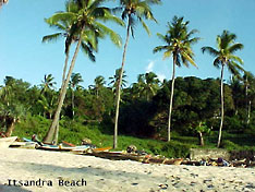 Comoros Beach Scenery |
Business & EconomyAnother one of the world's poorest countries. Its economy is a mostly rural, agricultural economy, hampered by inadequate transportation links, a low educational level of the labor force, and few natural resources.The country is heavy dependent on foreign grants and technical assistance. Agriculture and forestry, accounts for 50% of GDP, it employs 80% of the labor force and provides most of the exports. Main crops are vanilla, cloves, and ylang-ylang (Cananga odorata). Comoros government is struggling to provide basic services, upgrade education and technical training. Societé Nationale des Postes et Services Financiers The National Mail and Financial Service enterprise. Comores Télécom African Economic Outlook Comores African Economic Outlooksummary about Comoros' economy. Transportation Comores Aviation International Serves destinations on the Comoros archipelago, Dar es Salaam, and Zanzibar (Tanzania). |
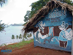 Bangas - traditional Comorian buildings |
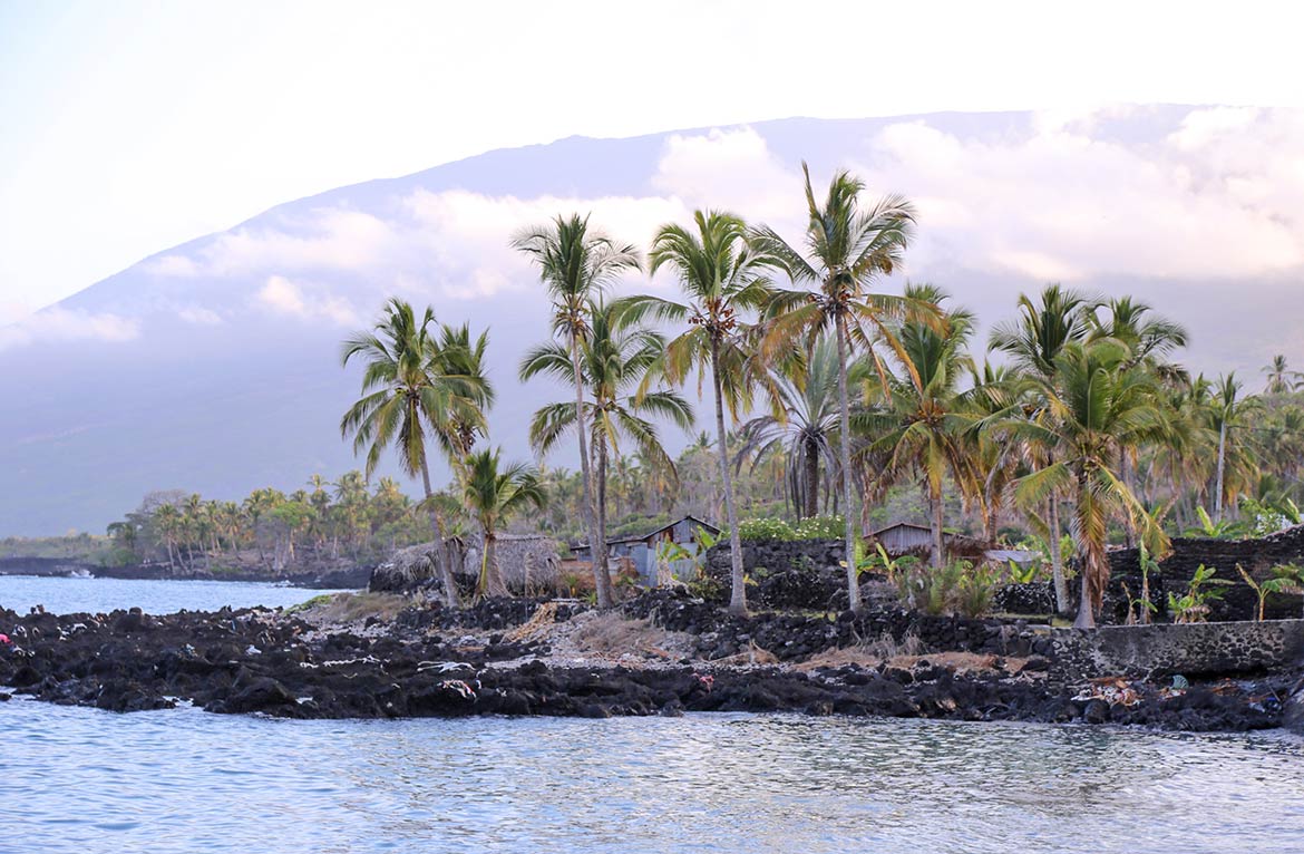
 Sunset near Nioumachoua seen on Mwali (Mohéli) island. Image: Hannah Jane Travel and Tour Consumer Information
Destination Comoros - Travel and Tour GuidesMain islands: Grande Comore (Ngazidja), Anjouan (Nzwani), Mayotte (Maore) and Mohéli (Mwali) Nature in the Comoros Islands conjures up images of peace: white beaches fringed by coconut palms, multicolored tropical gardens, myriad shells and fish, including the famous coelacanth which dates back 350 million years, bush babies and sea turtles. The perfumes of vanilla and cloves mingle with that of ylang-ylang flowers, one of the country's oldest sources of wealth. As well as natural beauty, visitors can also appreciate the islands' history and culture. Revenue from tourism is jeopardized by poor services for transport, water, electricity and health, and the unstable political climate. 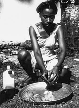 Comoros: Woman grinding coconuts Official website of the Ministry of Tourism with tourist information about the islands. COMORO ISLANDS Les Comores The Comoro Islands' Home Page with comprehensive information about the archipelago. Comores islands - les îles de la lune Comoros portal site with travel and tourism information. Mayotte Comité du Tourisme de Mayotte Official tourism website of Mayotte. l'île au Lagon More Mayotte tourism (in French) Malango-Mayotte A travel and tourism portal site about Mayotte (in French) |
 Students in class at the Coulee school in Moroni. Image: Global Partnership for Education - GPE EducationUniversité des Comores Official website of the University of the Comoros (UDC) a publicly-owned institution founded in 2003, Moroni (in French; temporarily not online). |
 Chomoni village Comoros Image: rabemananoro Environment & NatureCoelacanths Web site about that 400 million year old "living fossil" fish, living in the waters around Comoros. Moidjio C.R.C.A.D. Site of the Centre for Research Conservation and Development. Le Programme Régional à la Promotion d'une Education pour la Gestion de l'Environnement (ARPEGE) Indian Ocean Commission program for the environment (in French). PNUD Comores Site of the UN environment development program for the Comoros (in French). |
HistoryHistory of Comoros Wikipedia entry about the History of Comoros. |
Sources and additional Information on ComorosAfrica South of the Sahara: Comoros Stanford University. BBC Country Profile: Comoros GlobalEDGE: Comoros Indian Ocean Commission: Comoros Open Directory Project: Comoros Wikipedia: Comoros The World Factbook -- Comoros |
 |
Major cities of Eastern Africa Addis Ababa, Antananarivo, Asmara, Bujumbura, Dar es Salaam, Djibouti (City), Dodoma, Harare, Kampala, Kigali, Lilongwe, Lusaka, Maputo, Mogadishu, Moroni, Nairobi, Port Louis, Saint-Denis, Victoria Other Countries of Eastern Africa Burundi, Djibouti, Eritrea, Ethiopia, Kenya, Madagascar, Malawi, Mauritius, Mozambique Réunion, Rwanda, Seychelles, Somalia, Tanzania, Uganda, Zambia, Zimbabwe |
One World - Nations Online .:. let's care for this planet Promote that every nation assumes responsibility for our world. Nations Online Project is made to improve cross-cultural understanding and global awareness. More signal - less NOISE |
| Site Map
| Information Sources | Disclaimer | Copyright © 1998-2023 :: nationsonline.org |
