| Home |
|
|
|
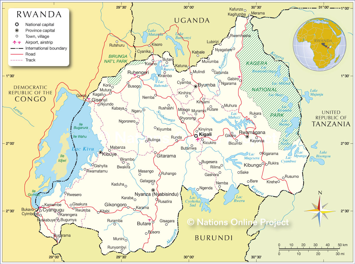
___ Political Map of Rwanda |
|
Map is showing Rwanda and the surrounding countries with international borders, prefectures boundaries, the national capital Kigali, prefecture capitals, major cities, roads, tracks, and airports. Border Countries Burundi, Democratic Republic of the Congo, Tanzania, Uganda |
 Bookmark/share this page |
 One World - Nations Online All Countries of the World |
|
|
||
One World - Nations Online .:. let's care for this planet Every nation is responsible for the current state of our world. |
| Site Map
| Information Sources | Disclaimer: Privacy Policy, etc. Contact: [email protected] | Copyright © 1998-2021 :: nationsonline.org |