Nations Online
All Countries in the World
Nations Online All Countries in the World | |
Home  |
___ Satellite View and Map of the City of Bridgetown, Barbados |
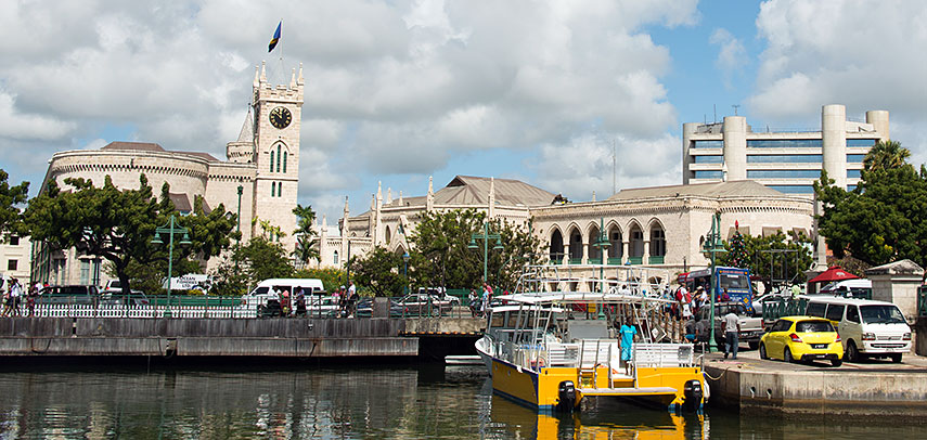 Barbados Parliament buildings and the Central Bank building in Bridgetown, Barbados. Image: Barry Haynes |
About Bridgetown Satellite view is showing Bridgetown, and the national capital of Satellite view is showing Bridgetown, and the national capital of The present day location of the city was established by English settlers in 1628. Bridgetown is a cruise-ship stop, its cityscape offers colonial buildings and many shopping facilities. The city has a population of almost 100,000 inhabitants. Official language is English. Some points of interest: Historic Bridgetown and its Garrison The map shows a city map of Bridgetown with expressways, main roads and streets, zoom out to find the location of Grantley Adams International Airport (IATA code: BGI) located in Seawell, 18.5 km (11.5 mi) by road (via Errol Barrow Highway and Tom Adams Highway) southeast of Bridgetown center. To find a location use the form below. |
|
| To find a location type: street or place, city, optional: state, country. |
Local Time Barbados:
Thursday-April-18 05:42
UTC/GMT -4 hours |
One World - Nations Online .:. let's care for this planet Promote that every nation assumes responsibility for our world. Nations Online Project is made to improve cross-cultural understanding and global awareness. More signal - less NOISE |
| Site Map
| Information Sources | Disclaimer | Copyright © 1998-2023 :: nationsonline.org |

