Nations Online
All Countries in the World
Nations Online All Countries in the World | |
Home  |
___ Satellite View and Map of Côte d'Ivoire (Ivory Coast) |
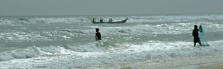 Fishermen near Assouindé village, Côte d'Ivoire. Image: Asram |
About Ivory Coast Satellite view is showing Côte d'Ivoire, the Ivory Coast, the West African country with a French-colonial legacy. It is bordered by Liberia and Guinea in west, by Mali and Burkina Faso in north, by Ghana in east and by the North Atlantic Ocean in south. With an area of 322,463 km² the Ivory Coast is slightly smaller than Poland, or slightly larger than than the U.S. state of New Mexico. The country's highest point is Mount Nimba (Mount Richard-Molard) with 1,752 m, located at the border to Guinea and Liberia. Satellite view is showing Côte d'Ivoire, the Ivory Coast, the West African country with a French-colonial legacy. It is bordered by Liberia and Guinea in west, by Mali and Burkina Faso in north, by Ghana in east and by the North Atlantic Ocean in south. With an area of 322,463 km² the Ivory Coast is slightly smaller than Poland, or slightly larger than than the U.S. state of New Mexico. The country's highest point is Mount Nimba (Mount Richard-Molard) with 1,752 m, located at the border to Guinea and Liberia.The country has a population of 22.7 million inhabitants (in 2015). Capital city is Yamoussoukro, located near the center of the country, former capital and largest city with nearly 5 million people is Abidjan. Spoken languages are French (official) and several local West African languages. The map shows Côte d'Ivoire with cities, towns, expressways, main roads and streets. To find a location use the form below. |
||
| To find a location type: street or place, city, optional: state, country. | Local Time Ivory Coast:
Wednsday-April-24 04:24
No UTC/GMT offset |
|
|
φ Latitude, λ Longitude (of Map center; move the map to see coordinates): , |
||||||
| Google Maps: Searchable Map of Republic of Cote d'Ivoire (Ivory Coast). | Bookmark/share this page |
|||||
| More about Cote d'Ivoire: Cities: Country: Continent: |
Current Weather Conditions Abidjan:
|
Related Consumer Information:
| ||||
Searchable Maps of other Countries in West Africa: Benin | Burkina Faso | Cape Verde | Côte d'Ivoire | Gambia | Ghana | Guinea | Guinea-Bissau Liberia | Mali | Mauritania | Niger | Nigeria | Senegal | Sierra Leone | Togo |
||||||
Map Help [ show ] |
||||||
One World - Nations Online .:. let's care for this planet Promote that every nation assumes responsibility for our world. Nations Online Project is made to improve cross-cultural understanding and global awareness. More signal - less NOISE |
| Site Map
| Information Sources | Disclaimer | Copyright © 1998-2023 :: nationsonline.org |

