Nations Online
All Countries in the World
Nations Online All Countries in the World | |
Home  |
___ Satellite View and Map of Mauritania |
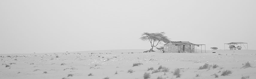 Sahara Desert Mauritania. Sahara Desert Mauritania.Image: stringer_bel |
Searchable Map and Satellite View of Mauritania using Google Earth Data Satellite view is showing Mauritania a Northern African country bordering the North Atlantic Ocean in south west. Countries with international borders to Mauritania are Algeria, Mali, Senegal, and Western Sahara. Satellite view is showing Mauritania a Northern African country bordering the North Atlantic Ocean in south west. Countries with international borders to Mauritania are Algeria, Mali, Senegal, and Western Sahara.Mauritania covers an area of 1,025,520 km², the country is about twice the size of Spain, or slightly larger than the US states of Texas and New Mexico combined. Much of the country is covered by the Sahara, about three quarters of Mauritania are desert or semidesert. 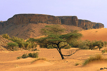 Adrar Plateau, a highland area in the Sahara Desert in northern Mauritania. Image: Emmanuel Brunner Spoken languages are Arabic (official), Wolof (official), and French. Mauritania is an Islamic country, the majority are Sunni Muslim. Slavery still persists in Mauritania as part of the culture. Although nominally abolished in 1981, it was not illegal to own slaves until 2007. An estimated 10% to 20% of Mauritania's population are enslaved — in “real slavery,” according to the United Nations' special rapporteur Just zoom in to see the The map shows Mauritania with cities, towns, expressways, main roads and streets. To find a location use the form below. |
| To find a location type: street or place, city, optional: state, country. | Local Time Mauritania:
Tuesday-April-23 06:11
Time zone: Greenwich Mean Time (GMT) |
|
φ Latitude, λ Longitude (of Map center; move the map to see coordinates): , |
||||||
| Google Maps: Searchable Map of Mauritania. | Bookmark/share this page |
|||||
| More about Mauritania: Cities: Country: Continent: |
Weather Conditions Nouakchott
|
Related Consumer Information:
|
||||
Searchable Maps of other Countries in West Africa: Benin | Burkina Faso | Cape Verde | Côte d'Ivoire | Gambia | Ghana | Guinea | Guinea-Bissau Liberia | Mali | Mauritania | Niger | Nigeria | Senegal | Sierra Leone | Togo |
||||||
Map Help [ show ] |
||||||
One World - Nations Online .:. let's care for this planet Promote that every nation assumes responsibility for our world. Nations Online Project is made to improve cross-cultural understanding and global awareness. More signal - less NOISE |
| Site Map
| Information Sources | Disclaimer | Copyright © 1998-2023 :: nationsonline.org |

