Nations Online
All Countries in the World
Nations Online All Countries in the World | |
Home  |
___ Satellite View and Map of Cape Verde |
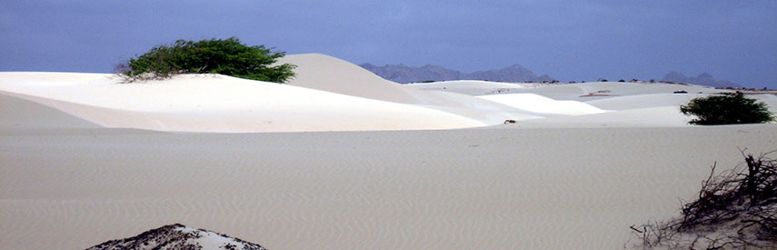 Deserto de Viana, a sand desert in the northwestern part of the island of Boa Vista, Cape Verde. Image: Ingo Wölbern |
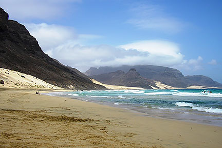
About Cape VerdeSatellite view is showing Cape Verde, a group of islands in the North Atlantic Ocean. Praia the country's capital is about 660 km west of Dakar, capital city of Senegal's on the African mainland. Cape Verde shares maritime borders with Gambia, Guinea-Bissau, Mauritania, and Senegal. Related countries: Portugal.Cape Verde consists traditionally of two island groups, the Barlavento (windward) islands, including the islands of Santo Antão, São Vicente, Santa Luzia, São Nicolau, Sal, and Boa Vista; the Sotavento (leeward) islands with the islands of Maio, Santiago, Fogo, and Brava. The archipelago is of volcanic origin. But only on Fogo is an active volcano, Pico do Cano (or Mount Fogo), with 2,829 m (9,281 ft) the highest point in Cape Verde. Cape Verde has a population of 525,000 people. Most Cape Verdeans are mulattos with mixed African and European origins. Around 95% of the population are Christian. Spoken languages are Portuguese (official) and Creole. The map shows Cape Verde with cities, towns, expressways, main roads and streets, and the location of the country’s international airports. To find a location use the form below. |
|
| To find a location type: street or place, city, optional: state, country. |
Local Time Cape Verde:
Tuesday-April-23 14:33
Timezone: Cape Verde Time (CVT) :: UTC/GMT -1h |
|
φ Latitude, λ Longitude (of Map center; move the map to see coordinates): , |
||||||
| Google Maps: Searchable Map of Republic of Cape Verde. | Bookmark/share this page |
|||||
| More about Cape Verde: Cities: Searchable map and satellite view of Cape Verde's capital city Country: Political Map of Cape Verde Map of Cape Verde showing the administrative divisions of Cape Verde. Continent: |
Weather Conditions Cameroon
|
Explore more:
Related Consumer Information:
|
||||
Searchable Maps of other Countries in West Africa: Benin | Burkina Faso | Cape Verde | Côte d'Ivoire | Gambia | Ghana | Guinea | Guinea-Bissau Liberia | Mali | Mauritania | Niger | Nigeria | Senegal | Sierra Leone | Togo |
||||||
Map Help [ show ] |
||||||
One World - Nations Online .:. let's care for this planet Promote that every nation assumes responsibility for our world. Nations Online Project is made to improve cross-cultural understanding and global awareness. More signal - less NOISE |
| Site Map
| Information Sources | Disclaimer | Copyright © 1998-2023 :: nationsonline.org |