Nations Online
All Countries in the World
Nations Online All Countries in the World | |
Home  |
___ Satellite View and Map of The Gambia (Islamic Republic of the Gambia) |
 Fishing boats at the beach in Gambia. Image: Ikiwaner |
About The Gambia Satellite view is showing tropical Gambia, a West African state bordering the North Atlantic Ocean in west. The country is a narrow strip of land on either side of the Gambia River, just 48 km (29 mi) at its widest point. Within the country, the Gambia River is navigable the entire length, it is Gambia's chief transport artery. Satellite view is showing tropical Gambia, a West African state bordering the North Atlantic Ocean in west. The country is a narrow strip of land on either side of the Gambia River, just 48 km (29 mi) at its widest point. Within the country, the Gambia River is navigable the entire length, it is Gambia's chief transport artery.The smallest country on mainland Africa occupies an area of 11,295 km², it is about the size of one third of Belgium or slightly less than twice the size of Delaware. The country forms an enclave within Senegal with the exception of its coast. 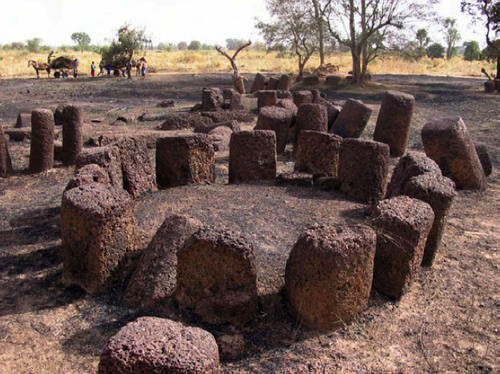 Stone Circles of Senegambia The country has a population of 1,9 million inhabitants (2015). Most of the people live near the coast. Gambia's population is made up of several ethnic groups, about one-third are Mandinka, followed by Fula, Wolof, and Jola people. Spoken languages are English (official), Malinke and other indigenous languages and Creole. More than 95 percent of the population in the Islamic Republic of the Gambia are Muslims. Capital city of The Gambia is Banjul. Other urban centers are Serekunda, situated between the Atlantic coast and Banjul, it is Gambia's largest city; Brikama, a market town and major trading center south of Serekunda; the resort and fishing town of Bakau with its botanical gardens, and its crocodile farm Bakau Kachikally naer Banjul; Janjanbureh (formerly Georgetown) on Janjanbureh Island. The map shows Gambia with cities, towns, main roads and streets. To find a location use the form below. |
||
| To find a location type: street or place, city, optional: state, country. |
Local Time The Gambia:
Thursday-April-25 00:23
West Africa Time (WAT): UTC/GMT +1 h |
|
|
φ Latitude, λ Longitude (of Map center; move the map to see coordinates): , |
||||||
| Google Maps: Searchable Map of Republic of The Gambia. | Bookmark/share this page |
|||||
| More about Gambia: Cities: Country: Continent: |
Banjul Current Weather Conditions:
|
Related Consumer Information:
|
||||
Searchable Maps of other Countries in West Africa: Benin | Burkina Faso | Cape Verde | Côte d'Ivoire | Gambia | Ghana | Guinea | Guinea-Bissau Liberia | Mali | Mauritania | Niger | Nigeria | Senegal | Sierra Leone | Togo |
||||||
Map Help [ show ] |
||||||
One World - Nations Online .:. let's care for this planet Promote that every nation assumes responsibility for our world. Nations Online Project is made to improve cross-cultural understanding and global awareness. More signal - less NOISE |
| Site Map
| Information Sources | Disclaimer | Copyright © 1998-2023 :: nationsonline.org |

