Nations Online
All Countries in the World
Nations Online All Countries in the World | |
Home  |
___ Satellite View and Map of Sierra Leone |
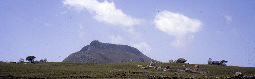 Mount Bintumani (Loma Mansa), highest mountain in Sierra Leone, located in the north east of the country, its lower slopes are covered in rainforest. Image: Jared & Melanie & Huxley Ponchot |
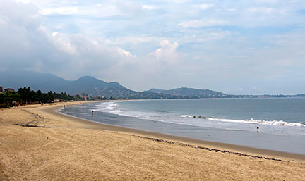
About Sierra Leone Satellite view is showing the tropical country in West Africa, situated between Guinea and Liberia, bordering the North Atlantic Ocean with a 400 km long coastline of low-lying mangrove swamps, cut in on and off by some estuaries and several wide, sandy beaches and by a mountainous Sierra Leone Peninsula. Satellite view is showing the tropical country in West Africa, situated between Guinea and Liberia, bordering the North Atlantic Ocean with a 400 km long coastline of low-lying mangrove swamps, cut in on and off by some estuaries and several wide, sandy beaches and by a mountainous Sierra Leone Peninsula. The eastern half of the country is mountainous. Mt. Bintumani (Loma Mansa) is located there, with 1,945 m (6,381 ft) the highest point in Sierra Leone. The country covers an area of 71,740 km² making Sierra Leone slightly larger than Ireland or slightly smaller than the U.S. state of South Carolina. Sierra Leone has a population of 6.3 million people (in 2015), largest city, chief port, and the national capital is Freetown with almost 1 million inhabitants. Other urban centers are Bo (Bo Town), the leading financial, educational, and commercial center in the Southern Province; Kenema, capital of Kenema District and the most ethnically diverse city in Sierra Leone; Makeni, fourth largest city and capital of Bombali District; Koidu Town (Sefadu), known as a major diamond trade center; Lunsar, a former iron ore mining town. Spoken languages are English (official), Sierra Leone Krio is spoken by 90% of the population. Sierra Leone is a predominantly Islamic country with 60% Muslims; 10% Christians; and 30% believers in traditional African religion. The map shows Sierra Leone with cities, towns, main roads and streets. To find a location use the form below. |
|
| To find a location type: street or place, city, optional: state, country. | Local Time Sierra Leone:
Tuesday-June-9 16:53
No GMT/UTC time offset, GMT/UTC +0 hour |
|
φ Latitude, λ Longitude (of Map center; move the map to see coordinates): , |
||||||
| Google Maps: Searchable Map of Republic of Sierra Leone. | Bookmark/share this page |
|||||
| More about Sierra Leone: Cities: Country: Continent: | Weather Conditions Sierra Leone at Freetown-Lungi International Airport
|
Related Consumer Information:
| ||||
Searchable Maps of other Countries in West Africa: Benin | Burkina Faso | Cape Verde | Côte d'Ivoire | Gambia | Ghana | Guinea | Guinea-Bissau Liberia | Mali | Mauritania | Niger | Nigeria | Senegal | Sierra Leone | Togo |
||||||
Map Help [ show ] |
||||||
One World - Nations Online .:. let's care for this planet Promote that every nation assumes responsibility for our world. Nations Online Project is made to improve cross-cultural understanding and global awareness. More signal - less NOISE |
| Site Map
| Information Sources | Disclaimer | Copyright © 1998-2024:: nationsonline.org |