Nations Online
All Countries in the World
Nations Online All Countries in the World | |
Home  |
___ Satellite View and Map of Ghana |
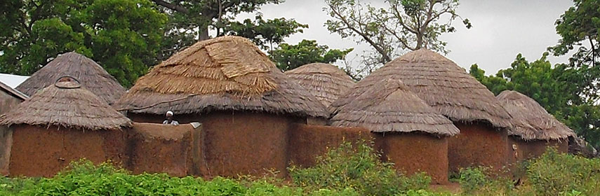 Traditional round mud and thatch houses forming a family compound in Northern Ghana, near Tamale. - Image: ZSM |
About Ghana Satellite view is showing Ghana the western African country with a southern coastline at the Gulf of Guinea. With an area of 238,533 km², the nation is slightly smaller than the UK, or slightly smaller than the U.S. state of Oregon. The country's terrain consists mostly of low plains with some hills. Mount Afadja (or Mount Afadjato) is Ghana's highest peak with 885 m (2,904 ft). The hill is located in the Agumatsa Range east of Lake Volta, the world's largest artificial lake. Satellite view is showing Ghana the western African country with a southern coastline at the Gulf of Guinea. With an area of 238,533 km², the nation is slightly smaller than the UK, or slightly smaller than the U.S. state of Oregon. The country's terrain consists mostly of low plains with some hills. Mount Afadja (or Mount Afadjato) is Ghana's highest peak with 885 m (2,904 ft). The hill is located in the Agumatsa Range east of Lake Volta, the world's largest artificial lake. 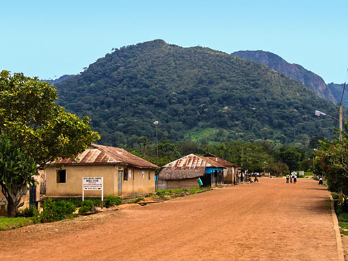 Mount Afadja, Ghanas highest mountain. Image: Krzysztof Gajos Spoken languages are English (official) and West African languages. Countries with international borders to Ghana are Burkina Faso, Cote d'Ivoire (Ivory Coast), and Togo. Ghana was in Frommer's list of Top Destinations 2012. The country is described as: "Ghana provides a perfect introduction to African travel. True, this small and amiable West African nation lacks the big name draws associated with the continent's top safari destinations. But for anybody seeking a holistic experience that embraces traditional and contemporary cultures as well as beaches and safaris, Ghana's microcosmic travel circuit is the perfect African primer." The map shows Ghana with cities, towns, expressways, main roads and streets. To find a location use the form below. |
|
| To find a location type: street or place, city, optional: state, country. | Local Time Ghana:
Tuesday-April-23 20:48
Time Zone: no time offset of GMT/UTC 0 hour. |
|
φ Latitude, λ Longitude (of Map center; move the map to see coordinates): , |
||||||
| Google Maps: Searchable Map of Republic of Ghana. |
Bookmark/share this page |
|||||
| More about Ghana: Cities: Country: Continent: | Current Weather Conditions Accra
|
Related Consumer Information:
| ||||
Searchable Maps of other Countries in West Africa: Benin | Burkina Faso | Cape Verde | Côte d'Ivoire | Gambia | Ghana | Guinea | Guinea-Bissau Liberia | Mali | Mauritania | Niger | Nigeria | Senegal | Sierra Leone | Togo |
||||||
Map Help [ show ] |
||||||
One World - Nations Online .:. let's care for this planet Promote that every nation assumes responsibility for our world. Nations Online Project is made to improve cross-cultural understanding and global awareness. More signal - less NOISE |
| Site Map
| Information Sources | Disclaimer | Copyright © 1998-2023 :: nationsonline.org |

