Nations Online
All Countries in the World
Nations Online All Countries in the World | |
| Home |
___ Administrative Map of Côte d'Ivoire (Ivory Coast) |
| Map is showing Côte d'Ivoire with surrounding countries, states borders, the national capital, region borders, and region capitals (in bold) and district capitals. Click for a Political Map of Côte d'Ivoire. 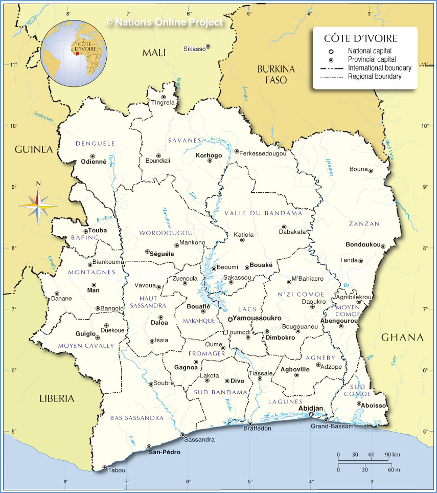 Administrative Map of Côte d'Ivoire |
| Administrative Regions of Côte d'Ivoire Côte d'Ivoire is divided into nineteen regions (régions) The regions are (region capital in parenthesis) 1. Agnéby (Agboville) 2. Bafing (Touba) 3. Bas-Sassandra (San-Pédro) 4. Denguélé (Odienné) 5. Dix-Huit Montagnes (Man) 6. Fromager (Gagnoa) 7. Haut-Sassandra (Daloa) 8. Lacs (Yamoussoukro) 9. Lagunes (Abidjan) 10. Marahoué (Bouaflé) 11. Moyen-Cavally (Guiglo) 12. Moyen-Comoé (Abengourou) 13. N'zi-Comoé (Dimbokro) 14. Savanes (Korhogo) 15. Sud-Bandama (Divo) 16. Sud-Comoé (Aboisso) 17. Vallée du Bandama (Bouaké) 18. Worodougou (Séguéla) 19. Zanzan (Bondoukou) |
One World - Nations Online .:. let's care for this planet Promote that every nation assumes responsibility for our world. Nations Online Project is made to improve cross-cultural understanding and global awareness. More signal - less NOISE |
| Site Map
| Information Sources | Disclaimer | Copyright © 1998-2023 :: nationsonline.org |