Nations Online
All Countries in the World
Nations Online All Countries in the World | |
Home  |
___ Satellite View and Map of Niger (République du Niger) |
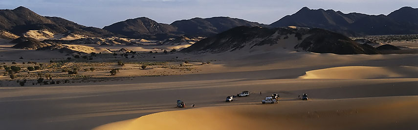 Transit between the Ténéré desert into Aïr Mountains near Arakao. Image: Jacques Taberlet |
About Niger Satellite view is showing Niger a landlocked country in West Africa on the southern edge of the Sahara Desert. The country is bordered by Algeria, Benin, Burkina Faso, Chad, Libya, Mali, and Nigeria. Satellite view is showing Niger a landlocked country in West Africa on the southern edge of the Sahara Desert. The country is bordered by Algeria, Benin, Burkina Faso, Chad, Libya, Mali, and Nigeria.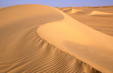 Erg of Bilma, a Dune Sea in the Ténéré desert region of Niger in the south central Sahara. Image: Holger Reineccius The country is mostly flat with the exception of the Aïr Mountains north east of Agadez, there is Niger's highest point at Mont Idoukal-n-Taghès with 2,022 m (6,634 ft). Niger has a population of 17,5 million people (est. 2015), it is the country with the world's highest total fertility rate. Largest city and the nation's capital is Niamey, located in the south western corner of the country, other urban centers are Agadez, Maradi, Tahoua, and Zinder. Spoken languages are French (official), Hausa, Tuareg, and a variety of West and North African languages. The map shows Niger with cities, towns, main roads and streets. To find a location use the form below. |
|
| To find a location type: street or place, city, optional: state, country. |
Local Time Niger:
Thursday-April-25 16:15
Time zone: West Africa Time (WAT) :: UTC/GMT +1 hours |
|
φ Latitude, λ Longitude (of Map center; move the map to see coordinates): , |
||||||
| Google Maps: Searchable Map of the Republic of Niger. | Bookmark/share this page |
|||||
| More about Niger: Cities: Country: Niger key statistical data. Continent: |
Weather Conditions Niamey:
|
Related Consumer Information:
|
||||
Searchable Maps of other Countries in West Africa: Benin | Burkina Faso | Cape Verde | Côte d'Ivoire | Gambia | Ghana | Guinea | Guinea-Bissau Liberia | Mali | Mauritania | Niger | Nigeria | Senegal | Sierra Leone | Togo |
||||||
Map Help [ show ] |
||||||
One World - Nations Online .:. let's care for this planet Promote that every nation assumes responsibility for our world. Nations Online Project is made to improve cross-cultural understanding and global awareness. More signal - less NOISE |
| Site Map
| Information Sources | Disclaimer | Copyright © 1998-2023 :: nationsonline.org |

