| Home |
___ The Gambia |
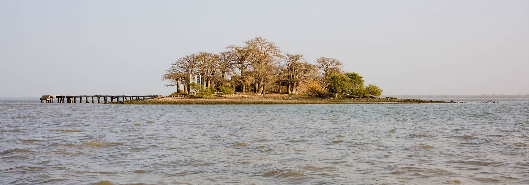 The ruins of Fort James on James Island (Kunta Kinteh Island), the small island in the Gambia River is an important historical site in the West African slave trade, it is now listed as a UNESCO World Heritage Site Image: Ikiwaner |
|
A virtual guide to Gambia, a West African nation bordering the North Atlantic Ocean in west. The sub-tropical country is a narrow strip of land on either side of the Gambia River, just 48 km (29 mi) at its widest point. Within the country, the Gambia River is navigable the entire length, it is Gambia's chief transport artery. The smallest country on mainland Africa occupies an area of 11,295 km², it is about the size of one third of Belgium or slightly less than twice the size of Delaware. The former British colony forms an enclave within Senegal with the exception of its coast. The country has a population of 1,9 million inhabitants (2015). Most of the people live near the coast. Gambia's population is made up of several ethnic groups, about one-third are Mandinka, followed by Fula, Wolof, and Jola people. Spoken languages are English (official), Malinke and other indigenous languages and Creole. More than 95% of the population in the Islamic Republic of the Gambia are Muslims. |
Republic of The Gambia |
Country Profile |
Background: The Gambia is a strip of land 15 to 30 miles (25 to 50 kilometres) wide and 295 miles long on either bank of the Gambia River; except for a short coastline, it is surrounded by Senegal. Its unusual shape and size are attributable to territorial compromises arising from 19th-century Anglo-French rivalry in western Africa. (from "Gambia, The." Encyclopaedia Britannica. 2006) After 200 years of British colonial rule The Gambia gained its independence in 1965; it formed a short-lived federation of Senegambia with Senegal between 1982 and 1989. In 1991 the two nations signed a friendship and cooperation treaty. A military coup in 1994 overthrew the president and banned political activity, but a 1996 constitution and presidential elections, followed by parliamentary balloting in 1997, completed a nominal return to civilian rule. The country undertook another round of presidential and legislative elections in late 2001 and early 2002. Yahya A. J. J. JAMMEH, the leader of the coup, has been elected president in all subsequent elections. Presidential elections were held in the Gambia on 1 December 2016, where opposition candidate ADAMA BARROW defeated long-term incumbent Yahya Jammeh. First Jammeh conceded defeat, but later announced that he was rejecting the results and called for a new election. (Source: CIA - The World Factbook and other) |
Official Name: Republic of The Gambia short form: The Gambia former: Senegambia; federation with Senegal (1982-1989) ISO Country Code: gm Time: Local Time = UTC Actual Time: Wed-Apr-24 13:08 Country Calling Code: +220 Capital City: Banjul (pop. 35 000, with suburbs 500 000) Other Cities: Serrekunda (pop. 200 000), Basse Santa Su, Georgetown (Jangjang-bureh), Juffureh. Government: Type: Civilian. Independence: 18 February 1965 (from the UK). Constitution:16 January 1997. Geography: Location: Western Africa, bordering the North Atlantic Ocean surrounded by Senegal. Area: 11,300 sq. km. (4 360 sq. mi.) Terrain: Flood plain of the Gambia River flanked by low hills. Climate: Tropical; hot rainy season (June to Nov.); cooler, dry season (Nov. to May). People: Nationality: Gambian(s). Population: 1.9 million (2015 UN estimate) Ethnic groups: Mandinka 40%, Fula 18%, Wolof 14%, Jola 10%, Serahule 9%, Serere 8%, Krio/Aku Marabout, Manjago, Bambara. Non-Gambians 13% of the population. Religions: Muslim 95%, Christian 4%, animists. Languages: English (official), Mandinka, Wolof, Fula (Pulaar), Jola, other indigenous languages. Literacy: 38% Natural resources: Fish, titanium, tin, zircon, silica sand. Agriculture products: Peanuts, rice, millet, sorghum, fish, palm kernels, vegetables, livestock, forestry. Industries: Peanut products, construction, telecommunications, brewing; tourism. Exports - commodities: peanut products, fish, cotton lint, palm kernels Exports - partners: China 47.6%, India 27.2%, France 5.9%, UK 4.9% (2015) Imports - commodities: foodstuffs, manufactures, fuel, machinery and transport equipment Imports - partners: China 34.2%, Brazil 8.1%, Senegal 6.9%, India 5.7%, Netherlands 4.8% (2015) Currency: Dalasi (GMD) |
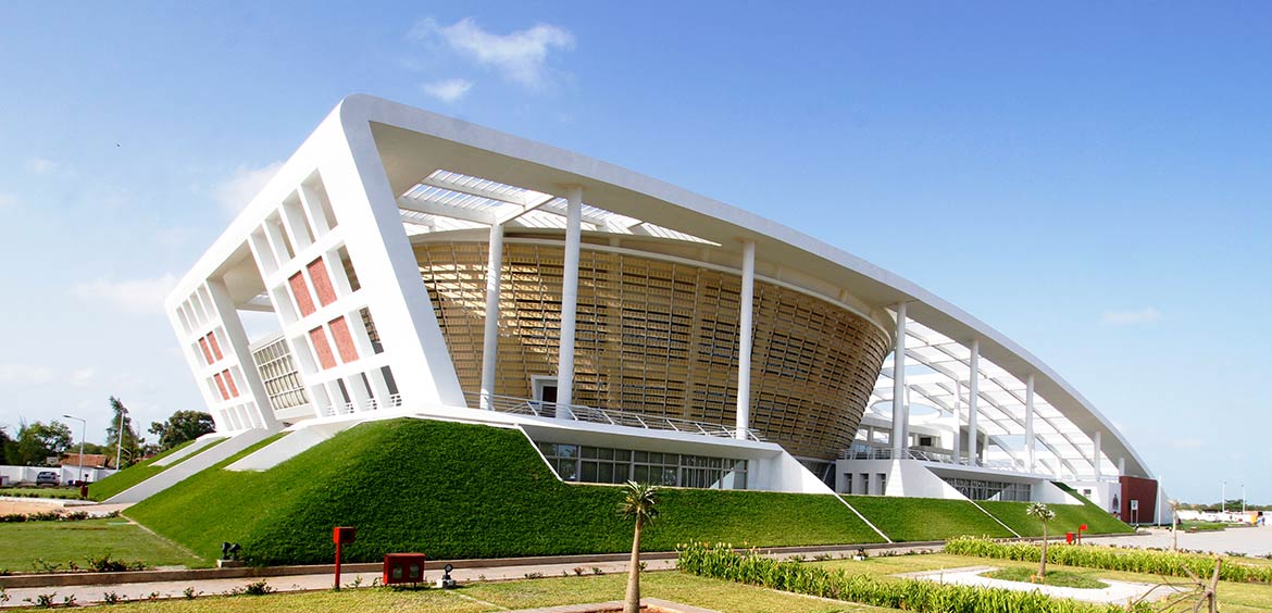 The National Assembly of The Gambia. Image: Minaean SP Construction Corp. Political system Gambia is a presidential republic with a multi-party system. Head of state and head of government is the President. The Cabinet of the Gambia is the chief executive body consisting of the President, a Vice President, and the Secretaries of State. After seizing power in a bloodless coup in 1994, President Yahya Jammeh ruled the country for 22 years with an iron fist. Presidential elections held in the Gambia on 1 December 2016 seemed to end his rule, Jammeh was defeated by Adama Barrow, but Jammeh refused to step down. Official Sites of The GambiaNote: External links will open in a new browser window.Republic of The Gambia State House Office of The Gambian President. National Assembly of The Gambia National Assembly Services Authority of The Gambia. Diplomatic Missions Embassy of the Republic of The Gambia to the USA Embassy website provides information on The Gambia and Embassy work. The Gambia - Permanent Mission to the United Nations The Gambia's UN mission website. United Nations United Nations System in The Gambia Information about UN agencies work in The Gambia. UNDP in The Gambia UN's global development network in the Gambia. MapsMap of GambiaPolitical map of Gambia. Searchable map and satellite view of Gambia. Searchable map and satellite view of Gambia's capital city. The 54 countries of Africa. A Relief Map of Africa. |
NewsA "pervasive climate of fear" forces most journalists to practice self-censorship or flee the country, says Reporters Without Borders (RSF). The organization ranks Gambia 145 out of the 180 countries included in the 2016 World Press Freedom Index.Daily Observer Daily news from the region (Banjul). The Daily News Gambian newspaper. Foroyaa Newspaper Private newspaper published twice weekly (Serrekunda). The Point National and regional news from the Gambian newspaper. International Nerws Sources IRIN News: The challenge of building “New Gambia” Gambia related article by the UN news agency. Radio Gambia Radio Stations A List of Gambian radio stations broadcasting on the internet. Radio Free Gambia - RFG Radio Free Gambia on Facebook with general information about The Gambia in English. |
Bookmark/share this page 
|
Arts & CultureGambian Griot School of Music and Dance Site about the tradition of The Gambia's music, dance and griots (court musicians). Listen All - Dembo Jobarteh Dembo Jobarteh is a griot from Niani Kayai, The Gambia. King Kora Gambia Tour - urban griot music. Gambia Radio Stations List of Gambian radio stations broadcasting on the internet. |
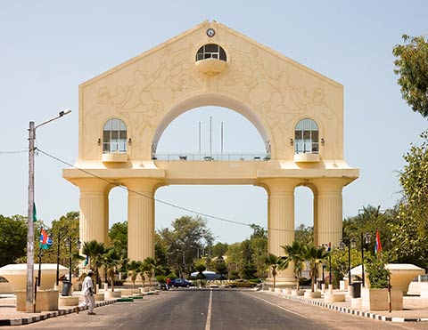 Arch 22 Memorial in Banjul, the monument is commemorating the 1994 coup which saw Yahya Jammeh seize power. |
Business & EconomyCentral Bank of The Gambia Official website of the Central Bank of The Gambia. Guaranty Trust Bank Gambia Licensed by the Central Bank of the Gambia to operate full commercial Banking activities. Trust Bank Limited Gambia's local Bank. Department of State for Trade, Industry and Employment (DOSTIE) "To transform The Gambia into a financial center, a tourist paradise, a trading, export-oriented agricultural and manufacturing nation". The Gambia Chamber of Commerce and Industry ( GCCI ) Official website withz information on the work of the Chamber and about The Gambia. Gambia Investment Promotion and Free Zones Agency The national agency charged with the promotion of The Gambia as an ideal investment destination. QuantumNET Gambia's IT and ISP. Transportation Gambia International Airlines The National Carrier of the Gambia . Port of Banjul Official website of The Gambia Ports Authority |
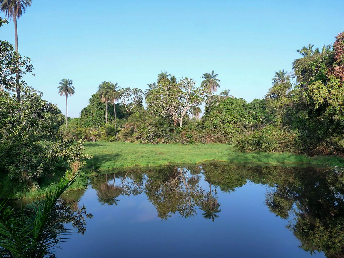 Abuko Nature Reserve near Serrekunda in Gambia, it is a popular tourist attraction and the country's first designated wildlife reserve. Image: Paul Walter Travel and Tour Consumer Information
Destination The Gambia - Travel and Tour GuidesDiscover Gambia: Banjul, Bakau, Gunjur, Wassu Stone Circles, Fort James Island, Juffureh. Links to accommodation, hotels, attractions, festivals, events, tourist boards, and more. The Gambia Tourism Website The Gambia travel and tourism information by Gambia Tourism Authority. Visit The Gambia Tours Travel and tourism information about The "Smiling Coast of Africa". Gambia Travel & Tourism Information on Gambia by Access Gambia. UNESCO World Heritage Sites There are four large groups of stone circles along the River Gambia, significant for a vast sacred landscape of tumuli, stone pillars and burial mounds, created over more than 1,500 years between the 3rd century BC and 16th century AD. Stone Circles of Senegambia |
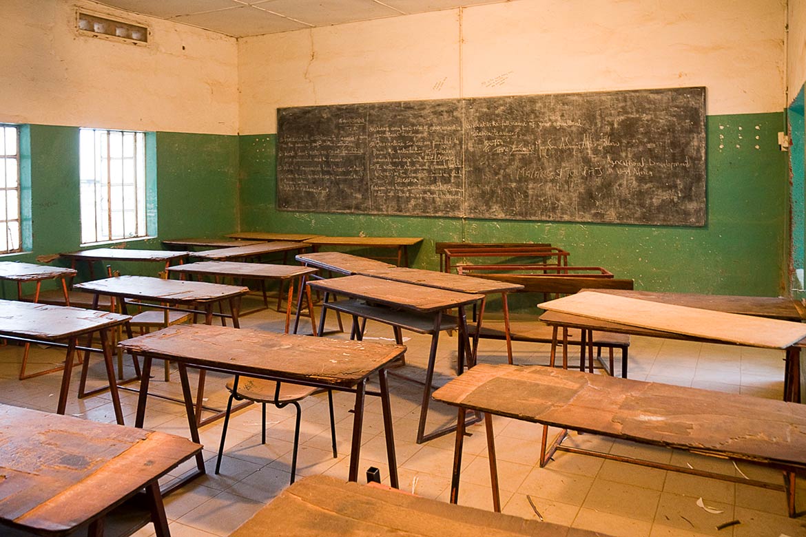 Classroom at Armitage High School in Janjanbureh on Janjanbureh Island in the Gambia River. Gambia's constitution mandates free and compulsory primary education in the Gambia, but a lack of resources and education infrastructure has made implementation difficult. The literacy rate in the Gambia is 64% for males and 47.6% for females. Image: Ikiwaner EducationDepartment of State for Education Provides information on the Gambia's education plans and programms. University of the Gambia Institution of higher education located in Serrekunda. It is the only university in the country. Global Partnership for Education - Gambia The Global Partnership for Education supports 65 developing countries. PAGEANT PAGEANT stands for Projects Aiding Gambian Education And Natural Talent. It was established as a UK Charity in 2002 specifically to support education and related projects in The Gambia. |
Environment & NatureChimpanzee Rehabilitation Trust Chimpanzee rehabilitation project at River Gambia National Park on Baboon Islands. |
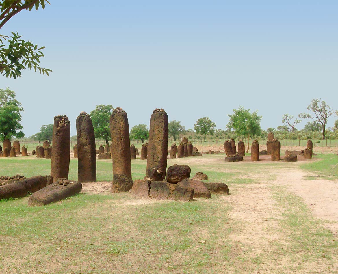 Stone Circles of Senegambia. Image: Niels Broekzitter HistoryHistory of The Gambia Information about Gambia's history by Access Gambia. Historical Dates and Personalities Brief Gambian history. |
|
SearchAccess GambiaPortal of Gambia related websites & information. Sources and additional Information on GambiaAmnesty International: Gambia BBC Country Profile: Gambia FAO: Gambia globalEDGE: The Gambia The Heritage Foundation: Gambia Human Rights Watch: Gambia OEC: Gambia Reporters Without Borders: Gambia Freedom House: The Gambia U.S. Relations With The Gambia Wikipedia: Gambia The World Factbook -- Gambia |
 |
Major Cities in West Africa Abidjan, Abuja, Accra, Bamako, Banjul, Bissau, Conakry, Cotonou, Dakar, Freetown, Lagos, Lomé, Monrovia, Niamey, Nouakchott, Ouagadougou, Porto-Novo, Praia, Sao Tome City, Yamoussoukro Other Countries of Western Africa Benin | Burkina Faso | Cape Verde | Côte d'Ivoire | Ghana | Guinea | Guinea-Bissau | Liberia | Mali | Mauritania Niger | Nigeria | Senegal | Sierra Leone | Togo |
One World - Nations Online .:. let's care for this planet Promote that every nation assumes responsibility for our world. Nations Online Project is made to improve cross-cultural understanding and global awareness. More signal - less NOISE |
| Site Map
| Information Sources | Disclaimer | Copyright © 1998-2023 :: nationsonline.org |