Nations Online
All Countries in the World
Nations Online All Countries in the World | |
Home  |
___ Satellite View and Map of the City of Cotonou, Benin |
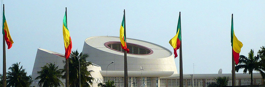 Congress Center of Cotonou located near the airport, it is used for large national and international conferences and symposia. Image: Sophie Graubert |
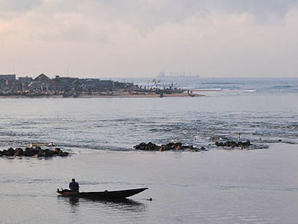
Searchable Map of Benin using Google Earth DataSatellite view is showing Cotonou, largest city and the economic capital ofCotonou is the seat of the government of Benin, while Benin's capital Porto-Novo is the seat of the parliament. The city is Benin's transportation hub, the beating heart of the nation with the only major international airport in the country and its chief port with ongoing expansion work to upgrade it to the standards of modern world ports. Cotonou is also home to the principal university in the country, the National University of Benin. Cotonou has a city population of about 800,000 inhabitants, more than 2 million people live in Cotonou region. Official language is French, the main languages spoken in Cotonou include the Fon, Aja, and Yoruba language. The Map shows the city of Cotonou with expressways and main roads, and the location of Cotonou Cadjehoun Airport (IATA Code: COO). To find another location in Benin use the form below. |
|
| To find a location type: street or place, city, optional: state, country. |
Local Time Benin:
Thursday-April-18 02:27
UTC/GMT +1 hours |
|
φ Latitude, λ Longitude (of Map center; move the map to see coordinates): , |
||||||
| Sorry! Google's pricing policy has made it impossible for us to continue showing Google Maps. We apologize for any inconvenience. Google Map: Searchable map and satellite view of the city of Cotonou, Benin. City Coordinates: 6°22′N 2°25′E |
Bookmark/share this page |
|||||
|
|
||||||
| More about Benin: Cities: Country: Continent: External Links Portail Web de Cotonou au Bénin Cotonou's portal web site (in French). Wikipedia: Cotonou Wikipedia article about Cotonou. |
Current Weather Conditions Cotonou
|
Explore More:
Related Consumer Information:
|
||||
Other Capital Cities in West Africa Abuja, Accra, Bamako, Banjul, Bissau, Conakry, Dakar, Freetown, Lomé, Monrovia, Niamey, Nouakchott, Ouagadougou, Praia, Yamoussoukro Searchable Maps of other Countries in West Africa: Burkina Faso | Cape Verde | Côte d'Ivoire | Gambia | Ghana | Guinea | Guinea-Bissau Liberia | Mali | Mauritania | Niger | Nigeria | Senegal | Sierra Leone | Togo |
||||||
Map Help [ show ] |
||||||
One World - Nations Online .:. let's care for this planet Promote that every nation assumes responsibility for our world. Nations Online Project is made to improve cross-cultural understanding and global awareness. More signal - less NOISE |
| Site Map
| Information Sources | Disclaimer | Copyright © 1998-2023 :: nationsonline.org |