Nations Online
All Countries in the World
Nations Online All Countries in the World | |
Home  |
___ Satellite View and Map of the City of Accra, Ghana |
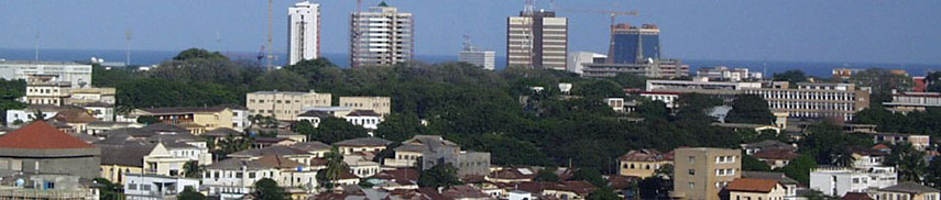 Panorama view of Accra, Ghana's capital. Image: Elegant Machines (Jason Armstrong) |
About the City of Accra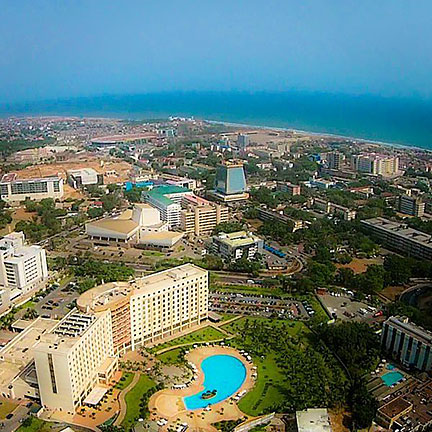 View of Central Accra. Image: null In the 17th century it was the site of three European trading fortresses, which were all in British hands by 1871. Accra became the capital of the British colony of the Gold Coast in 1876 and was made capital of independent Ghana in 1957. Today Accra has a population of 2.3 million inhabitants (2012). Spoken language is English. The Map shows a city map of Accra with expressways, main roads and streets, zoom out to find the location of Kotoka International Airport (IATA code: ACC) about 8 km by road (via Independence Ave and Liberation Rd) northeast of the city center. To find a location use the form below. To see just the map click on the "Map" Button. |
|
| To find a location type: street or place, city, optional: state, country. |
Local Time Ghana:
Friday-April-26 04:47
Time Zone: no time offset of GMT/UTC GMT/UTC 0 hours |
|
φ Latitude, λ Longitude (of Map center; move the map to see coordinates): , |
||||||
| Sorry! Google's pricing policy has made it impossible for us to continue showing Google Maps. We apologize for any inconvenience. Google Map: Searchable map/satellite view of the city of Accra, Republic of Ghana. City Coordinates: 5°33′00″N 0°12′00″W |
Bookmark/share this page |
|||||
| More about Ghana: Country: Continent: External Link: Wikipedia: Accra | Current Weather Conditions Accra
|
Related Consumer Information:
|
||||
Other Major Cities in West Africa Abuja, Abidjan, Bamako, Banjul, Bissau, Conakry, Dakar, Freetown, Lagos, Lomé, Monrovia, Niamey, Nouakchott, Ouagadougou, Porto-Novo, Praia, Yamoussoukro Searchable Maps of other Countries in West Africa: Benin | Burkina Faso | Cape Verde | Côte d'Ivoire | Gambia | Ghana | Guinea | Guinea-Bissau Liberia | Mali | Mauritania | Niger | Nigeria | Senegal | Sierra Leone | Togo |
||||||
Map Help [ show ] |
||||||
One World - Nations Online .:. let's care for this planet Promote that every nation assumes responsibility for our world. Nations Online Project is made to improve cross-cultural understanding and global awareness. More signal - less NOISE |
| Site Map
| Information Sources | Disclaimer | Copyright © 1998-2023 :: nationsonline.org |

