Nations Online
All Countries in the World
Nations Online All Countries in the World | |
Home  |
___ Satellite View and Map of the City of Lagos |
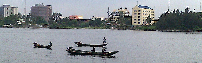 Fishermen returning to their base through the Lagos lagoon. Image: Anutawfiqah |
About Lagos Satellite View is showing Lagos, largest city and principal port of Satellite View is showing Lagos, largest city and principal port of 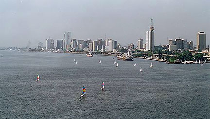 Lagos Island and part of Lagos Harbour, seen from Victoria Island. Lagos Island and part of Lagos Harbour, seen from Victoria Island.Image: Benji Robertson And the city grows, at Lagos’ Bar Beach comes Eko Atlantic City into existence, a planned city under construction for at least 250,000 residents on land reclaimed from the Atlantic Ocean. Spoken languages are English and Yoruba as well as Igbo and Hausa. Just zoom in (+) to see Lagos Island, the historical center and commercial core of the city, to the south and south west lies Victoria Island and Ikoyi, with upscale real estate properties, many embassies reside there. The Map shows a city map of Lagos with expressways, main roads and streets, zoom out to find the location of Murtala Muhammed International Airport, (IATA code: LOS) in north west. To find a location use the form below. To see just the map click on the "Map" Button. |
|
| To find a location type: street or place, city, optional: state, country. |
Local Time Nigeria:
Sunday-April-21 00:36
West Africa Time (WAT): UTC/GMT +1 h |
One World - Nations Online .:. let's care for this planet Promote that every nation assumes responsibility for our world. Nations Online Project is made to improve cross-cultural understanding and global awareness. More signal - less NOISE |
| Site Map
| Information Sources | Disclaimer | Copyright © 1998-2023 :: nationsonline.org |

