Nations Online
All Countries in the World
Nations Online All Countries in the World | |
| Home |
___ Administrative Map of Tunisia |
Map is showing Tunisia and the surrounding countries with international borders, provinces boundaries, the national
capital Tunis, provinces capitals, major cities, main roads, railroads and airports. Primary Administrative Divisions of TunisiaTunisia is divided into 24 units called governorates (Wilayah), The governorates are named after their capital city:Ariana, Béja, Ben Arous, Bizerte, Gabès, Gafsa, Jendouba, Kairouan, Kasserine, Kebili, Kef, Mahdia, Manouba, Medenine, Monastir, Nabeul, Sfax, Sidi Bouzid, Siliana, Sousse, Tataouine, Tozeur, Tunis, and Zaghouan. Note: regional borders provided by Center for International Earth Science Information Network (CIESIN) and Wikipedia Click on the map to enlarge. 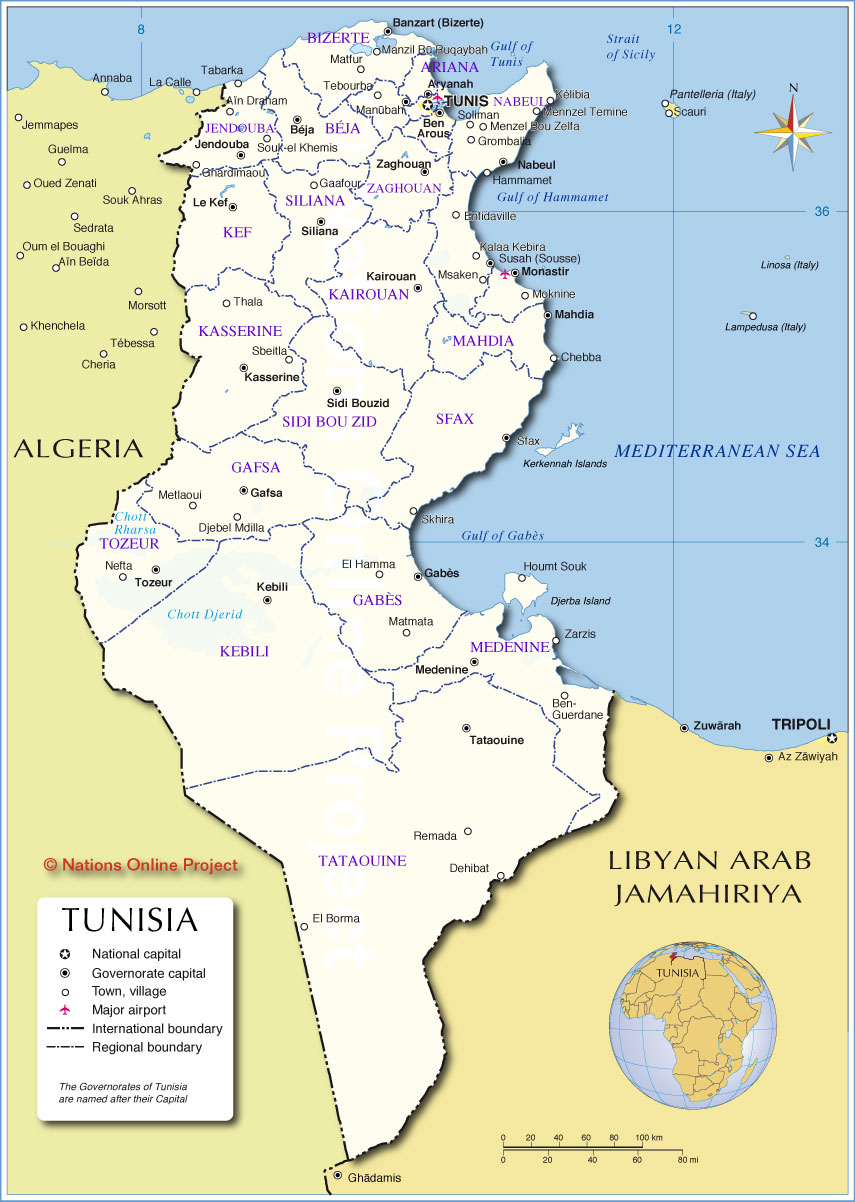 Administrative Map of Tunisia |
||||||
| More about Tunisia Cities: Country: Tunisia key statistical data. Continent: |
Current Weather Conditions Tunis:
|
Related Consumer Information:
|
||||
Other Countries in the Mediterranean: Albania | Algeria || Bosnia and Herzegovina | Croatia | Cyprus | Egypt | France | Gaza Strip | Greece | Israel | Italy | Lebanon Libya | Malta | Monaco | Montenegro | Morocco | Portugal | Slovenia | Spain | Syria | Turkey Maps of other Countries in North Africa: Algeria Map | Egypt Map | Libya Map | Morocco Map | Sudan Map |
One World - Nations Online .:. let's care for this planet Promote that every nation assumes responsibility for our world. Nations Online Project is made to improve cross-cultural understanding and global awareness. More signal - less NOISE |
| Site Map
| Information Sources | Disclaimer | Copyright © 1998-2024:: nationsonline.org |
