Advertising

Bolivia Flag detail
Home Earth Continents The Americas Barbados Country Profile Map of Barbados

Maps Index

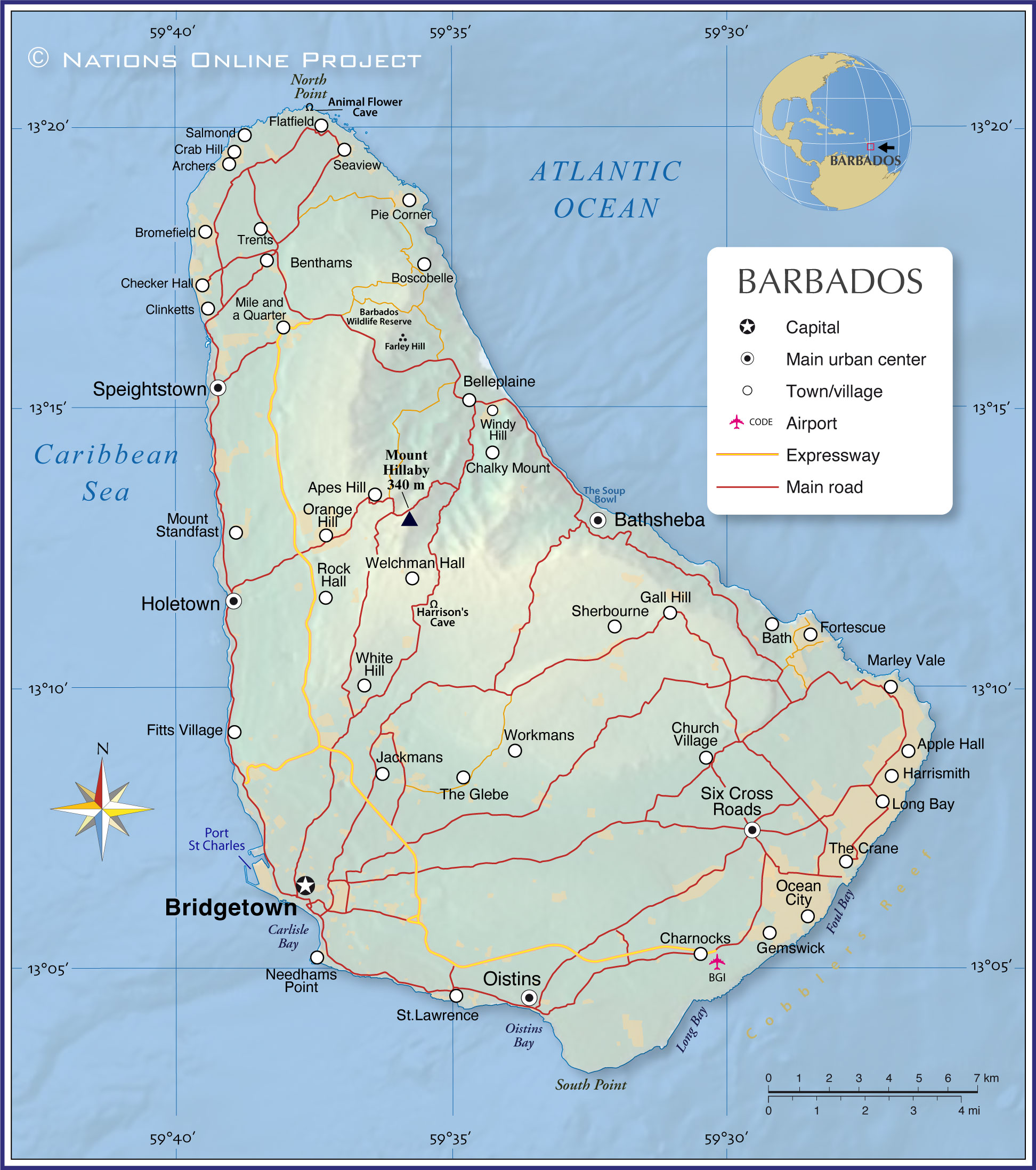
Map of Barbados


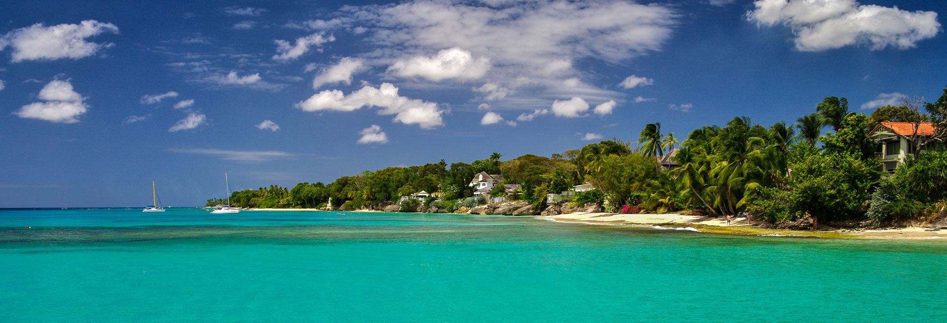
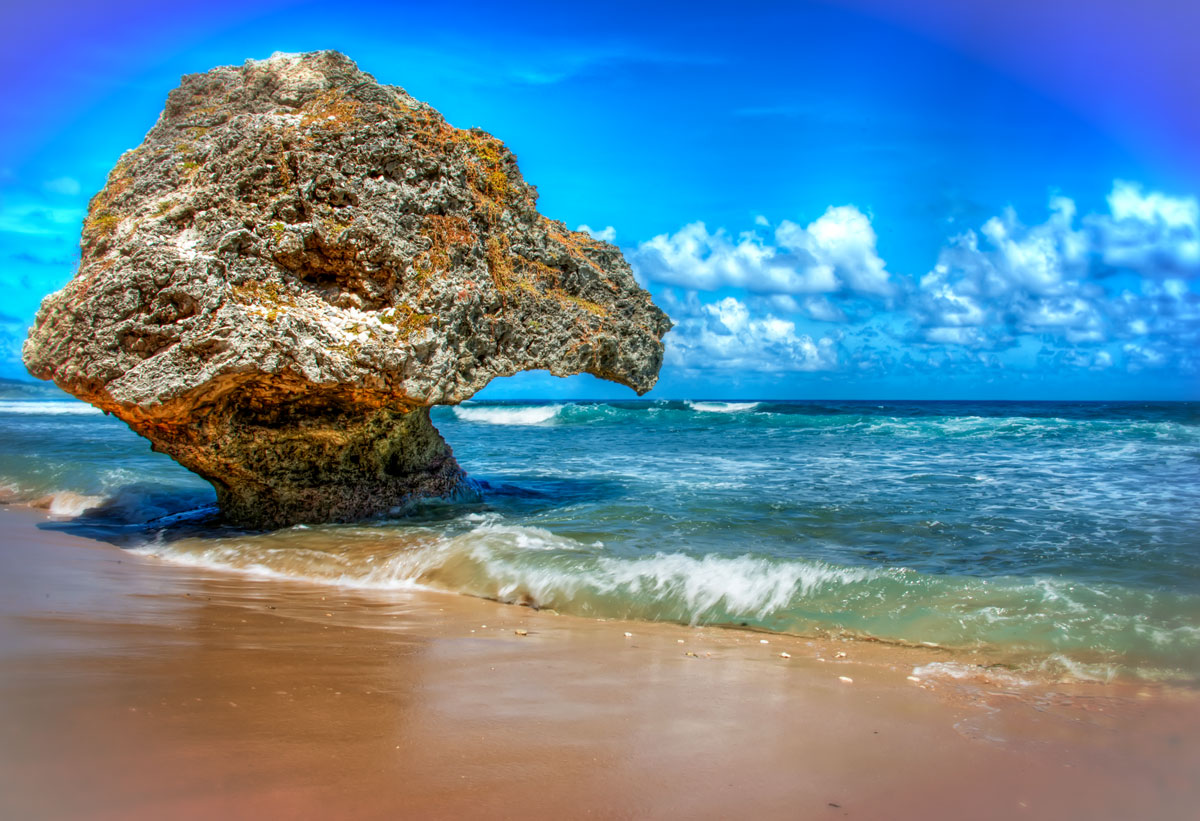
The colors of the Caribbean at a beach in Barbados.
Image: Jean-Marc Astesana

About Barbados


Barbados Flag
The map shows Barbados, the easternmost Caribbean island in the Lesser Antilles. The island country is located between the Caribbean Sea and the Atlantic Ocean, northeast of Venezuela and about 160 km (100 mi) east of Saint Vincent and the Grenadines.

The island was a British colony from 1625 until 1966. From 1966 to 2021, Barbados was a constitutional monarchy and parliamentary democracy with Elizabeth II, Queen of Barbados, as head of state. Monarchy was abolished on 30 November 2021, when Barbados became a parliamentary republic with an elected president as head of state.

Barbados is among the smallest countries in the Americas with an area of about 434 km² (167 sq mi), compared; it is about the size of Andorra or seven times smaller than the US state of Rhode Island.

Barbados has a population of 268,000 (in 2022). The capital and largest city is Bridgetown, other major urban centers are Speightstown, Oistins and Holetown.
The people of Barbados are predominantly of Afro-Caribbean descent (more than 90%), 3% are mixed. [gov.bb] The official language is English; the majority of the population speaks Bajan, an English-based and West African-influenced Creole. The main religion in Barbados is Christianity, with a majority of Protestants (66%).


Map of Barbados

Map of Barbados
Map of Barbados

The map shows the island country of Barbados with the location of the national capital Bridgetown, major urban centers, expressways and the local airport.

You are free to use the above map for educational and similar purposes; if you publish it online or in print, you need to credit Nations Online Project as the source.


More about Barbados


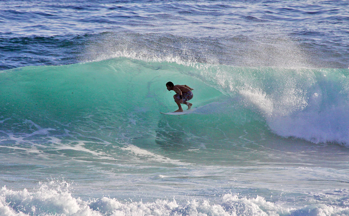
Surfing at the Soup Bowl surfing spot, a beach in Bathsheba on the east coast of Barbados.
Surfing at the Soup Bowl surfing spot. Bathsheba's beach on the east coast of Barbados is known for its big waves.
Photo: Tarik Browne


The easternmost island in the Caribbean is relatively small but offers a variety of geographical and natural features.


Major geographical features of Barbados

Reef-related carbonate rocks
The surface of Barbados consists of 85% coral limestone. A famous example of an underground crystallized limestone cavern is Harrison's Cave, a major tourist attraction, rediscovered in the early 1970s.

Coasts
Barbados is best known for its beach activities, such as diving, snorkeling, surfing and swimming.

The island's West Coast (Platinum Coast) is characterized by calm waters and fine sandy beaches; it is popular for swimming and other water sports.

On the South East Coast, the Caribbean Sea meets the Atlantic Ocean, resulting in livelier waters suitable for water activities like windsurfing.

The rugged and wild East Coast of Barbados is exposed to the Atlantic Ocean. The beaches here offer big waves and are popular for surfing, especially at Bathsheba, known for the Soup Bowl surf spot.

Cliffs and dramatic coastal scenery dominate the North Coast.


Water carved rocks at Bathsheba beach
Water-carved rocks at Bathsheba beach.
Photo: Rick Schwartz


Mountains
There are no mountains in Barbados, but it does have some elevated regions. Mount Hillaby in the parish of St. Andrew is the highest point, reaching about 340 meters (1,120 feet) above sea level.

Gullies
There are no real rivers on the island, but gullies, which are ditches that have been carved out over time by fast-flowing water. Gullies are found all over Barbados; they serve as drainage channels during heavy rains. [Biodiversity Barbados]

Coral Reefs
Barbados' narrow shelf offers easily accessible coral reefs, mainly along the sheltered west and semi-sheltered southwest coasts. The coral reefs play a vital role in protecting the coastline from erosion. The reefs are rich in marine biodiversity and provide entertainment for fish, snorkelers and divers.


Climate
Barbados has a temperate, tropical monsoon climate with average temperatures ranging from 20 to 31 °C (68 to 88 °F). The island is known for two seasons. There is a dry season from December to May and a wet season from June to December with significantly more rainfall.

Transport
Barbados is served by Grantley Adams International Airport (GAIA) (IATA code: BGI).
The island's seaport, the Port of Bridgetown (Deep Water Harbour), is the port of call for commercial container and cruise ship traffic. The nearby Port St. Charles is a luxury marina development with facilities for residents to berth their yachts near their vacation homes.

The map shows the location of the following Barbadian cities and towns:

Apes Hill, Apple Hall, Archers, Bath, Bathsheba, Belleplaine, Benthams, Boscobelle, Bridgetown, Bromefield, Chalky Mount, Charnocks, Checker Hall, Church Village, Clinketts, Crab Hill, Fitts Village, Flatfield, Fortescue, Gall Hill, Gemswick, Harrismith, Holetown, Jackmans, Long Bay, Marley Vale, Mile and a Quarter, Mount Standfast, Needhams Point, Ocean City, Oistins, Orange Hill, Pie Corner, Rock Hall, Salmond, Seaview, Sherbourne, Six Cross Roads, Speightstown, St.Lawrence, The Crane, The Glebe, Trents, Welchman Hall, White Hill, Windy Hill, and Workmans.


Advertisements:


More about Barbados

Google Earth Google Earth map Barbados
Searchable map and satellite view of Barbados.
Google Earth Google Earth map Bridgetown
Searchable map and satellite view of Barbados's capital city.

Caribbean Political Map
Map of the Caribbean.
Map of Central America and the Caribbean
Reference Map of Central America and the Caribbean.
 

Weather Conditions Bridgetown:

BRIDGETOWN WEATHER


Advertisements:


Maps of other Countries in the Caribbean
Bahamas Map, Cuba Map, Dominican Republic, Haiti Map, Jamaica Map, Puerto Rico Map