Nations Online
All Countries in the World
Nations Online All Countries in the World | |
Home  |
___ Satellite View and Map of the City of Mombasa, Kenya |
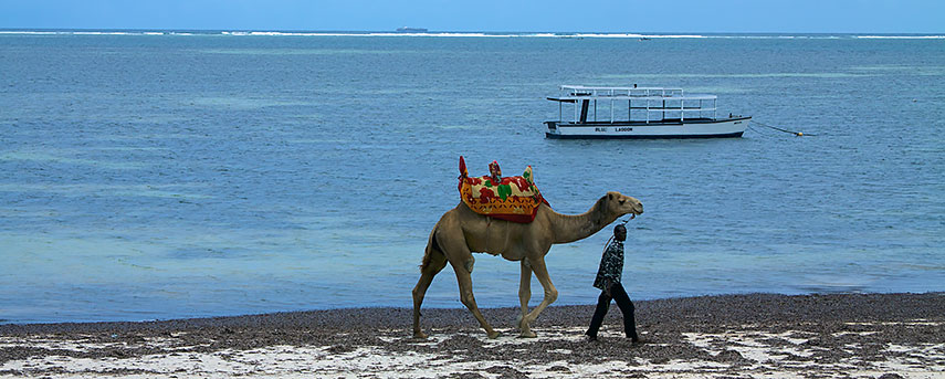 Mombasa beach Image: McKay Savage |
About Mombasa Satellite view is showing Mombasa, second largest city and chief port of Satellite view is showing Mombasa, second largest city and chief port of 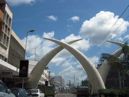 Moi Avenue in Mombasa with the Mombasa "Tusks" portal, the memorial was built to commemorate the visit of Queen Elizabeth to Mombasa in 1952. Image: Collins432 Before Mombasa became an Arab trading center in the 8th century until the 18th century, the area was originally inhabited by the African Bantu people. The Portuguese (namely Vasco da Gama), became the first known Europeans to visit the port of Mombasa in 1498, but were met with hostility and soon departed. The Portuguese eventually controlled the city from 1529 to 1698, when a three-year siege of Fort Jesus by Arabs ended with their expulsion. In the 18th century Mombasa was again briefly held by the Portuguese but then became subject to Oman, whose local representative eventually became the independent ruler of Zanzibar. In 1887 it passed to the British and became capital of the British East Africa Protectorate of Kenya until 1907. Today Mombasa has a population of about 900,000 inhabitants. Spoken languages are Swahili and English. Main attractions in Mombasa are Fort Jesus, the Portuguese fort built in the end of the 17th century, Mombasa Marine Park, a national reserve established in 1986 to protect the biodiversity and the general environment of the area. Shimba Hills National Reserve is near the city, the area of coastal rainforest, woodland and grassland offers the highest density of African elephant in Kenya. Just zoom in (+) to see the remains of Fort Jesus, built by the Portuguese in 1593-1596 to protect the port of Mombasa, today a UNESCO World Heritage Site The map shows a city map of Mombasa with expressways, main roads and streets, and the location of Moi International Airport (IATA code: MBA). To find a location use the form below. |
|
| To find a location type: street or place, city, optional: state, country. |
Local Time Kenya:
Friday-June-19 14:32
Time zone: Eastern Africa Time (EAT) :: UTC/GMT +3 hours |
|
φ Latitude, λ Longitude (of Map center; move the map to see coordinates): , |
||||||
| Google Earth: Searchable Map and Satellite view of Mombasa, Kenya. City Coordinates: 4°3′ S, 39°40′ E |
Bookmark/share this page |
|||||
| More about Kenya: Cities: Country: Kenya key statistical data. Continent: | Weather Conditions Mombasa:
External Link: Standard Digital Kenya news. Wikipedia: Mombasa |
Related Consumer Information:
|
||||
Map Help [ show ] |
||||||
One World - Nations Online .:. let's care for this planet Promote that every nation assumes responsibility for our world. Nations Online Project is made to improve cross-cultural understanding and global awareness. More signal - less NOISE |
| Site Map
| Information Sources | Disclaimer | Copyright © 1998-2024:: nationsonline.org |

