Nations Online
All Countries in the World
Nations Online All Countries in the World | |
Home  |
___ Satellite View and Map of the City of Tbilisi (Tiflis) |
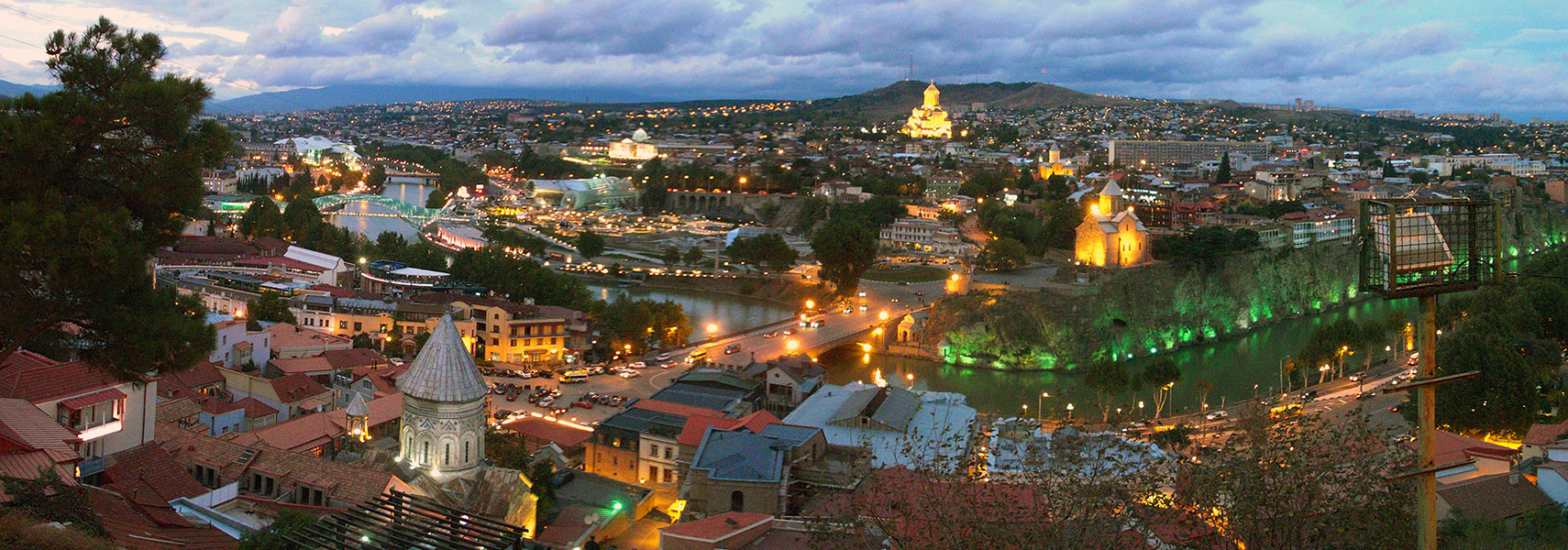 Sunset over the historical center of Tbilisi situated on both banks of the Kura River. Image: Vladimer Shioshvili |
About Tbilisi Satellite view is showing Tbilisi, the national capital of Satellite view is showing Tbilisi, the national capital of 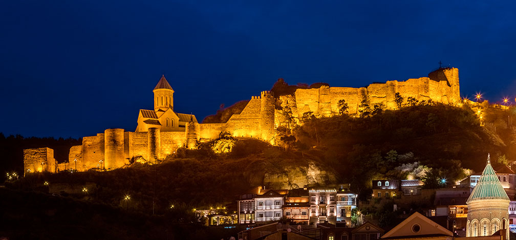 Narikala citadel, the ancient fortress overlooking Tbilisi. Image: Diego Delso Tbilisi has a long, complicated history, it was founded sometime in the 5th century and it became a very much sought-after site, - from the late 6th century to the end of the 11th century, the city was conquered by Persians, Byzantines, Arabs, Khazars, and Seljuk Turks. In the 13th century the city was even devastated by the Mongols. While Georgia remained nominally independent throughout all of this and the Kings of Georgia fought ceaselessly to protect their kingdoms, it gradually became evident that Georgia simply could not adequately defend itself alone. Under Russian rule the city was the seat of the Imperial administration of the Caucasus from 1801 to 1917, it became later the capital of the Georgian Soviet Socialist Republic from 1921 to 1991. Since then it is the capital of a kind of independent Georgia. Today Tbilisi has a population of about 1.1 million inhabitants (in 2015). Spoken languages are Georgian (official), far less frequently Russian, Armenian, and Azeri. The historical center of Tbilisi (Tbilisi Historic District The road map shows the city's mazelike alleyways of the old town and the roads and streets of the capital. Zoom out to find the location of Tbilisi International Airport (IATA code: TBS) about 20 km (12.5 mi) by road via Kakheti Highway, east-southeast of the city center. |
|
| To find a location type: street or place, city, optional: state, country. |
Local Time Tbilisi:
Saturday-April-27 08:19
UTC/GMT +4 hours |
|
φ Latitude, λ Longitude (of Map center; move the map to see coordinates): , |
||||||
| Google Maps: Searchable map/satellite view of Tbilisi, Georgia. City Coordinates (WGS 84): 41°43′0″N 44°47′0″E |
Bookmark/share this page |
|||||
| More about Georgia: Country: Georgia key statistical data. Continent: External Links: Tbilisi Municipal Portal Official website of Tbilisi. Wikipedia: Tbilisi Wikipedia entry Tbilisi. |
Weather Conditions Tbilisi
|
Related Consumer Information:
|
||||
Searchable Maps of other Cities in Western Asia and Middle East: Abu Dhabi | Amman | Ankara | Baku | Beirut | Damascus | Doha | Jerusalem | Kuwait (City) | Manama | Muscat | Nicosia | Riyadh | Sanaa | Yerevan |
||||||
Map Help [ show ] |
||||||
One World - Nations Online .:. let's care for this planet Promote that every nation assumes responsibility for our world. Nations Online Project is made to improve cross-cultural understanding and global awareness. More signal - less NOISE |
| Site Map
| Information Sources | Disclaimer | Copyright © 1998-2023 :: nationsonline.org |

