Nations Online
All Countries in the World
Nations Online All Countries in the World | |
Home  |
___ Satellite View of American Samoa |
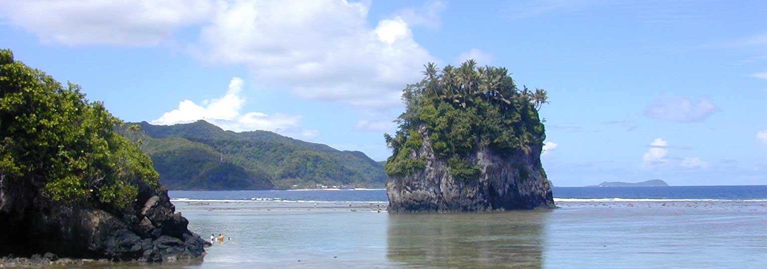 Fatu Rock, a natural landmark and offshore island of American Samoa in center, is also called the Flower Pot Rock. Aunu‘u Island in the distance to the right. Image: Marshman |
About American Samoa Satellite view is showing the island of Tutuila, American Samoa's main island in the South Pacific Ocean, zoom out to find the much smaller islands of Ta'u, Ofu, Olosega, Aunu'u, and Nu'utele located east of Tutuila. Satellite view is showing the island of Tutuila, American Samoa's main island in the South Pacific Ocean, zoom out to find the much smaller islands of Ta'u, Ofu, Olosega, Aunu'u, and Nu'utele located east of Tutuila.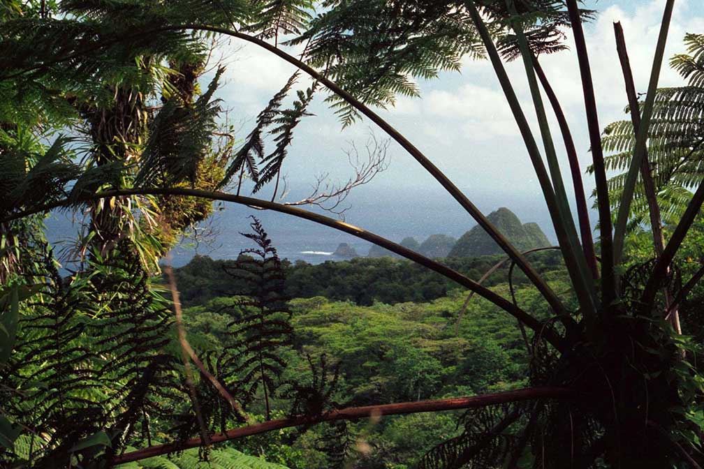 Rainforest on Tutuila Island, American Samoa. Image: nps.gov American Samoa is geographically part of the Samoan island chain, situated in the southeast of the Independent State of Samoa. The island chain lies within the Polynesian Triangle, about 2600 mi (4200 km) south west of Hawaii, and about 2500 mi (4000 km) east of Australia. American Samoa has a population of about 66,000 people, territorial capital is Pago Pago on Tutuila island, where Fagatogo village is the seat of the government. Spoken languages are English and Samoan. The map shows a island map of Tutuila with main roads and streets, Tafuna Airport (IATA code: PPG) is located southwest of the central business district of American To find a location use the form below. To view just the map, click on the "Map" button. |
|
| To find a location type: street or place, city, optional: state, country. |
Local Time American Samoa:
Monday-June-22 04:15
American Samoa Time: UTC -11 hours |
|
φ Latitude, λ Longitude (of Map center; move the map to see coordinates): , |
||||||
| Sorry! Google's pricing policy has made it impossible for us to continue showing Google Maps. We apologize for any inconvenience. Google Map: Searchable Map and Satellite View of Tutuila, largest island of the U.S. territory of American Samoa. |
Bookmark/share this page |
|||||
| More about American Samoa: Cities: Country: Continent: |
Weather Conditions Pago Pago
|
Related Consumer Information:
|
||||
Other Polynesian Island Nations and Territories: French Polynesia (Tahiti), Niue, Pitcairn, Samoa, Tonga, Tuvalu |
||||||
Map Help [ show ] |
||||||
One World - Nations Online .:. let's care for this planet Promote that every nation assumes responsibility for our world. Nations Online Project is made to improve cross-cultural understanding and global awareness. More signal - less NOISE |
| Site Map
| Information Sources | Disclaimer | Copyright © 1998-2024:: nationsonline.org |

