Nations Online
All Countries in the World
Nations Online All Countries in the World | |
Home  |
___ Satellite View and Map of Honduras |
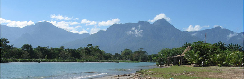 View of a beach at el Porvenir in direction of Pico Bonito National Park, central north Honduras. - Image: Gaceta |
About HondurasMap is showing the Central American country occuping a quite mountainous portion of the land bridge between North and South America. Honduras is bordering the Caribbean Sea (Atlantic Ocean) in north and has a short coastline on the Pacific Ocean (at the Gulf of Fonseca). Countries with international borders to Honduras are El Salvador, Guatemala, and Nicaragua.Honduras has a population of 8.5 million people (in 2013). Capital city is Tegucigalpa (pop. 1.2 million). Spoken language is Spanish (official). More about Honduras... The Map shows Honduras with cities, expressways, and main roads. To find a location use the form below. To view just the map, click on the "Map" button. |
|
| To find a location type: street or place, city, optional: state, country. |
Local Time Tegucigalpa:
Friday-April-26 06:37
UTC/GMT -6 hours
|
|
φ Latitude, λ Longitude (of Map center; move the map to see coordinates): , |
||||||
| Google Earth: Searchable map/satellite view of Republic of Honduras. |
Bookmark/share this page |
|||||
| More about Honduras: Cities: Country: Honduras Key Statistical Data. Continent: Reference Map of Central America and the Caribbean. |
Current Weather Conditions Tegucigalpa
|
Related Consumer Information:
|
||||
| Searchable Maps of other Countries of Central America: Belize, Costa Rica, El Salvador, Guatemala, Nicaragua, Panama Country Profiles: Countries and Territories of The Americas |
||||||
Map Help [ show ] |
||||||
One World - Nations Online .:. let's care for this planet Promote that every nation assumes responsibility for our world. Nations Online Project is made to improve cross-cultural understanding and global awareness. More signal - less NOISE |
| Site Map
| Information Sources | Disclaimer | Copyright © 1998-2023 :: nationsonline.org |

