Nations Online
All Countries in the World
Nations Online All Countries in the World | |
Home  |
___ Satellite View and Map of Guyana |
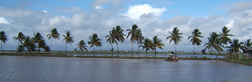 Tractor in rice field, Guyana. Image: Tracey Dos Santos |
About GuyanaMap is showing the Northern South American country bordering the North Atlantic Ocean. Countries with international borders to Guyana are Brazil, Suriname, and Venezuela.The country is part of the Guianas, a region in the north-eastern part of the continent on the Guiana Shield, an old stable geological formation that forms a portion of the northern coast. The Guianas are bounded by the Orinoco, Negro, and Amazon rivers and the Atlantic Ocean. It includes Guyana, Suriname, and Guyana's area is somewhat smaller than that of the United Kingdom, or slightly smaller than that of the U.S. state of Idaho. Large areas of Guyana are covered by dense rain forests (Forested Highland Region) in the southern part of the country. Most of Guyana's population (90%) lives in a narrow and fertile marshy plain along the Atlantic coast in the east of the country. The four Hinterland regions, which occupy more than two-thirds of the total land area is still largely unoccupied. The country has a population of 748,000 people (Census 2012). Capital and largest city is Georgetown (pop. 192,000). Spoken languages are English (official), the vast majority of the population speaks Guyanese Creole, an English based Creole, Indo-Guyanese people speak also Hindi. The map shows Guyana with cities, towns, villages, resorts, main roads and streets. To find a location use the form below. |
|
| To find a location type: street or place, city, optional: state, country. |
Local Time Guyana:
Friday-April-26 13:10
Standard time zone: Guyana Time (GYT) :: UTC/GMT -4 hours |
|
φ Latitude, λ Longitude (of Map center; move the map to see coordinates): , |
||||||
| Google Maps: Searchable Map of Guyana. Some Points of interest: Georgetown with its St. George's Cathedral, Guyana National Museum and Walter Roth Museum of Anthropology, Iwokrama Forest, Kaieteur National Park with Kaieteur Falls, Mount Roraima, Kanuku Mountains. |
Bookmark/share this page |
|||||
| More about Guyana: Cities: Country: Continent: |
Current Weather Conditions Georgetown, weather station at the Cheddi Jagan International Airport near Timehri.
|
Related Consumer Information:
|
||||
| Searchable Maps of other Countries in South America: Argentina, Brazil, Bolivia, Chile, Colombia, Ecuador, French Guiana Guyana, Paraguay, Peru, Suriname, Uruguay, Venezuela Maps of other Countries in South America: Argentina Map, Brazil Map, Bolivia Map, Chile Map, Colombia Map, Ecuador Map, French Guiana Map, Guyana Map, Paraguay Map, Peru Map, Suriname Map, Uruguay Map, Venezuela Map Countries and Territories of The Americas |
||||||
Map Help [ show ] |
||||||
One World - Nations Online .:. let's care for this planet Promote that every nation assumes responsibility for our world. Nations Online Project is made to improve cross-cultural understanding and global awareness. More signal - less NOISE |
| Site Map
| Information Sources | Disclaimer | Copyright © 1998-2023 :: nationsonline.org |

