Nations Online
All Countries in the World
Nations Online All Countries in the World | |
Home  |
___ Satellite View of Ko Phuket |
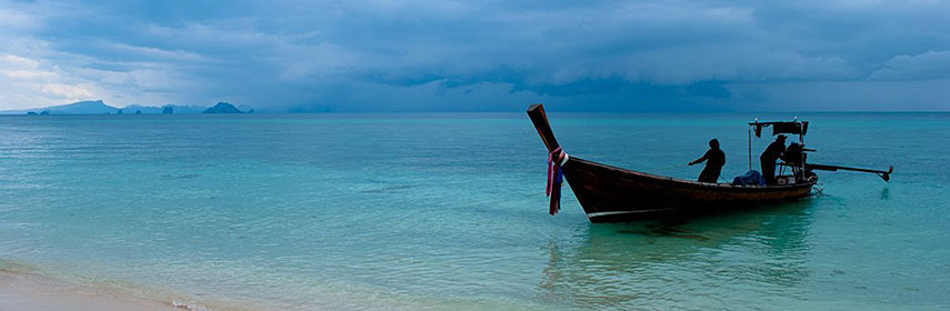 Koh Hae (Coral Island), Phuket Province, Thailand Image: Endrjuch |
Searchable map/satellite view of Phuket using Google Earth DataSatellite view is showing Phuket, biggest island inThe island has a population of about 300,000 inhabitants. To find a location use the form below. To view the map, click on the "Map" button. |
|
| To find a location type: street or place, city, optional: state, country. |
Local Time Phuket:
Sunday-April-28 15:43
UTC/GMT +7 hours |
|
φ Latitude, λ Longitude (of Map center; move the map to see coordinates): , |
||||||
| Sorry! Google's pricing policy has made it impossible for us to continue showing Google Maps. We apologize for any inconvenience. Google Map: Searchable Map and Satellite View of the Island of Phuket, Thailand. |
Bookmark/share this page |
|||||
| More about Thailand: Thailand statistical key figures. External Link Tourism Thailand: Phuket Wikipedia: Phuket |
Phuket Weather Conditions:
|
Related Consumer Information:
|
||||
Other Countries in South East Asia: Brunei, Cambodia, Indonesia, Laos, Malaysia, Myanmar (Burma), Philippines, Singapore, Vietnam All Countries and Territories of Asia Countries of the World: A - C | D - G | H - L | M - P | Q - T | U - Z Continents: Africa | The Americas | Australia/Oceania | Europe |
|||
Map Help [ show ] |
|||
One World - Nations Online .:. let's care for this planet Promote that every nation assumes responsibility for our world. Nations Online Project is made to improve cross-cultural understanding and global awareness. More signal - less NOISE |
| Site Map
| Information Sources | Disclaimer | Copyright © 1998-2023 :: nationsonline.org |

