Advertising

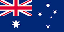
Australia flag detail
Home Earth Continents Australia/Oceania Australia Country Profile Map of Australia

Maps Index

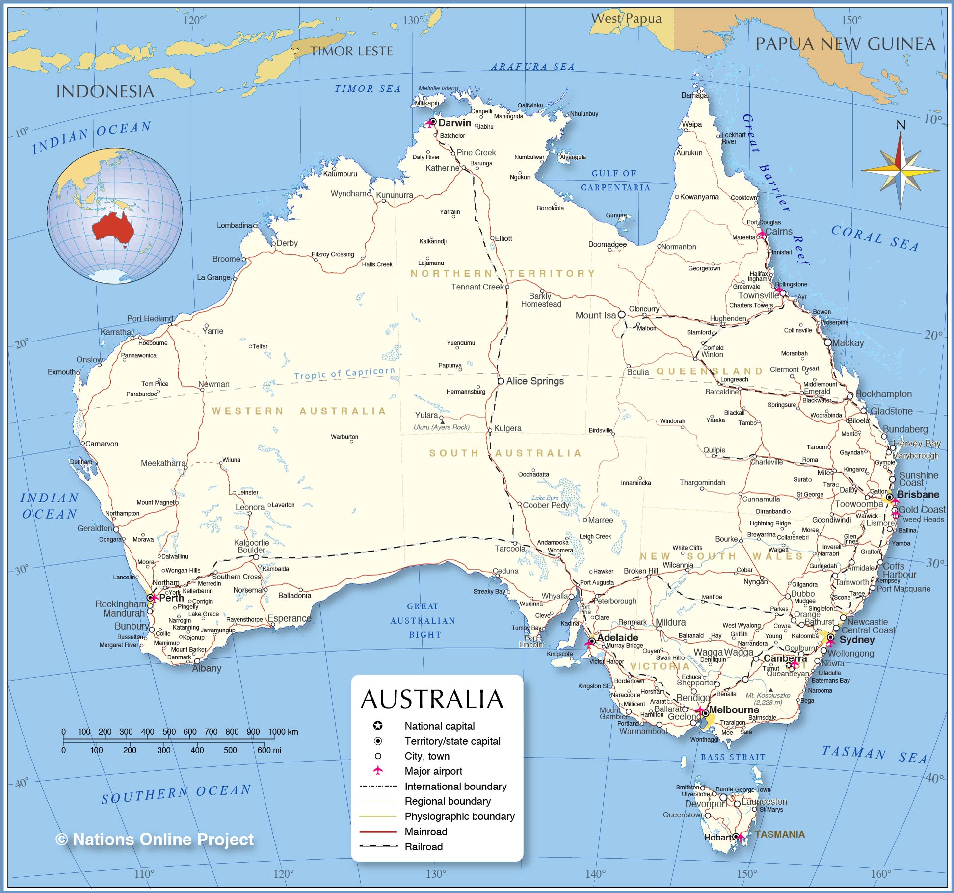
Map of Australia


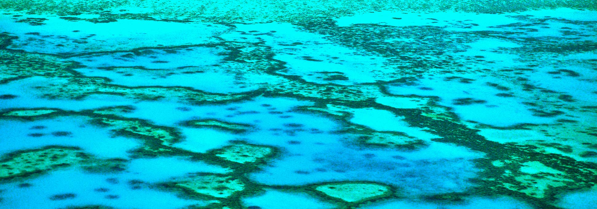
Aerial view of the Great Barrier Reef near the Capricorn Group, Queensland, Australia
Image: LBM1948

About Australia


Australia Flag
The map shows Australia, an island country in the southern hemisphere. The world's smallest continent borders the Timor Sea and the Arafura Sea in the north, the Coral Sea in the northeast, and the Tasman Sea in the southeast. The Indian Ocean lies to the west and the Southern Ocean to the south.

Australia has no land borders. The country shares maritime borders with East Timor, Indonesia, New Zealand, Papua New Guinea, Solomon Islands, and the islands of New Caledonia (a special collectivity of France).

The country is divided into six states and two territories; the states are New South Wales (NSW), Queensland (QLD), South Australia (SA), Tasmania (TAS), Victoria (VIC) and Western Australia (WA), the territories are the Northern Territory (NT) and the Australian Capital Territory (ACT) with the nation's capital city Canberra.

Several outlying islands belong to Australia, Ashmore and Cartier Islands, Christmas Island, Cocos (Keeling) Islands, the Coral Sea Islands, the Heard and McDonald Islands, and Norfolk Island. Adjacent to the continent's southeastern coast lies the mountainous island of Tasmania, separated from the mainland by the Bass Strait.

Off the northeastern coast of the country lies the Great Barrier Reef, the world's most extensive coral reef system in the southwestern Pacific Ocean. The Great Barrier Reef official website is a World Heritage Site.

An area of 7,692,024 kmĀ² makes Australia the sixth largest country in the world.

Australia is a member state of the Commonwealth of Nations. The country has a population of 25.4 million people (in 2020); capital is Canberra, the largest city is Sydney; official language is English.


Map of Australia

Political Map of Australia

The map shows Australia and surrounding countries with international borders, the national capital Canberra, state capitals, major cities, main roads, railroads, and major airports.

You are free to use above map for educational purposes (fair use), please refer to the Nations Online Project.
 

Map shows the location of following Australian cities and towns:

Adelaide, Albany, Alice Springs, Armidale, Aurukun, Balladonia, Ballarat, Bamaga, Barcaldine, Barkly Homestead, Bathurst, Bendigo, Biloela, Boulia, Bourke, Brisbane, Broken Hill, Broome, Bunbury, Bundaberg, Cairns, Canberra, Carnarvon, Ceduna, Central Coast, Charleville, Clermont, Cloncurry, Coffs Harbour, Coober Pedy, Cunnamulla, Dalby, Darwin, Derby, Devonport, Doomadgee, Dubbo, Elliott, Emerald, Esperance, Exmouth, Geelong, Geraldton, Gladstone, Gold Coast, Goondiwindi, Goulburn, Hervey Bay, Hobart, Hughenden, Kalgoorlie-Boulder, Kalumburu, Karratha, Katherine, Kowanyama, Kulgera, Kununurra, La Grange, Launceston, Leonora, Lismore, Lombadina, Mackay, Mandurah, Marree, Maryborough, Meekatharra, Melbourne, Mildura, Miles, Mount Gambier, Mount Isa, Newcastle, Newman, Nguiu, Normanton, Norseman, Northam, Nowra, Nyngan, Onslow, Orange, Perth, Peterborough, Pine Creek, Port Hedland, Port Lincoln, Port Macquarie, Queanbeyan, Queenstown, Quilpie, Renmark, Rockhampton, Rockingham, Shepparton, Southern Cross, Sunshine Coast, Sydney, Tamworth, Tarcoola, Tennant Creek, Thargomindah, Toowoomba, Townsville, Tweed Heads, Wagga Wagga, Warrnambool, Weipa, Whyalla, Wilcannia, Winton, Wollongong, Wyndham, Yarrie, and Yulara.


Bookmark/share this page
  Instagram button

Weather Conditions Sydney

SYDNEY WEATHER


Advertisements:


Maps of other countries in Australia/Oceania and the Pacifics:
New Caledonia Map, New Zealand Map, Papua New Guinea Map, Samoa Map
up