Nations Online
All Countries in the World
|
One Planet Nations Online All Countries in the World | |
Home  |
___ Satellite View and Map of the City of Canberra, Australian Capital Territory (45-degree view available) |
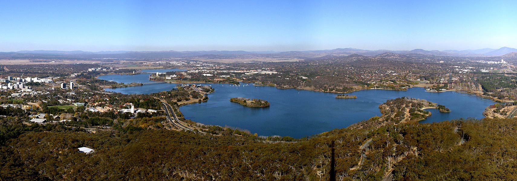
 View of Canberra, Australia's capital city from the Telstra Tower on Black Mountain. Image: SimonEast |
About Canberra Satellite view is showing Canberra, the national capital of Satellite view is showing Canberra, the national capital of Canberra is the seat of the government of Australia, the site of Parliament House, the High Court of Australia and numerous government departments and agencies. On the map you can see that Canberra is a planned city. Australia became an independent nation on 1 January 1901 and the country was in need for a capital. The site where Canberra should be built was selected in 1908 and construction begun five years later in 1913. The city's layout is based on geometric shapes like circles, hexagons and triangles. Today the Nation's Capital has a population of about 381,000 inhabitants (in 2014). Just Zoom in to see Parliament House, the meeting place of the Parliament of Australia. At the time of its construction (prior to 1988) it was the most expensive building in the Southern Hemisphere. The Map shows a city map of Canberra with expressways, main roads and streets, Canberra International Airport (IATA Code: CBR) to the east. To find a location use the form below. To view just the map, click on the "Map" button. |
|
| To find a location type: street or place, city, optional: state, country. |
Local Time Canberra:
Saturday-April-27 12:16
Standard time zone (AEST): UTC/GMT +10 hoursDaylight saving time (AEDT) in use from beginning of October until end of March, time zone offset: UTC/GMT +11 hours |
|
φ Latitude, λ Longitude (of Map center; move the map to see coordinates): , |
||||||
| Google Earth: Searchable map/satellite view of the city of Canberra, Capital Territory, Australia. City Coordinates: 35°18′29″S 149°07′28″E |
Bookmark/share this page
|
|||||
| More about Australia: Landmarks: Cities, searchable map and satellite view of : Country: Continent: |
Weather Conditions Canberra External Link National Capital Authority NCA's official website. Visit Canberra Official tourism web site by Australian Capital Tourism. Canberra Times Local news. Wikipedia: Canberra Wikipedia article about Canberra. |
Related Consumer Information:
|
||||
|
Countries and territories of Australia/Oceania |
||
Map Help [ show ]  |
||
One World - Nations Online .:. let's care for this planet Promote that every nation assumes responsibility for our world. Nations Online Project is made to improve cross-cultural understanding and global awareness. More signal - less NOISE |
| Site Map
| Information Sources | Disclaimer | Copyright © 1998-2023 :: nationsonline.org |