Nations Online
All Countries in the World
Nations Online All Countries in the World | |
Home  |
___ Satellite View and Map of the City of Brisbane, Queensland (QLD), Australia |
About Brisbane Satellite view is showing Brisbane, the capital and most populous city in Queensland, one of the six states of Satellite view is showing Brisbane, the capital and most populous city in Queensland, one of the six states of 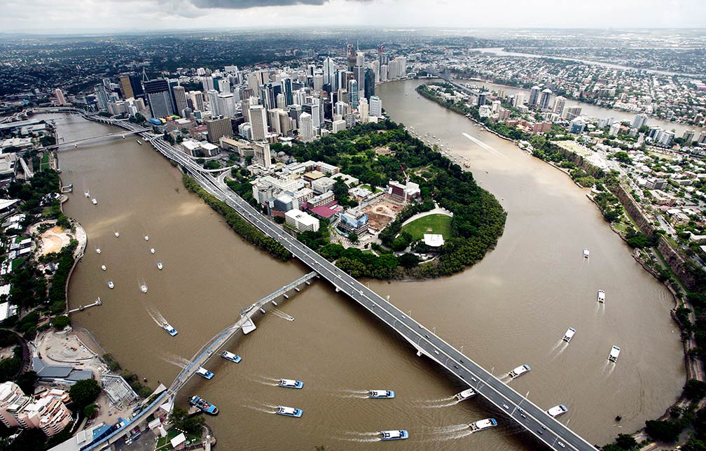 Aerial view of Brisbane, with Brisbane River. Image: Brisbane City Council The city is Queensland's administrative, commercial, industrial, and cultural center. It is home to the State Library Of Queensland and to several universities including the University of Queensland, a public university, founded in 1909. Some of Brisbane's major attractions are: South Bank Parklands, Lone Pine Koala Sanctuary, a park to view native Australian animals, and Roma Street Parkland, the world's largest inner-city subtropical garden. You may take a boat ride on the Brisbane River or visit St. Helena Island, the former prison island. For art lovers there is the Queensland Cultural Centre, a multi-venue center with the Gallery of Modern Art, the Queensland Art Gallery, the Queensland Museum, the Queensland Performing Arts Centre and the Queensland Theatre Company. The Map shows a city map of Brisbane with expressways, main roads and streets; zoom out to find the location of Brisbane Airport (IATA Code: BNE) located in a suburb of Brisbane in the north eastern part of the city, 14 kilometers (9 mi) from the central business district. To find a location use the form below. |
|
| To find a location type: street or place, city, optional: state, country. |
Local Time Brisbane:
Tuesday-April-30 14:24
Standard time zone (AEST): UTC/GMT +10 hoursDaylight saving time (AEDT) in use from beginning of October until end of March, time zone offset: UTC/GMT +11 hours |
|
φ Latitude, λ Longitude (of Map center; move the map to see coordinates): , |
||||||
| Google Earth: Map and Satellite View of the city of Brisbane, Queensland, Australia. City Coordinates: 27°28′04″S 153°01′40″E |
Bookmark/share this page |
|||||
| More about Australia: Landmarks: Cities, searchable map and satellite view of : Country: Continent: |
Weather Conditions Brisbane
External Links: Brisbane (official web site) Visit Brisbane (official visitors web site) Brisbane Times Local news. Wikipedia: Brisbane Wikipedia entry Brisbane. |
Related Consumer Information:
|
||||
| Countries and territories of Australia/Oceania |
Map Help [ show ] |
One World - Nations Online .:. let's care for this planet Promote that every nation assumes responsibility for our world. Nations Online Project is made to improve cross-cultural understanding and global awareness. More signal - less NOISE |
| Site Map
| Information Sources | Disclaimer | Copyright © 1998-2023 :: nationsonline.org |

