Nations Online
All Countries in the World
Nations Online All Countries in the World | |
Home  |
___ Satellite View and Map of Gabon |
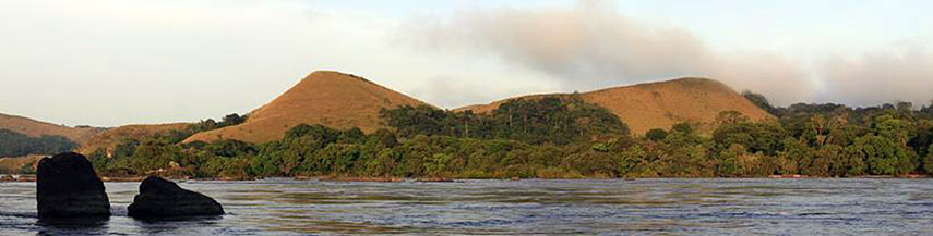 Lopé National Park, one of Gabon's 13 National Parks. Image: FX |
About GabonMap/Satellite view is showing Gabon, a country in West-Central Africa bordering the Atlantic Ocean in west.The country has a population of 1.5 million inhabitants. Capital city of Gabon is Libreville. Spoken languages are French (official) and West African languages most notablyFang, and Myene. Countries with international borders to Gabon are Equatorial Guinea, Cameroon, Republic of the Congo. ... more about Gabon The map shows Gabon with cities, towns, expressways, main roads and streets. To find a location use the form below. |
||
| To find a location type: street or place, city, optional: state, country. | Local Time Gabon:
Friday-April-26 23:24
West Africa Time (WAT): UTC/GMT +1 h |
|
|
φ Latitude, λ Longitude (of Map center; move the map to see coordinates): , |
||||||
| Google Maps: Searchable Map of Gabonese Republic. |
||||||
| More about Gabon: Cities: Country: Continent: |
Current Weather Conditions Libreville:
|
Related Consumer Information:
|
||||
| Countries and Territories of Africa | ||||||
Map Help [ show ] |
||||||
One World - Nations Online .:. let's care for this planet Promote that every nation assumes responsibility for our world. Nations Online Project is made to improve cross-cultural understanding and global awareness. More signal - less NOISE |
| Site Map
| Information Sources | Disclaimer | Copyright © 1998-2023 :: nationsonline.org |

