
| Home |
|
|
|
___ Topographic Map of Sudan |
|
About Sudan |
|
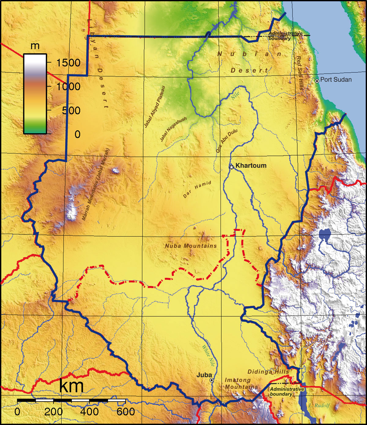
| Map is showing Sudan, Africa's second largest country, after Algeria. With an area of 1,886,068 km², compared, it is more than five times the size of Germany, or slightly less than one-fifth the size of the USA. Border Countries: Central African Republic, Chad, Democratic Republic of the Congo, Egypt, Eritrea, Ethiopia, Kenya, Libya, Uganda | Bookmark/share this page |  One World - Nations Online countries of the world |
| The map shows topographic features of Sudan. The country consists of a vast plain bordered on three sides by mountains: to the north east by the Red Sea Hills, to the west by the Marrah Mountains (Jabal Marrah), in the southeastern corner of Sudan by the Didinga Hills, home to the Didinga (diDinga) people, and in south by the Imatong mountains near the border to Uganda. Other topographic features are, the Nubian Desert which is part of the Sahara Desert, Qoz Abu Dulu Hills, a hilly region with sand dunes, Dar Hamid (tribal area of Dar Hamid people of Sudan), Jabal Nagashush hills, Jabal Abyad Plateau and the Nuba Mountainsin the center of the country. |
||
|
|
||
 Topographic Map of the Sudan |
|||||||||||
| More about Sudan: Cities: (capital city of South Sudan) Country: Continent: |
Current Weather Conditions Khartoum:
|
Port Sudan Current Weather Conditions:
| Related Consumer Information:
| ||||||||
Other Countries in North Africa: Algeria | Egypt | Libya | Morocco | Tunisia Maps of other Countries in North Africa: Algeria Map | Egypt Map | Libya Map | Morocco Map | Tunisia Map |
|||||||||||
One World - Nations Online .:. let's care for this planet Every nation is responsible for the current state of our world. |
| Site Map
| Information Sources | Disclaimer: Privacy Policy, etc. Contact: [email protected] | Copyright © 1998-2021 :: nationsonline.org |

